You are using an outdated browser. Please
upgrade your browser to improve your experience.
*** New exclusive function: mapXpan ***

Aqua Map Bahamas Pro - GPS Wavey Line Charts
by GEC s.r.l.
What is it about?
*** New exclusive function: mapXpan ***
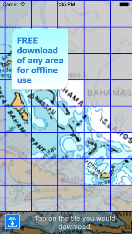
App Screenshots

App Store Description
*** New exclusive function: mapXpan ***
An app to satisfy all your Fishing and Boating's needs, developed with the help of professional fishermen.
You will be able to download the best nautical charts and enjoy your new fishing season. Press the RECORD button, put the phone in your pocket and record your fishing trolling track....and much more.
►► Features:
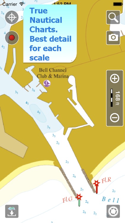
• Nautical raster charts from Wavey Line, perfectly represented and automatically selected at each zoom level to offer a seamless coverage for navigation
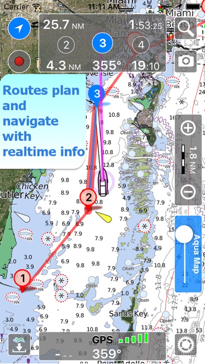
• Plan and navigate your ROUTE
• You can download maps (for FREE, no additional purchase is required) on the device, to be used later without any internet connection.
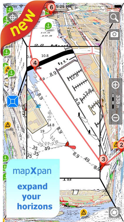
• *** NEW *** Expand your horizons with mapXpan (patent pending).
• Full coverage of charts of Bahamas received by Wavey Line
• Easy to use.
• ActiveCaptain community integration
• Optimized battery usage with battery consumption monitoring; up to 14 hours continuous track.
• Share tracks, markers, routes and pictures in various formats (KMZ and GPX).
• Store an unlimited number of tracks, routes and markers.
• Customize your Marker's icon and Track's color.
• Switch between Map display modes (Offline, Satellite, Roads).
• Measure distances on the map.
• Load any track, route and marker from internet communities (KMZ, KML, GPX also if zipped)
• Query map objects with your finger tip
• Search map objects around you or search places by name worldwide
*** NEW ***
► mapXpan
This new mode will greatly extend your display; you will have the details you need for a safe navigation seamlessly integrated with a large overview area.
Using this new mode you will see a map 64 times larger than the standard mode without losing any detail in the center part of the screen.
► MAPS
Aqua Map lets you download - for FREE!! - the best charts derived from the material received from Wavey Line with their permission; all Nautical Raster Charts, have been prepared to offer a seamless coverage of the area. No additional purchase is required. With an amazingly clear display at all zoom levels, you can download the maps at home within your device and then use them on the boat without any Internet connection. Check our Nautical charts at: http://www.globalaquamaps.com/AquaMarine.html#Bahamas
► SHARING
Why do not sharing your favorite's markers on Facebook or sending an email with your last daily track, with all the pictures you captured to show them on a PC ? With Aqua Map it is just a click.
► ROUTES and WAYPOINTS
Plan your trip, insert and edit waypoints. Navigate your route and monitor distance, time and direction toward your next waypoint.
► ENJOY ActiveCaptain Community
Join the community of more than 100.000 boaters who write reviews, update data and provide up to date hazard information.
Read and contribute reviews and rating about marinas, shared local boating knowledge, anchorage and hazards
► LOADING OTHER's TRACKS, ROUTES and MARKERS
Aqua Map can load any KML, KMZ, GPX (also zipped) you can find over the internet or received from your friends. You can load tracks and markers generated from any application (e.g. Google EarthTM, Maps, or other iPhone/iPad apps), obviously including Aqua Map, or any device (e.g. Garmin, Nuvi, Magellan, etc.).
► OPTIMIZED BATTERY USAGE
Unlike many other apps, Aqua Map is designed to use at the best the battery power. Its Battery Consumption Monitoring will stop the track recording when the battery is too low, in order to ensure the phone is still usable at the end of your outdoor's day.
► iOS BACKGROUND MODE
Aqua Map works also when in background, you can receive/make calls and messages while the track recording is running.
————
Like any GPS, the signal quality can vary very much depending by the amount of visible sky, foliage, weather condition, etc. GPS is not reliable indoor.
The continuous GPS usage, also in background, can drastically reduce the battery life.
Disclaimer:
AppAdvice does not own this application and only provides images and links contained in the iTunes Search API, to help our users find the best apps to download. If you are the developer of this app and would like your information removed, please send a request to takedown@appadvice.com and your information will be removed.
AppAdvice does not own this application and only provides images and links contained in the iTunes Search API, to help our users find the best apps to download. If you are the developer of this app and would like your information removed, please send a request to takedown@appadvice.com and your information will be removed.