You are using an outdated browser. Please
upgrade your browser to improve your experience.

Aviation Map is a customizable flight reference map for pilots of all types

Aviation Map
by Dwight Edison Industries, LLC
What is it about?
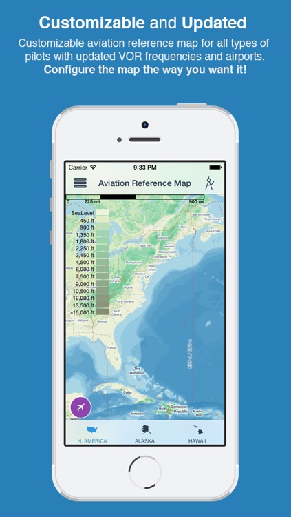
Aviation Map is a customizable flight reference map for pilots of all types. Gone are the days of cumbersome fold out reference maps with outdated VOR frequencies and airports. Not only is Aviation Map less expensive than the cumbersome fold out maps; our map contains more data, is customizable, and is updated!
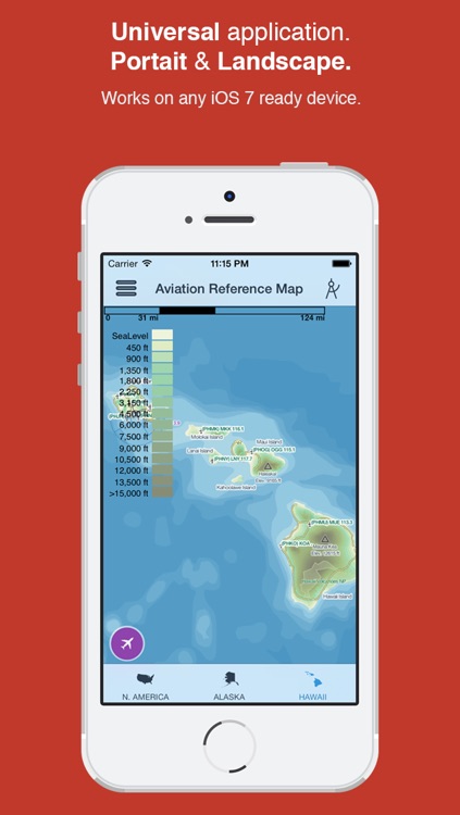
App Screenshots
App Store Description
Aviation Map is a customizable flight reference map for pilots of all types. Gone are the days of cumbersome fold out reference maps with outdated VOR frequencies and airports. Not only is Aviation Map less expensive than the cumbersome fold out maps; our map contains more data, is customizable, and is updated!
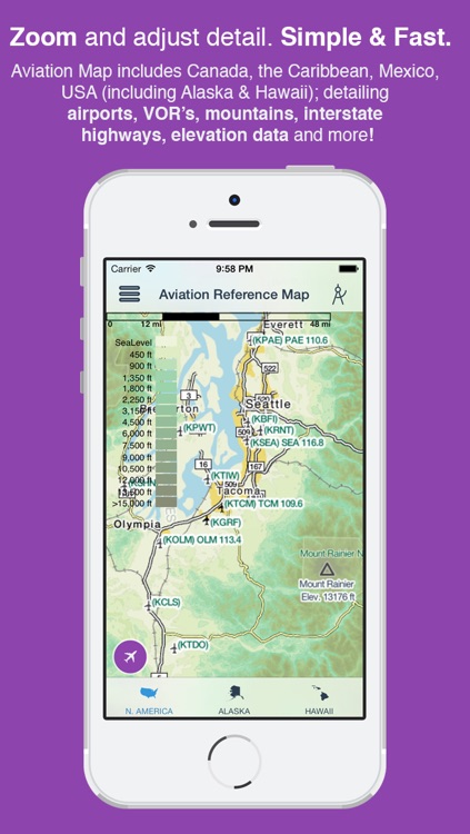
Aviation Map displays geographical data for: Continental United States, Alaska, Hawaii, Puerto Rico, Canada, Mexico, Bahamas, Jamaica, Haiti, and the Dominican Republic.
Configurable display data includes: states, capital cities, cities, metropolitan areas, mountain ranges, mountain peaks, elevation gradients, lakes, rivers, national parks, highways, railroads, class bravo airspace, VORs, airports, and time zones.
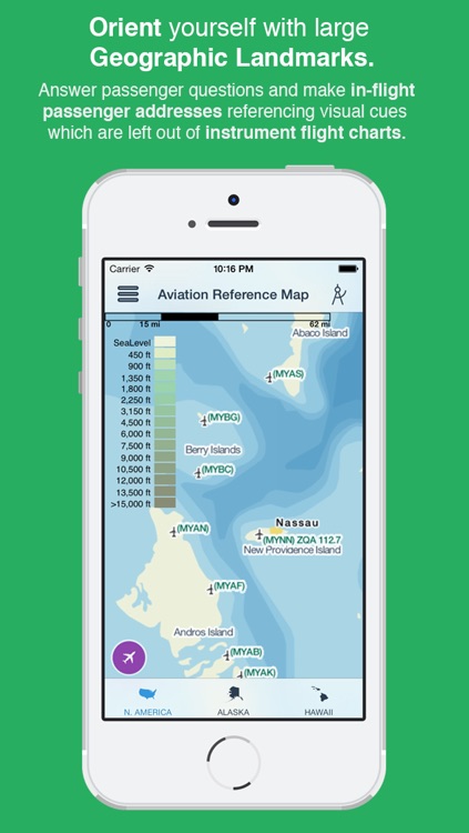
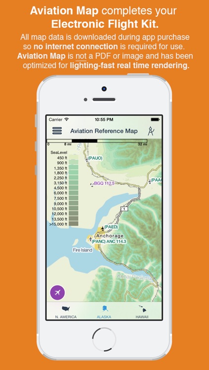
With Aviation Map, you can easily orient yourself with large geographic landmarks to assist in passenger questions and in-flight passenger addresses. If you are planning on making the transition to a paperless cockpit, or already have, Aviation Map is a perfect addition to your electronic flight kit. All map data is downloaded during app purchase so no internet connection is required for use.
This app is designed for any pilot who would like to supplement their in flight navigation charts with a visual reference map. This map is not designed for nor is it to be used as a navigation source. We include VOR locations, names, and frequencies for orientation only. Purely navigation-only items (airways, etc.) are not included.
Disclaimer:
AppAdvice does not own this application and only provides images and links contained in the iTunes Search API, to help our users find the best apps to download. If you are the developer of this app and would like your information removed, please send a request to takedown@appadvice.com and your information will be removed.
AppAdvice does not own this application and only provides images and links contained in the iTunes Search API, to help our users find the best apps to download. If you are the developer of this app and would like your information removed, please send a request to takedown@appadvice.com and your information will be removed.