You are using an outdated browser. Please
upgrade your browser to improve your experience.

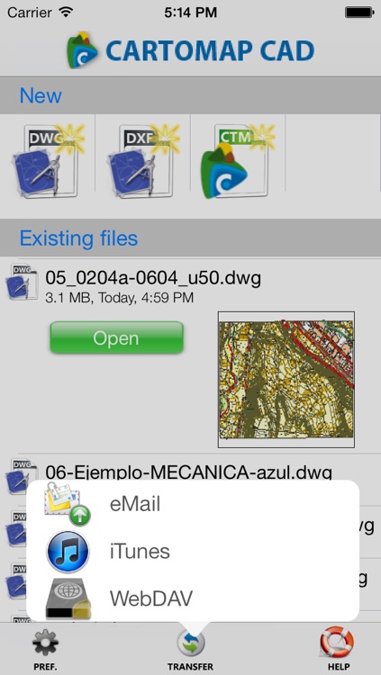
CARTOMAP CAD allows you to create, read, edit, send and receive DWG/DXF/CTM drawing files directly from your e-mail, iTunes or any WebDAV compatible storage, and provides you more than 150 CAD tools to consult and edit the files

CARTOMAP CAD
by ANEBA Geoinformatica, SL
What is it about?
CARTOMAP CAD allows you to create, read, edit, send and receive DWG/DXF/CTM drawing files directly from your e-mail, iTunes or any WebDAV compatible storage, and provides you more than 150 CAD tools to consult and edit the files. New snaps to, rulers, grid and UCS makes easiest to draw. There is no need of Internet connection or additional applications: your project confidentiality is guaranteed.
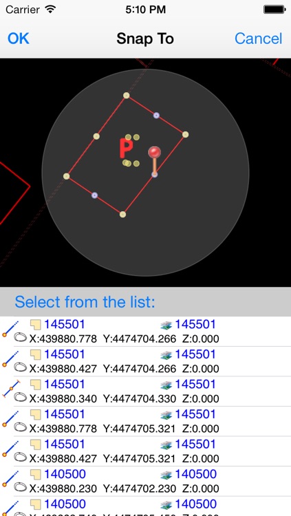
App Screenshots
App Store Description
CARTOMAP CAD allows you to create, read, edit, send and receive DWG/DXF/CTM drawing files directly from your e-mail, iTunes or any WebDAV compatible storage, and provides you more than 150 CAD tools to consult and edit the files. New snaps to, rulers, grid and UCS makes easiest to draw. There is no need of Internet connection or additional applications: your project confidentiality is guaranteed.
1. Send and receive DWG/DXF/CTM drawing files directly from e-mail, iTunes or any WebDAV compatible storage, with no need of additional applications.
2. Work from anywhere without requiring Internet connection.
3. Confidentiality and a total control of your projects.
4. File manager that allows you to create new projects, delete, rename, send/receive drawing files by email, iTunes or WebDAV.
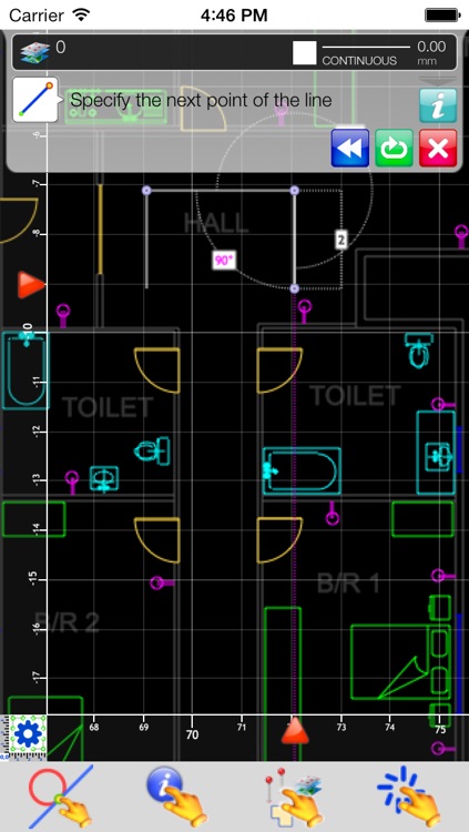
5. More than 150 CAD tools that include edition of lines, arcs, circles, polylines, freehand, axis, texts, symbols, dimensions, rectangles, information query, zoom options, object selection, coordinates selection, UCS... Multiple object selection and tools (move/rotate, mirror, copy one time, in array rectangular or polar...).
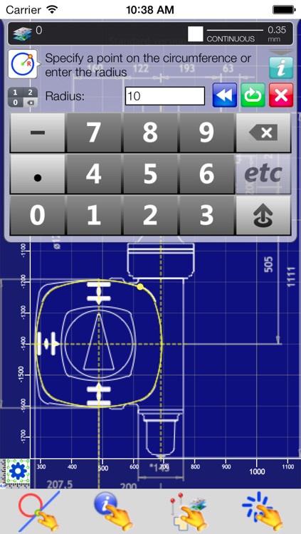
6. New objects can be drawn in different ways: by specifying points, by entering object analytical parameters (radius, angle, distance…) and by using existing elements as a reference (copy, parallel, chamfer, orthogonal…)
7. To modify drawing objects you can use the edition tools to move, cut, extend, rotate; insert, edit and delete vertices.
8. Point selection can be done using multiple options that can be selected by default or specifically for one action. Point selection options are: touch location, absolute coordinates or referred to a selected point, endpoints, intersections, proyected in an item, perpendicular to an item, curve center, midpoint...
9. SnapTo by orientation, length, point, endpoint, midpoint, intersection, grid...
10. Graphical tracking with magnifying glass, smart cursor and properties info.
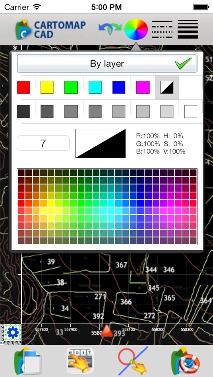
11. Layer manager with preview, line type selection, color; visibility and lock status, etc.
12. Undo/redo with the historical actions of file modifications.
13. Linear and angular units can be selected by the user. CARTOMAP CAD alerts if the file units are not coincident with the units selected in preferences. X-Y-Z and North-East-Elevation coordinates system. Angular systems suitable to surveying and civil engineering.
14. Multiple views with independent zoom and layer visibility selection that makes easier to access to drawing details.
15. Layers and Views preview.
16. Color selection by color table (256 colors) or by true color. Background color can be selected for each view.
17. Selection of line type, line width, etc.
18. Multiple zoom options: zoom to a point or entity, move, zoom in, zoom out; these options are essential when using a pointer because it does not have multitouch.
19. DWG/DXF files supported from v.14 up to 2010. Some drawing objects are not supported (xref, paper-space, very complex hatches, some proxy without embedded geometry...) but they are maintained in the DWG/DXF file.
20. All screens and toolbars are prepared to be used on the iPad in layout or portrait mode, you can rotate the device at any time you need.
21. Unicode compliant: language as chinese, arabic, russian, etc, are supported.
22. Rulers can be shown or hidden, fixed or auto adjusted.
23. Grid can be shown or hidden, fixed or auto adjusted, with 3 levels of detail and lines selected by user. New snap-to grid to make easier to sketch.
24. Multiple User Coordinate Systems (UCS) by one or two points (moves and/or rotates the view). Info request and data entry can be done in UCS.
Disclaimer:
AppAdvice does not own this application and only provides images and links contained in the iTunes Search API, to help our users find the best apps to download. If you are the developer of this app and would like your information removed, please send a request to takedown@appadvice.com and your information will be removed.
AppAdvice does not own this application and only provides images and links contained in the iTunes Search API, to help our users find the best apps to download. If you are the developer of this app and would like your information removed, please send a request to takedown@appadvice.com and your information will be removed.