You are using an outdated browser. Please
upgrade your browser to improve your experience.

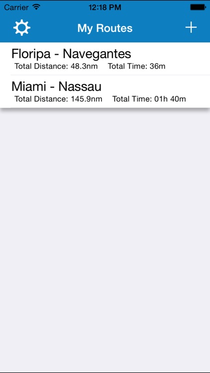
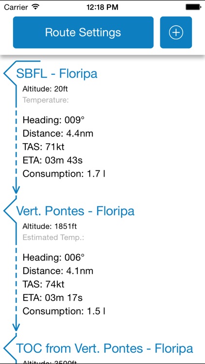
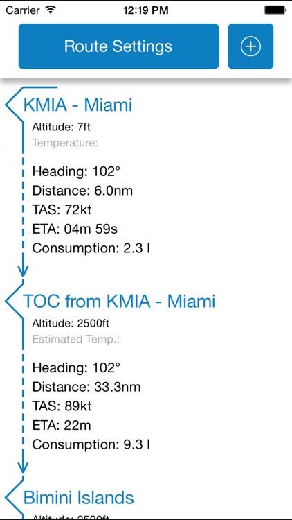
EasyPlan is an app developed to help pilots to calculate their VFR route

EasyPlan - Visual Flight Route
by Renan Wolf Pace

What is it about?
EasyPlan is an app developed to help pilots to calculate their VFR route. You just need to preset the waypoints, indicated air speed, vertical speeds, fuel consumption and magnetic variation, so the app will calculate the route providing to you:
App Screenshots
App Store Description
EasyPlan is an app developed to help pilots to calculate their VFR route. You just need to preset the waypoints, indicated air speed, vertical speeds, fuel consumption and magnetic variation, so the app will calculate the route providing to you:
- Estimated temperatures and altitudes
- Distance between waypoints
- TOCs and TODs
- Heading to next waypoint
- True air speed
- ETA to next waypoint
- Fuel consumption
No GPS and internet connection are required to create a route, your location is only used to center your area on the map when you are creating a new waypoint.
Disclaimer:
AppAdvice does not own this application and only provides images and links contained in the iTunes Search API, to help our users find the best apps to download. If you are the developer of this app and would like your information removed, please send a request to takedown@appadvice.com and your information will be removed.
AppAdvice does not own this application and only provides images and links contained in the iTunes Search API, to help our users find the best apps to download. If you are the developer of this app and would like your information removed, please send a request to takedown@appadvice.com and your information will be removed.