You are using an outdated browser. Please
upgrade your browser to improve your experience.
“Hinchinbrook Island National Park is Australia's largest island National Park offers isolation and wilderness experiences

Hinchinbrook Island NP GPS map with guide
by Flytomap
What is it about?
“Hinchinbrook Island National Park is Australia's largest island National Park offers isolation and wilderness experiences! The challenging Trail is one of the world's most popular wilderness walks, beautiful bays to walk with; Trekking along the coast will be fascinating. Explore the National park Hiking through the stunning rainforest, Bird Watching, Camping, Walking….. Relaxing on the many beaches and visiting the Island's lookout to watch the sunset will be a great experience.”
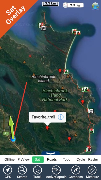
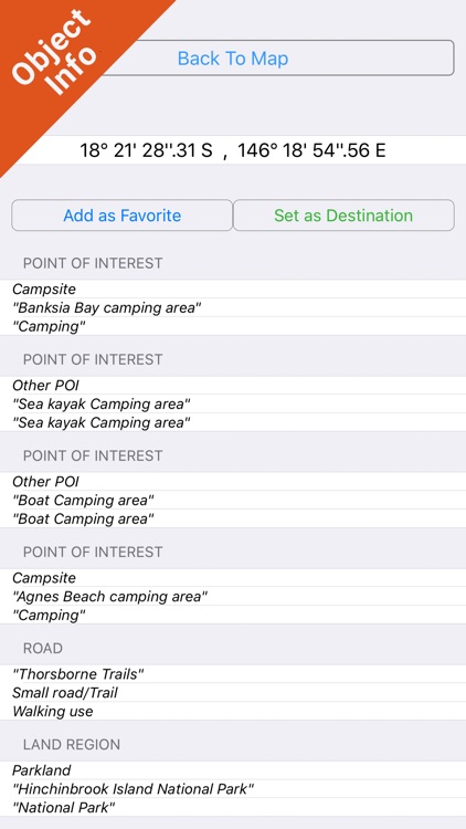
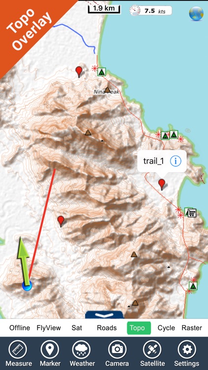
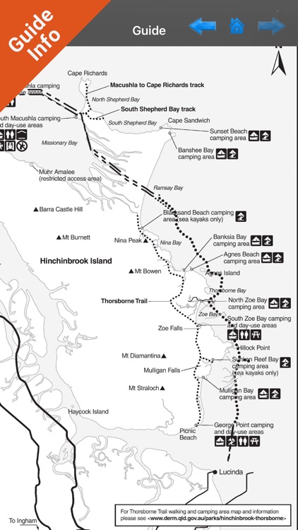
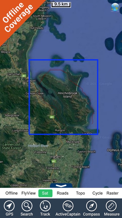
App Screenshots
App Store Description
“Hinchinbrook Island National Park is Australia's largest island National Park offers isolation and wilderness experiences! The challenging Trail is one of the world's most popular wilderness walks, beautiful bays to walk with; Trekking along the coast will be fascinating. Explore the National park Hiking through the stunning rainforest, Bird Watching, Camping, Walking….. Relaxing on the many beaches and visiting the Island's lookout to watch the sunset will be a great experience.”
Park Map Contains:
Park map applications are extremely advanced contains embedded electronic charts with all information collected from the National Park Service and local sources. The maps contain all multiple trails (Hiking, biking, Stairway trails, Bicycle trails, Equestrian trails etc.,) and Point of interests (POI) like Campgrounds, Eating places, Ranger Stations, Picnic areas, Boat/Canoe launching, Parking areas etc., which are provided depending on the relevant park areas they exists.
“Covers all Trails, Lakes and Rivers within the Parks”
“Covers complete park boundary from (NPS)”
“Elevation Contours with 10 meters interval”
“Mountain Summits”
“All Roads and Railways”
Use to Explore:
GPS
COMPASS
TRACKING & eMAIL
FIND SPEED & ANGLE towards DESTINATION
GUIDE-HOW TO USE MAP
OFFLINE MAP
STREET MAP
ADD UNLIMITED FAVORITES & more
……………………………….!
Every effort is made to be as accurate as possible when presenting information for every destination.
“Have a Great Journey"
"Continued use of GPS running in the background can dramatically decrease battery life."
Disclaimer:
AppAdvice does not own this application and only provides images and links contained in the iTunes Search API, to help our users find the best apps to download. If you are the developer of this app and would like your information removed, please send a request to takedown@appadvice.com and your information will be removed.
AppAdvice does not own this application and only provides images and links contained in the iTunes Search API, to help our users find the best apps to download. If you are the developer of this app and would like your information removed, please send a request to takedown@appadvice.com and your information will be removed.