You are using an outdated browser. Please
upgrade your browser to improve your experience.

Track the tide times for the entire state of Louisiana, including Mississippi River, Bastian Island, Barataria Bay, Comfort Island, Manilla, Cocodrie, Atchafalaya Bay, Empire Jetty and Raccoon Point

Louisiana Tide Times
by TXTVault
What is it about?
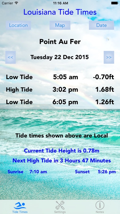
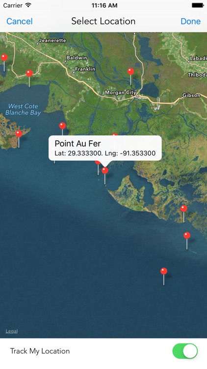
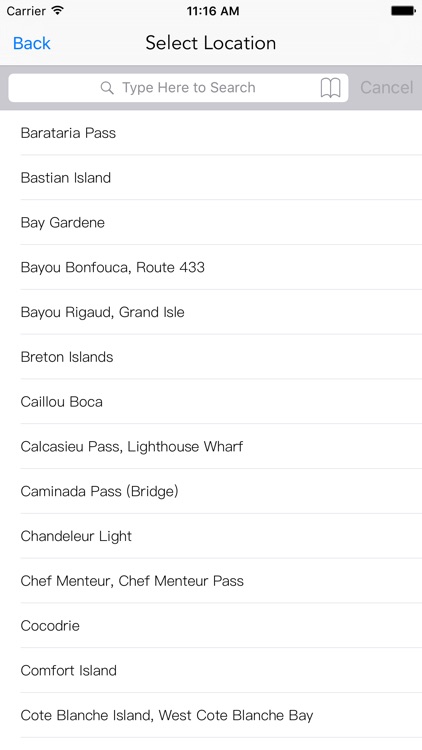
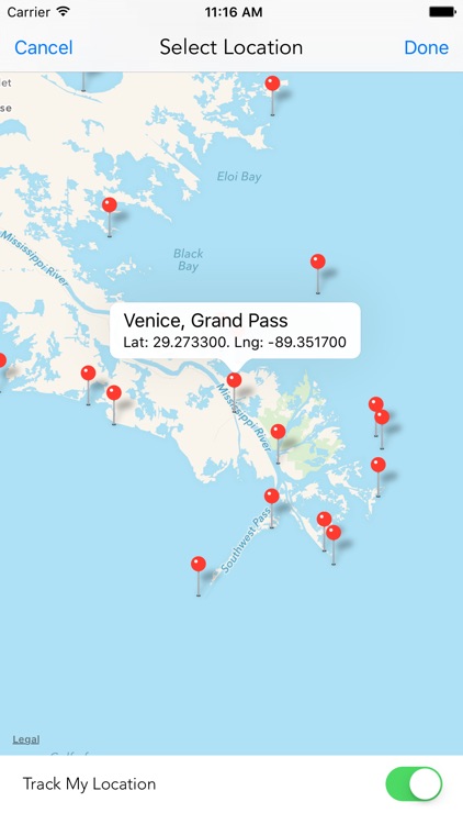
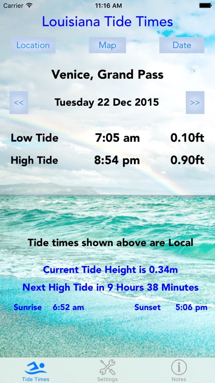
Track the tide times for the entire state of Louisiana, including Mississippi River, Bastian Island, Barataria Bay, Comfort Island, Manilla, Cocodrie, Atchafalaya Bay, Empire Jetty and Raccoon Point. In total 56 locations throughout the state are covered. Displays the low and high tides for the day, allowing selection of any date through to Dec 2016. It also shows the current tide height and the time to the next tide. The map uses your GPS to make it easier to select the port to display. No internet connection is needed for the tide times although the maps do require data to display. The sunrise and sunset times for the port selected are also shown.
App Screenshots
App Store Description
Track the tide times for the entire state of Louisiana, including Mississippi River, Bastian Island, Barataria Bay, Comfort Island, Manilla, Cocodrie, Atchafalaya Bay, Empire Jetty and Raccoon Point. In total 56 locations throughout the state are covered. Displays the low and high tides for the day, allowing selection of any date through to Dec 2016. It also shows the current tide height and the time to the next tide. The map uses your GPS to make it easier to select the port to display. No internet connection is needed for the tide times although the maps do require data to display. The sunrise and sunset times for the port selected are also shown.
Disclaimer:
AppAdvice does not own this application and only provides images and links contained in the iTunes Search API, to help our users find the best apps to download. If you are the developer of this app and would like your information removed, please send a request to takedown@appadvice.com and your information will be removed.
AppAdvice does not own this application and only provides images and links contained in the iTunes Search API, to help our users find the best apps to download. If you are the developer of this app and would like your information removed, please send a request to takedown@appadvice.com and your information will be removed.