You are using an outdated browser. Please
upgrade your browser to improve your experience.
Map Altitude uses GPS to determine your current location, altitude (height from sea level) ,Longitude,Latitude,Your Locale Info

Map Altitude-خريطة الارتفاع
by Lana Al-Manaseer
What is it about?
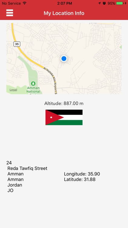
Map Altitude uses GPS to determine your current location, altitude (height from sea level) ,Longitude,Latitude,Your Locale Info.
App Store Description
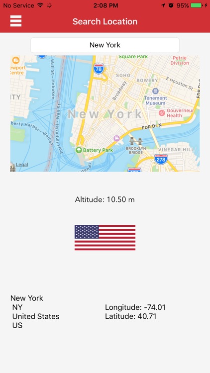
Map Altitude uses GPS to determine your current location, altitude (height from sea level) ,Longitude,Latitude,Your Locale Info.
It also allows you to Search for a location to get all information you need.
Amazing,Easy.... New
Enjoy.
خريطة الارتفاع تطبيق يستخدم نظام الموقع لتحديد معلومات عن موقعك مثل ارتفاعك عن سطح البحر وخطوط الطول والعرض وايضآ يوفر لك معلومات اخرى عن منطقتك
ويمنحك التطبيق ايضا امكانية البحث عن موقع معين لمعرفة جميع المعلومات عنه
سهل،جميل ...... جديد
Disclaimer:
AppAdvice does not own this application and only provides images and links contained in the iTunes Search API, to help our users find the best apps to download. If you are the developer of this app and would like your information removed, please send a request to takedown@appadvice.com and your information will be removed.
AppAdvice does not own this application and only provides images and links contained in the iTunes Search API, to help our users find the best apps to download. If you are the developer of this app and would like your information removed, please send a request to takedown@appadvice.com and your information will be removed.