You are using an outdated browser. Please
upgrade your browser to improve your experience.

#### A Great App for Map Lovers

MapTrace
by Nasir Jeevanjee
What is it about?
#### A Great App for Map Lovers! ####
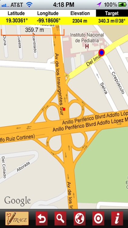
App Screenshots
App Store Description
#### A Great App for Map Lovers! ####
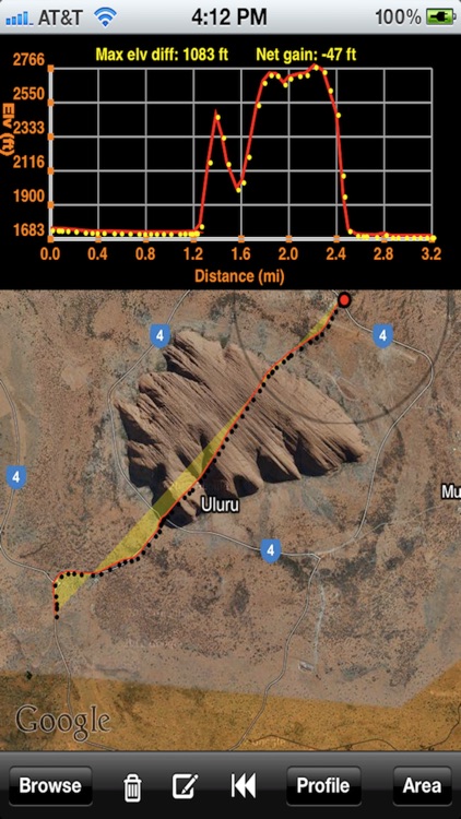
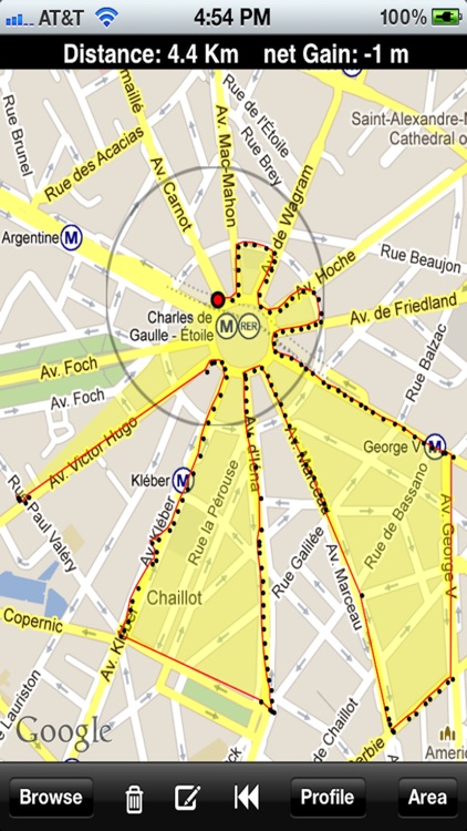
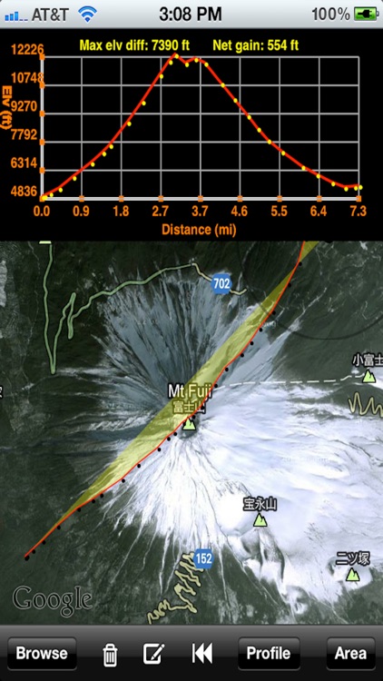
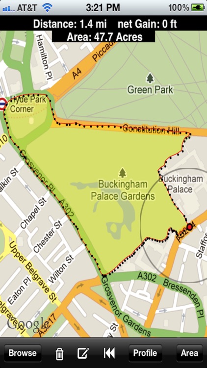
Have you ever wished you could quickly get the distance travelled, an area enclosed or an elevation profile of any arbitrary curvy path on a map? Have you ever wanted a scale while browsing a map? A flexible scale that can be moved or rotated? Well this is the app for you! This App can do all this and much more! This is the ONLY App in the store that computes the AREA on the MAP of a closed path of ANY SHAPE! Yes, just trace out any path with your finger along any geographical feature like a road, trail, mountain, house, river, lake or park and instantly obtain the distance, area and net elevation gain/loss. Tap a button and full elevation profile of the traced out path is plotted!
It is a great tool for somebody who wants to plan a walk or a jog for a specific distance, or a town planner, landscape designer, civil engineer or an architect for estimating distances, perimeters, areas and elevation profiles. Trace out the hiking/trekking trail and know your covered distance and the elevation gain. Even do geocaching, or even get the profile of a golf course to plan your next great shot!
## MAIN FEATURES ##
# Measure distance, area and net elevation gain/loss of any path on a map or satellite view traced out by finger
# Detailed elevation profile of traced path
# Flexible tracing allows going off screen
# Pan/Zoom the path traced
# Slower tracing speed gives higher elevation profile resolution
# Circular tracing pen
# Undo/Delete trace
# Shows GPS coordinates and elevation of screen’s center location
# Jump to any location by entering GPS coordinates
# Tag locations by dropping pins
# Do navigation or geocaching by setting Target location
# Search by giving the full or partial address
# Get complete street address of any dropped pins
# Toggle unit of measurement (miles / kilometers)
Disclaimer:
AppAdvice does not own this application and only provides images and links contained in the iTunes Search API, to help our users find the best apps to download. If you are the developer of this app and would like your information removed, please send a request to takedown@appadvice.com and your information will be removed.
AppAdvice does not own this application and only provides images and links contained in the iTunes Search API, to help our users find the best apps to download. If you are the developer of this app and would like your information removed, please send a request to takedown@appadvice.com and your information will be removed.