You are using an outdated browser. Please
upgrade your browser to improve your experience.

Available on all iPhone and iPod touch devices with OS 3

Mexico Metro
by Southopia
What is it about?
Available on all iPhone and iPod touch devices with OS 3.1 or later.
App Screenshots
App Store Description
Available on all iPhone and iPod touch devices with OS 3.1 or later.
Do you want a good, nice and non expensive guide? And which does not require internet connection? With Mexico Metro it is possible!
Please note on the maps of the underground network of the city of Distrito Federal and each of the metro lines, plus all associated services each station nearest streets and major tourist spots, and route between two stations using the network of the metro, without a Internet connection.
You can also search for the nearest station by detecting the current position using GPS.
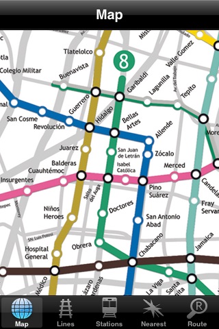
MAIN MAP
You can view the map of the entire network with the streets near each station. Also shown are the combinations between the lines of the metro, trains metropolitan and major public transport terminals. It does not require internet connection!
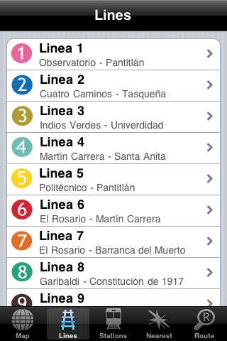
LINES
For each of the lines is reported.
• Accessible for people with disabilities
• Elevators
• Public Bathrooms
• Police
• Passenger Service Center
Also on the service hours provided each line.
• First and last service Monday to Friday
• First and last service on Saturdays
• First and last service on Sundays
• Frequency of service
Of course, it does not require internet connection!
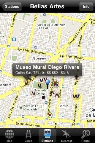
STATIONS
For each of the lines are reported in addition to the services available to the station, point of interest nearby:
• Police station
• Companies
• Shopping Malls
• Cinemas
• Hospitals
• Universities
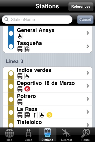
It also shows all stations with the following references:
• Combines between the lines
• Combines with rail terminals
• Combines with metro terminals
• Access for disabled / Lifts
• Public Bathrooms
• Police station
• Passenger Service Center
We also reported the last service which passes through each station. All this information, without Internet connection!
NEAREST
Don’t you know what to do? Do you want to learn more about the city? Through GPS we detect your location and show all the point of interest (POI) near at your position.
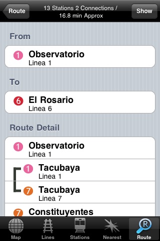
ROUTE
Indicators on which station to station these and want to be, we will show the route, marking the total time and number of stations in the same, All this information, without Internet connection!
Disclaimer:
AppAdvice does not own this application and only provides images and links contained in the iTunes Search API, to help our users find the best apps to download. If you are the developer of this app and would like your information removed, please send a request to takedown@appadvice.com and your information will be removed.
AppAdvice does not own this application and only provides images and links contained in the iTunes Search API, to help our users find the best apps to download. If you are the developer of this app and would like your information removed, please send a request to takedown@appadvice.com and your information will be removed.