You are using an outdated browser. Please
upgrade your browser to improve your experience.

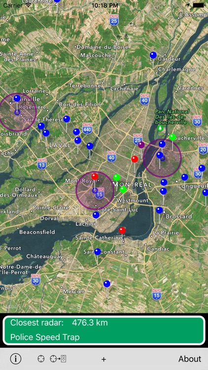
Quebec Photo Radars provides an interactive map with all of Quebec's newly installed photo radar

Quebec Photo Radars
by Simon Guertin
What is it about?
Quebec Photo Radars provides an interactive map with all of Quebec's newly installed photo radar.
App Store Description
Quebec Photo Radars provides an interactive map with all of Quebec's newly installed photo radar.
Visual or Sound alert when you are approaching a photo radar.
Display the distance to the closest radar.
Toggle ON/OFF any unwanted radar.
This app is very simple and all the photo radars's location are published by the provincial government of Quebec:
https://www.transports.gouv.qc.ca/en/radars-photo-surveillance-feux-rouges/locations/Pages/emplacements.aspx
Add your own radars and be alerted also! (Police, Squeege, Danger or name it yourself)
-Independent foreground and background alert distances.
-Universal application that runs on iPhone and iPad
"Continued use of GPS running in the background can dramatically decrease battery life."
Disclaimer:
AppAdvice does not own this application and only provides images and links contained in the iTunes Search API, to help our users find the best apps to download. If you are the developer of this app and would like your information removed, please send a request to takedown@appadvice.com and your information will be removed.
AppAdvice does not own this application and only provides images and links contained in the iTunes Search API, to help our users find the best apps to download. If you are the developer of this app and would like your information removed, please send a request to takedown@appadvice.com and your information will be removed.