You are using an outdated browser. Please
upgrade your browser to improve your experience.

Allows users to view a map of the Appalachian Trail in Smoky Mountain National Park of the United States from Fontana mile 164

SMNP A.T. Guide
by Trail- Guides

What is it about?
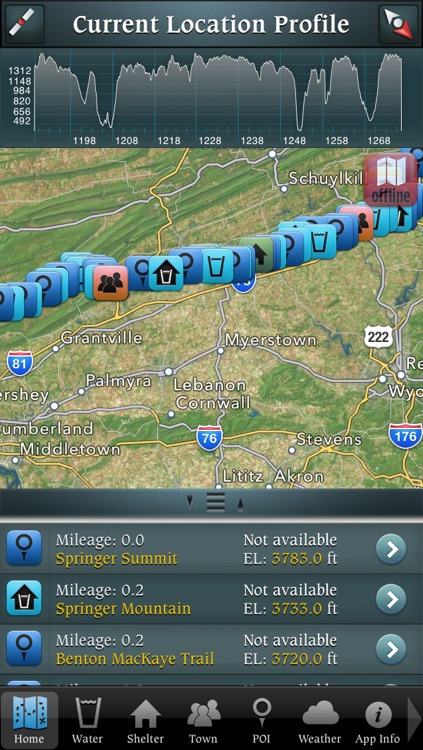
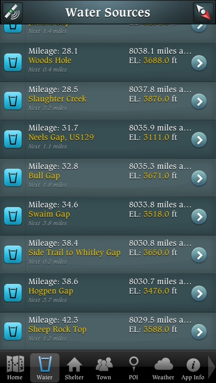
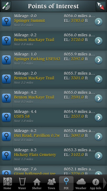
Allows users to view a map of the Appalachian Trail in Smoky Mountain National Park of the United States from Fontana mile 164.6 to Davenport Gap mile 238.1. Displays the user's location on the trail, updated in real time. Users may also see the location of shelters, water sources, parking lots, towns, as well as points of interest along the trail.
App Screenshots

App Store Description
Allows users to view a map of the Appalachian Trail in Smoky Mountain National Park of the United States from Fontana mile 164.6 to Davenport Gap mile 238.1. Displays the user's location on the trail, updated in real time. Users may also see the location of shelters, water sources, parking lots, towns, as well as points of interest along the trail.
The SMNP AT Guide app also shows towns close to the trail, as well as shows various services that can be found in town, including hospitals, post offices, libraries, etc.
Users may also use the app to view weather forecasts for the area they are in.
Disclaimer:
AppAdvice does not own this application and only provides images and links contained in the iTunes Search API, to help our users find the best apps to download. If you are the developer of this app and would like your information removed, please send a request to takedown@appadvice.com and your information will be removed.
AppAdvice does not own this application and only provides images and links contained in the iTunes Search API, to help our users find the best apps to download. If you are the developer of this app and would like your information removed, please send a request to takedown@appadvice.com and your information will be removed.