You are using an outdated browser. Please
upgrade your browser to improve your experience.
♦ KEY FEATURES

Tokyo Metro by Zuti
by Visual IT Ltd
What is it about?
♦ KEY FEATURES
App Screenshots
App Store Description
♦ KEY FEATURES
● Designed for the first time visitor and experienced commuter.
● Simple, fast and intuitive to use.
● Full offline map and routing, works underground, no internet connection required.
● Animates the route and allows tracking of the journey using GPS
● Instantly see the route of any transport service drawn on the map.
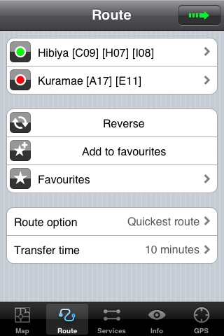
● Save and recall favourite and recent journeys.
● Take me home feature.
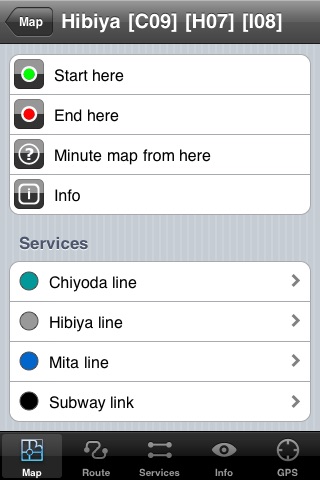
● Unique “Minute Map” feature allows quick view of all journey times from a start location.
● Services can be turned on or off, routing round problems.
● Works on iPhone or iPod and in landscape or portrait mode.
● GPS location and tracking.
● Streets, Places of interest etc built into the application.
♦ OVERVIEW
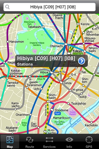
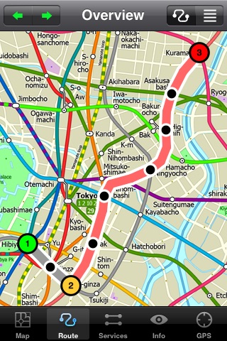
The new Tokyo Metro app makes it easy to travel in and around the city using the Toei Subway, JR East routes (within the Tokyo Suburban area), Shinkansen routes, Streetcars, some important private lines and Tokyo Cruise lines. Unlike old fashioned schematic style maps this product contains a geographically accurate central area showing major streets, parks and places of interest etc, allowing the user to easily get their bearings.
♦ MAP
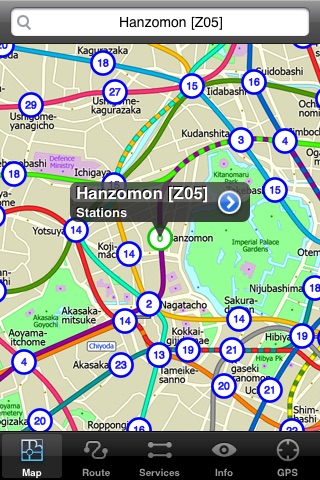
The map is hand drawn by Visual IT and provides a unique geographically based view of the Tokyo Metro with many places of interest drawn directly on the background so you can easily get your bearings when traveling around the city. You can also use your inbuilt GPS to accurately locate and track yourself within the city centre and see the nearest transportation stop and distance to it. This is the only pubic transportation route planner with this ability.
Tap on the map for location information, use the inbuilt search feature or choose from a list of locations. Places of interest, museums, hotels, parks, restaurant, shops, hospitals, streets, etc, are also included. The route planner will automatically suggest the nearest station to any place of interest you select.
♦ MINUTE MAP
Another great feature is the “Minute Map” option which allows you to see the travel times from a start point to all other locations on the map. This is a unique way to view the topology of a city and gauge traveling times.
♦ ROUTING
The application does not require an internet connection and will always be available to display a clear and detailed view of the city transport systems, plus list and animate the optimum route for your journey. This product provides the fastest route calculations of any mobile routing application (virtually instantaneous) using actual published journey times with the ability to select the quickest route or the route with the least changes.
♦ MORE MAPS
This map is one in a series of Zuti worldwide city maps, if you like this product you may also enjoy some of our other offerings, please visit www.zuti.co.uk for further information.
Disclaimer:
AppAdvice does not own this application and only provides images and links contained in the iTunes Search API, to help our users find the best apps to download. If you are the developer of this app and would like your information removed, please send a request to takedown@appadvice.com and your information will be removed.
AppAdvice does not own this application and only provides images and links contained in the iTunes Search API, to help our users find the best apps to download. If you are the developer of this app and would like your information removed, please send a request to takedown@appadvice.com and your information will be removed.