You are using an outdated browser. Please
upgrade your browser to improve your experience.
FlyToMap – “Solutions for your Voyage”

Washington Park map GPS charts
by Flytomap

What is it about?
FlyToMap – “Solutions for your Voyage”
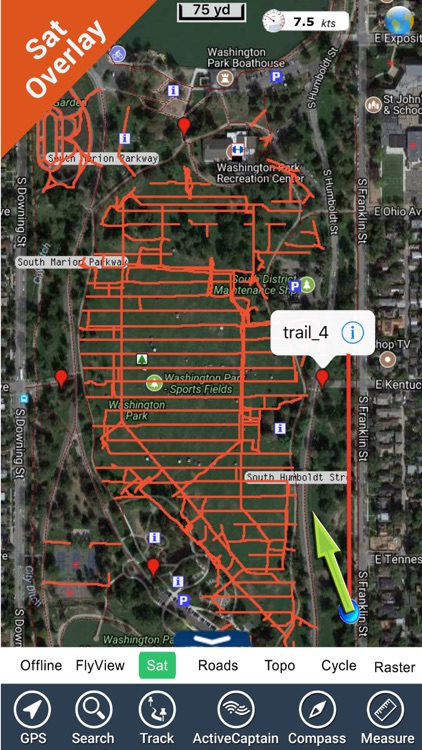
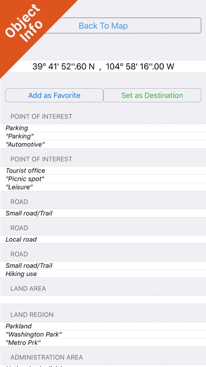
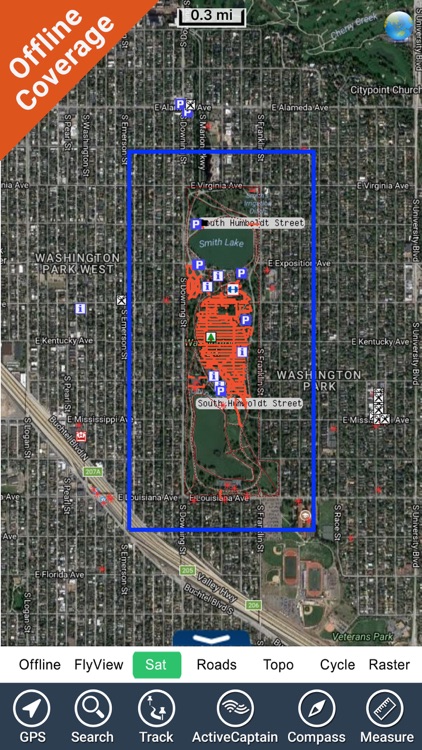
App Screenshots

App Store Description
FlyToMap – “Solutions for your Voyage”
Park Map contains extremely advanced embedded electronic charts in offline with all information collected from the National Park Service and local sources. The map contains all multiple trails (Hiking, Biking…) and point of interests like Campgrounds, Picnic grounds, mountain summits, Road & Rail information from tiger etc.
Map Features:
•Travel Guide
•Search Favorites using Latitudes/Longitudes
•Insert Destination Waypoint and track Distance, Speed & Direction
•Gps (also in low signal conditions)
•Advanced Photo Managing
•Track Routes & Email them & more…
FlyToMap provides rich maps for all parks and recreational regions in US & Other major parts of the World.
! Enjoy Great Voyages!
Note:
"Continued use of GPS running in the background can dramatically decrease battery life."
"Turn off GPS when not in use"
Disclaimer:
AppAdvice does not own this application and only provides images and links contained in the iTunes Search API, to help our users find the best apps to download. If you are the developer of this app and would like your information removed, please send a request to takedown@appadvice.com and your information will be removed.
AppAdvice does not own this application and only provides images and links contained in the iTunes Search API, to help our users find the best apps to download. If you are the developer of this app and would like your information removed, please send a request to takedown@appadvice.com and your information will be removed.