You are using an outdated browser. Please
upgrade your browser to improve your experience.
With this app, first responders can collect location-based data like building preplans, hydrants, hazmat locations, landing zones, gate/lock codes, residents with special needs, etc

911 Preplans & Locations
by Peakview Software LLC
What is it about?
With this app, first responders can collect location-based data like building preplans, hydrants, hazmat locations, landing zones, gate/lock codes, residents with special needs, etc. and it is readily accessible during an emergency. In an instant you can see the important items near your destination, and also along your route to get there. 911 Locations is an app that helps you get prepared for emergencies, and assists you during the incident.
911 Preplans & Locations is FREE but there are more add-ons
-
$4.99
Unlimited Locations
App Screenshots
App Store Description
With this app, first responders can collect location-based data like building preplans, hydrants, hazmat locations, landing zones, gate/lock codes, residents with special needs, etc. and it is readily accessible during an emergency. In an instant you can see the important items near your destination, and also along your route to get there. 911 Locations is an app that helps you get prepared for emergencies, and assists you during the incident.
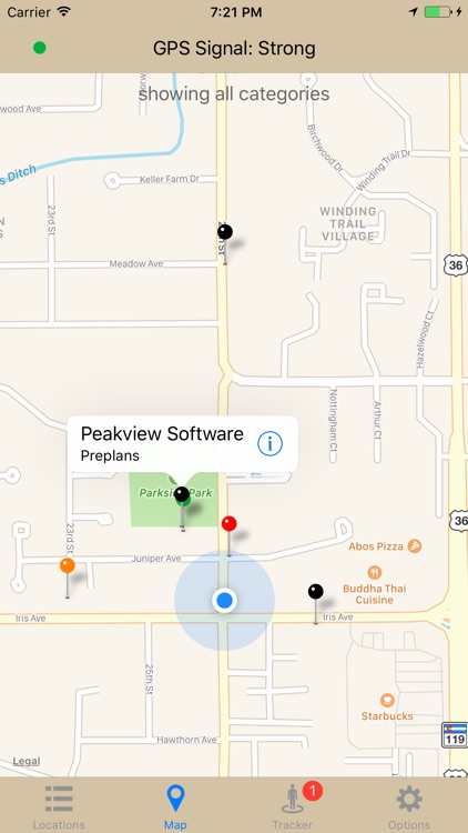
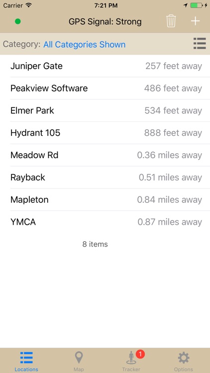
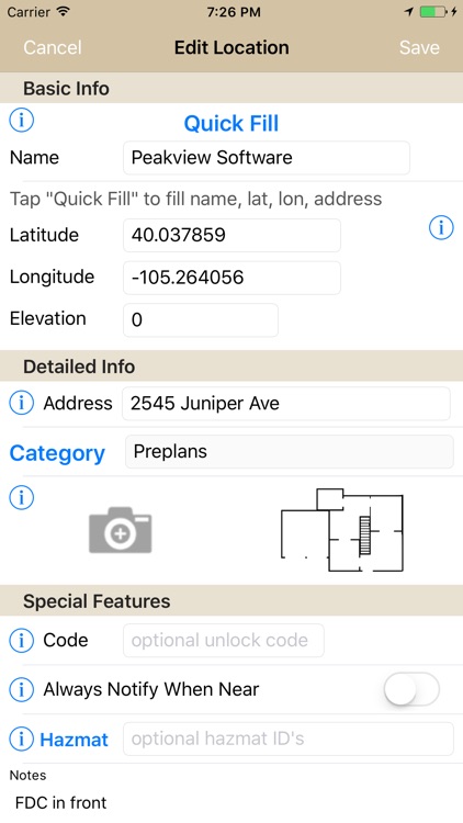
911 Locations was designed to be super-easy to use. Nobody wants another software tool that takes a rocket scientist to figure it out, or is too clunky to use. You can collect GPS coordinates, street address, and photos of a new location in just a few seconds with the Quick Fill automatic data entry! You can view your database in a list, sorted the way you like, and on a map.
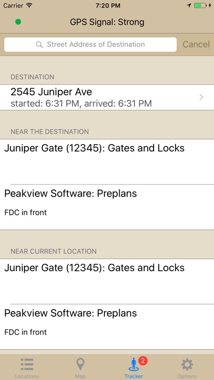
During an incident, you can quickly enter your destination just like you would a maps app, and you will be shown any incident preplanning information that already exist near that destination. 911 Locations will even alert you when you approach a gate or lock and show you the unlock code, for example, automatically. Your en-route and arrival times are tracked automatically when you use this feature.
Since this app is so fast and easy to use, you can also use it to collect structure defense information very quickly during a wildfire, for example. It has also been used to store district landmarks and key addresses for new member training purposes.
Free version lets you create up to 20 locations. A one-time upgrade gives you unlimited locations. Supports import and export of spreadsheet-style data files.
Continued use of GPS running in the background can dramatically decrease battery life. This app will automatically turn off background GPS tracking after 30 minutes in the background. To resume, simply launch the app.
Disclaimer:
AppAdvice does not own this application and only provides images and links contained in the iTunes Search API, to help our users find the best apps to download. If you are the developer of this app and would like your information removed, please send a request to takedown@appadvice.com and your information will be removed.
AppAdvice does not own this application and only provides images and links contained in the iTunes Search API, to help our users find the best apps to download. If you are the developer of this app and would like your information removed, please send a request to takedown@appadvice.com and your information will be removed.