You are using an outdated browser. Please
upgrade your browser to improve your experience.

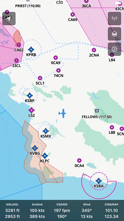
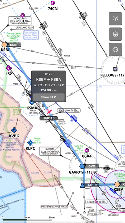
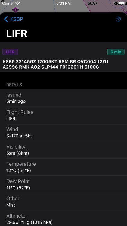
AeroNavMap is a moving map for X-Plane and PilotEdge

AeroNavMap
by Jan Chaloupecky

What is it about?
AeroNavMap is a moving map for X-Plane and PilotEdge.
App Screenshots


App Store Description
AeroNavMap is a moving map for X-Plane and PilotEdge.
Features
- X-Plane live position on the map
- Display many data from X-Plane
- Detailed aeronautical maps with updated nav cycles
- Different map styles (dark, light, terrain, satellite, aeronautical)
- FAA D-TTP Procedures
- Sectional VFR charts
- IFR high/low enroute charts
- Weather overlays
- Live PilotEdge traffic
- Live PilotEdge ATC audio
- Set the nav radio frequencies X-Plane by selecting them on the map
- ATIS
Disclaimer:
AppAdvice does not own this application and only provides images and links contained in the iTunes Search API, to help our users find the best apps to download. If you are the developer of this app and would like your information removed, please send a request to takedown@appadvice.com and your information will be removed.
AppAdvice does not own this application and only provides images and links contained in the iTunes Search API, to help our users find the best apps to download. If you are the developer of this app and would like your information removed, please send a request to takedown@appadvice.com and your information will be removed.