You are using an outdated browser. Please
upgrade your browser to improve your experience.

“Alta Via dei Parchi 3D” is the official mapping product of “Appennino e Verde – Regione Emilia Romagna” to support the hikers along the best itineraries of the Apennines, in an unspoiled countryside, in real contact with nature, culture and history

Alta Via dei Parchi - 3D Maps
by GeoMind

What is it about?
“Alta Via dei Parchi 3D” is the official mapping product of “Appennino e Verde – Regione Emilia Romagna” to support the hikers along the best itineraries of the Apennines, in an unspoiled countryside, in real contact with nature, culture and history.
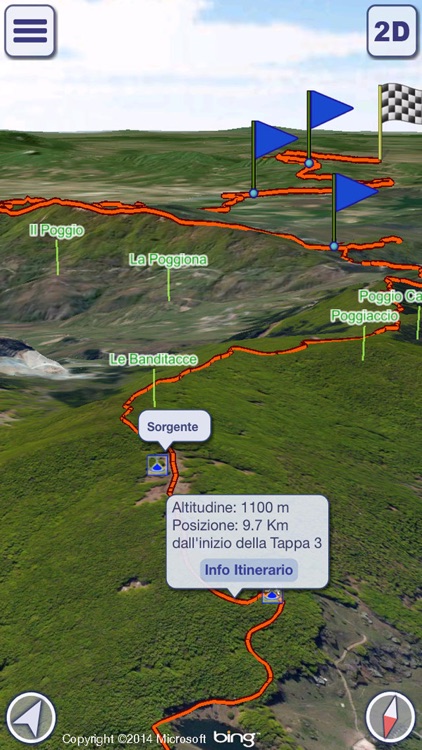
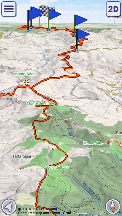
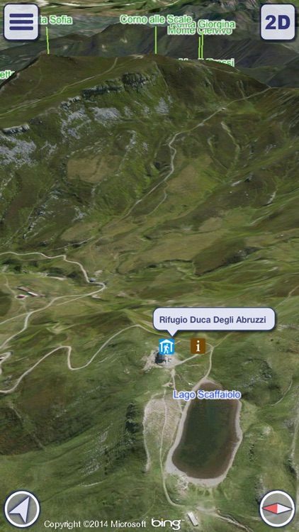
App Screenshots

App Store Description
“Alta Via dei Parchi 3D” is the official mapping product of “Appennino e Verde – Regione Emilia Romagna” to support the hikers along the best itineraries of the Apennines, in an unspoiled countryside, in real contact with nature, culture and history.
MAIN FEATURES
- Highly detailed 3D terrain
- Online and Offline modes
- Pre-defined itineraries
- GPS tracking
- Name search (also in Offline mode)
- Calculation of custom paths (routing)
- Altimetry graph, travel times and statistics
- Custom made gCARTA Topographic chart
- Gyroscope features: GyroPilot and First Person View
Alta Via dei Parchi 3D shows you high quality terrain details, 3D topographic maps and aerial images, with points of interest, natural attractions, trails and paths.
The pre-defined itineraries show you the best hiking routes of the Apennines, with support information for your excursions; it also possible to build your own custom routes.
Maps can be stored offline on your device, so you will always follow the best path, no matter if in the middle of the forest or at the top of a mountain.
The three phases of the use of “Alta Via dei Parchi 3D”:
1)Before you go: plan your trip on the 3D map, check the best way points, discover the local attractions. Take a preview of your hike, or just fly over your favorite mountains with a virtual tour.
2)During your trip: record your GPS tracks, check your ascent rates and times, improve your hiking experience in “First Person View” mode, where “Alta Via dei Parchi 3D” uses your position and view direction to display what is in front of you, with the names of mountains, landmarks, etc..
3)When you come back home: review your paths, share your saved tracks with your friends, save them for future use and check your stats information.
WARNING
Continued use of GPS running in the background can dramatically decrease battery life.
AVAILABLE ITINERARIES
- Sentiero Matilde
- The Way of Gods
- Alta Via delle Foreste Sacre – Camaldoli
Disclaimer:
AppAdvice does not own this application and only provides images and links contained in the iTunes Search API, to help our users find the best apps to download. If you are the developer of this app and would like your information removed, please send a request to takedown@appadvice.com and your information will be removed.
AppAdvice does not own this application and only provides images and links contained in the iTunes Search API, to help our users find the best apps to download. If you are the developer of this app and would like your information removed, please send a request to takedown@appadvice.com and your information will be removed.