You are using an outdated browser. Please
upgrade your browser to improve your experience.

Just over 100 miles long, the Altamaha River is formed by the confluence of the Ocmulgee and Oconee Rivers just east of Lumber City

Altamaha River Guide
by Gaurav Kumar


What is it about?
Just over 100 miles long, the Altamaha River is formed by the confluence of the Ocmulgee and Oconee Rivers just east of Lumber City. Critical habitat is found here for bald eagles, swallow-tailed kites and red-cockaded woodpeckers. The waterway is flush with wildlife, and not the first man-made dam. Boat ramps and landings facilities are located in each county as well as a range of services from bait and tackle shops to picnic areas and marked hiking trails.
App Screenshots

App Store Description
Just over 100 miles long, the Altamaha River is formed by the confluence of the Ocmulgee and Oconee Rivers just east of Lumber City. Critical habitat is found here for bald eagles, swallow-tailed kites and red-cockaded woodpeckers. The waterway is flush with wildlife, and not the first man-made dam. Boat ramps and landings facilities are located in each county as well as a range of services from bait and tackle shops to picnic areas and marked hiking trails.
This app provided by the Altamaha River Partnership features:
GPS Enabled Mapping
WMA Areas Defined on Map
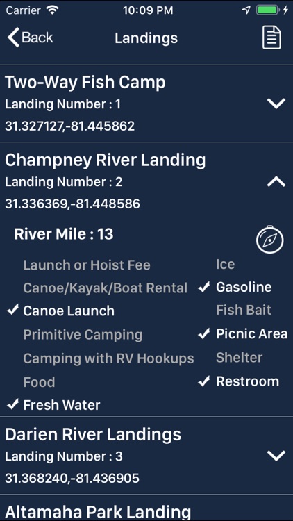
Locations of River Landings with Available Amenities
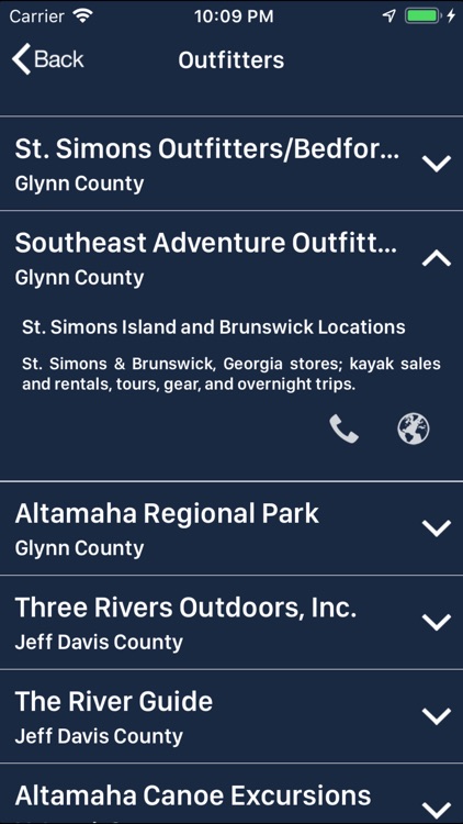
Listings of Local Outfitters
Tourist Information
Water Levels
Events Along the River
Web and Social Media Connection
This app is for reference only and should not be used as the only source of navigation. All boundaries and locations are approximate.
Disclaimer:
AppAdvice does not own this application and only provides images and links contained in the iTunes Search API, to help our users find the best apps to download. If you are the developer of this app and would like your information removed, please send a request to takedown@appadvice.com and your information will be removed.
AppAdvice does not own this application and only provides images and links contained in the iTunes Search API, to help our users find the best apps to download. If you are the developer of this app and would like your information removed, please send a request to takedown@appadvice.com and your information will be removed.