You are using an outdated browser. Please
upgrade your browser to improve your experience.

Use Benchmrk to kickstart any field survey mapping and reality capture workflow to deliver property boundary data (dcdb) and survey control to any field or office software

Benchmrk
by Geolocarta Pty Ltd


What is it about?
Use Benchmrk to kickstart any field survey mapping and reality capture workflow to deliver property boundary data (dcdb) and survey control to any field or office software.
Benchmrk is FREE but there are more add-ons
-
$1.49
Benchmrk Document
App Screenshots
App Store Description
Use Benchmrk to kickstart any field survey mapping and reality capture workflow to deliver property boundary data (dcdb) and survey control to any field or office software.
Benchmrk is for all Survey, Mapping and Construction Professionals who work with survey control. Benchmrk aggregates and provides intelligent tools to use the Australian Survey Control Network.
Benchmrk is Australia's first smartphone app that allows you to find survey grade Benchmrk locations using Augmented Reality. Use Benchmrk to instantly give you access to the closest Benchmrk locations.
USE BENCHMRK TO ...
- Geolocate Reality Capture
- Geolocate Digital Twins
- Create highly accurate real-world AR Applications
- Validate UAV Data
- Locate "Mean Sea Level"
- Overlay survey data on any Web Map
- Coordinate with local and state government infrastructure
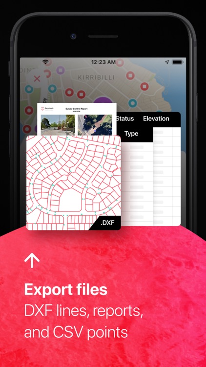
Once you have found the Benchmrk's you need you can export the DCDB and local benchmrk data for use in any field and office software.
What can this help me do?
Benchmrk provides direct access to the Survey Control network for the whole of Australia. With the help of Benchmrk you will have up-to-date access to all government records allowing for the reliable completion of legally traceable spatial content capture such and drone mapping, reality capture, field surveys and cadastral surveys.
- All data sources from Authoritative point of truth.
- Start all surveys with Export of property boundaries (DCDB) and survey control to your favourite field and office software.
- National coverage
- Evaluate site location with street-view
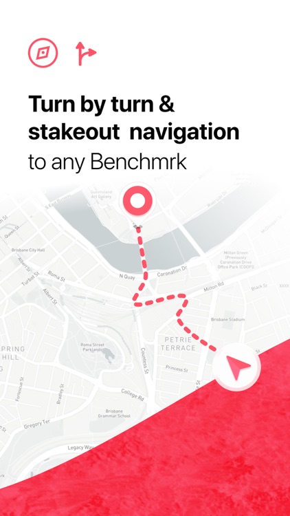
- Compass stakeout for detailed navigation to recover your control
- Track all your work with a Benchmrk package of all subject control records
- Filter Content that best suits your use case
- Search any survey plan location, lot and plan or plan.
- Search any survey control ID
- Instantly find survey control near your device
- integrated driving directions
For more information head over to http://www.benchmrk.com.au where you will also find our terms and conditions, privacy policy and where you to can find the open data that powers Benchmrk.
Disclaimer:
AppAdvice does not own this application and only provides images and links contained in the iTunes Search API, to help our users find the best apps to download. If you are the developer of this app and would like your information removed, please send a request to takedown@appadvice.com and your information will be removed.
AppAdvice does not own this application and only provides images and links contained in the iTunes Search API, to help our users find the best apps to download. If you are the developer of this app and would like your information removed, please send a request to takedown@appadvice.com and your information will be removed.