You are using an outdated browser. Please
upgrade your browser to improve your experience.

‘Blitz Map’ is a free application that provides real-time lightning strike information in the Asia-Pacific region

Blitz Map
by tomomi narita

What is it about?
‘Blitz Map’ is a free application that provides real-time lightning strike information in the Asia-Pacific region. Blitzortung.org, which is used as the data source, is a global, high-precision lightning strike location network that is operated by volunteers to display lightning strike locations in real-time. Please note that the use of this application for commercial purposes is prohibited.
App Store Description
‘Blitz Map’ is a free application that provides real-time lightning strike information in the Asia-Pacific region. Blitzortung.org, which is used as the data source, is a global, high-precision lightning strike location network that is operated by volunteers to display lightning strike locations in real-time. Please note that the use of this application for commercial purposes is prohibited.
[About this application]
-The real-time lightning information is displayed.
-The color-coded data in the past two hours is displayed.
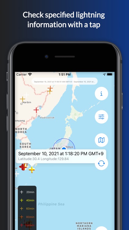
-You can check the time and location of lightning strike with a single tap.
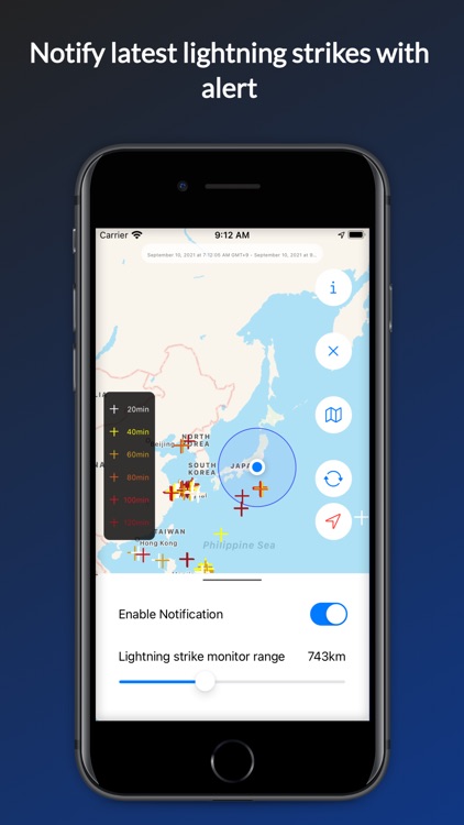
-When lightning strikes a location you specify, a warning pops up on the screen.
-Three types of maps are available to check the location of the lightning strike.
[How to use]
* Lightning information
-The lightning movement in the past two hours is displayed in different colors every 20 minutes.
-By tapping on a lightning location, you can see the time and location.
* Warning information
-When lightning strikes the area you specify, a warning will be shown within a radius of 1km to 2000km.
* Map Information
-You can select the display from three types of maps: standard, aerial photo and hybrid.
[Notes]
Any commercial use of this application is strictly prohibited. We assume no responsibility for the completeness, timeliness, quality, or accuracy of the information displayed.
-Provided by: Blitzortung.org
-Application developed by:Shonan Insttitute of technology, Narita-LAB with the cooperation of Manabelle
Disclaimer:
AppAdvice does not own this application and only provides images and links contained in the iTunes Search API, to help our users find the best apps to download. If you are the developer of this app and would like your information removed, please send a request to takedown@appadvice.com and your information will be removed.
AppAdvice does not own this application and only provides images and links contained in the iTunes Search API, to help our users find the best apps to download. If you are the developer of this app and would like your information removed, please send a request to takedown@appadvice.com and your information will be removed.