You are using an outdated browser. Please
upgrade your browser to improve your experience.

View Canadian weather radar, satellite imagery, GFA, and surface analysis charts

Canada Weather
by Gauld Developments


What is it about?
View Canadian weather radar, satellite imagery, GFA, and surface analysis charts.
App Screenshots


App Store Description
View Canadian weather radar, satellite imagery, GFA, and surface analysis charts.
--- Radar Images ---
Canada Weather is location-aware and can automatically find the closest radar station. Select from a list of 31 stations nationwide, including five regional views: Pacific, Prairies, Ontario, Quebec, and Atlantic. Animate up to 100 images calibrated for either rain or snow and displayed in one of two preset formats. Visit the Environment Canada website for a detailed map of radar coverage in your area.
--- Radar Map ----
View up to 3 hours of radar animations for all of North America and choose between Reflectivity or Precipitation Rate (rain/snow). Customize animation speed, delay, radar opacity, and map type.
--- Satellite ---
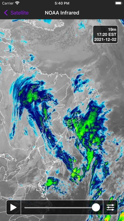
View satellite imagery from the GOES-16 weather satellite in visible light, infrared, and combined. Choose between the Meteorological Society of Canada (MSC) or the US National Oceanic and Atmospheric Administration (NOAA) and animate up to 6 hours of imagery. Coverage includes all of Canada and most of the USA.
--- Charts ---
View Surface Analysis and Graphical Area Forecast (GFA) charts for all of Canada. The Surface Analysis is a snapshot of the current pressure and frontal systems across Canada. GFAs give you a 12-hour forecast of the expected pressure and frontal systems at a regional level, along with information such as expected precipitation, cloud height & coverage, turbulence, icing, and freezing level. While these charts are typically used by pilots, they offer an excellent look at the current weather systems in a given region.
Quickly switch between 0/+6/+12 GFA images and between "Clouds & Weather" and "Icing, Turbulence, & Freezing Level" images. You can also view GFA pairs side-by-side instead of having to switch between them.
--- Data Providers ---
Radar: Environment Canada
Satellite: Meteorological Service of Canada (MSC), National Oceanic and Atmospheric Administration (NOAA), Cooperative Institute for Research in the Atmosphere (CIRA)
Charts: NAV CANADA
Disclaimer:
AppAdvice does not own this application and only provides images and links contained in the iTunes Search API, to help our users find the best apps to download. If you are the developer of this app and would like your information removed, please send a request to takedown@appadvice.com and your information will be removed.
AppAdvice does not own this application and only provides images and links contained in the iTunes Search API, to help our users find the best apps to download. If you are the developer of this app and would like your information removed, please send a request to takedown@appadvice.com and your information will be removed.