You are using an outdated browser. Please
upgrade your browser to improve your experience.

All-in-one assistant with a map, compass, GPS coordinates to view and share in 6 formats, altitude, distance, sunset/sunrise, speedometer with top and average speed, navigator to your target or along the route and a whole lot more

Compass 55. Map & GPS kit.
by Kalimex-Consulting s.r.o. @Blocoware & Stanislav Dvoychenko


What is it about?
All-in-one assistant with a map, compass, GPS coordinates to view and share in 6 formats, altitude, distance, sunset/sunrise, speedometer with top and average speed, navigator to your target or along the route and a whole lot more!
Compass 55 is FREE but there are more add-ons
-
$3.99
Pro pack
App Screenshots


App Store Description
All-in-one assistant with a map, compass, GPS coordinates to view and share in 6 formats, altitude, distance, sunset/sunrise, speedometer with top and average speed, navigator to your target or along the route and a whole lot more!
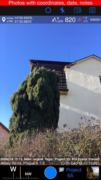
+ Advanced target/waypoint editor. Can be also used as a coordinates converter. You can use map to check or set waypoint location and add photo or audio note.
+ Share your location via email, text message, Facebook or Twitter. This includes UTM, MGRS and Latitude/Longitude (MENU>Share my location).
+ You can use UTM, MGRS or Lat/Long, just pick your preference in settings (Coordinate Format).
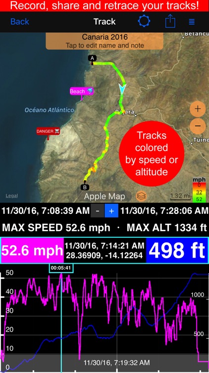
+ Speedometer. Shows you the speed and pace. Speedometer also gives you options to control average and max speed and pace counters (MENU > RESET and PAUSE/RESUME counters).
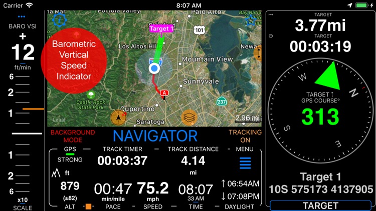
+ Compass. Instant reaction compass, no delays. Automatically pickups the direction based on magnetic or GPS course. If you mostly walk or drive, you can change this automatic mode in app settings > Compass or GPS course. NATO mils? Same place in settings to set.
+ Magnetic declination δ for the current location and any location on the map (via World Magnetic Model, WMM, no need for data/internet).
+ Sunset and sunrise. So you can plan your travel better.
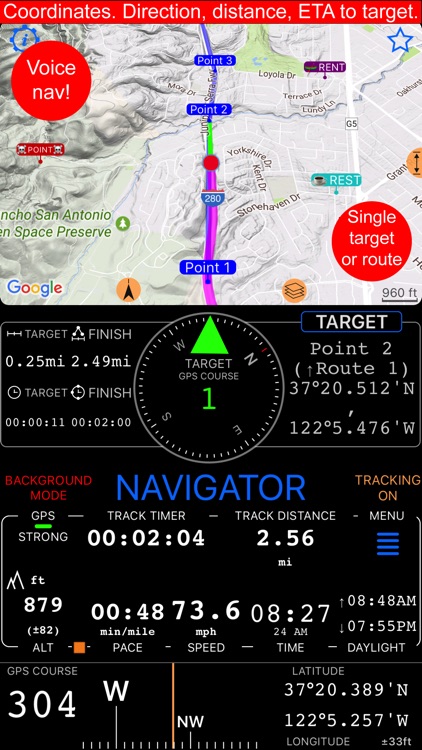
+ Arrow pointing to your target waypoint. Distance and bearing to it.
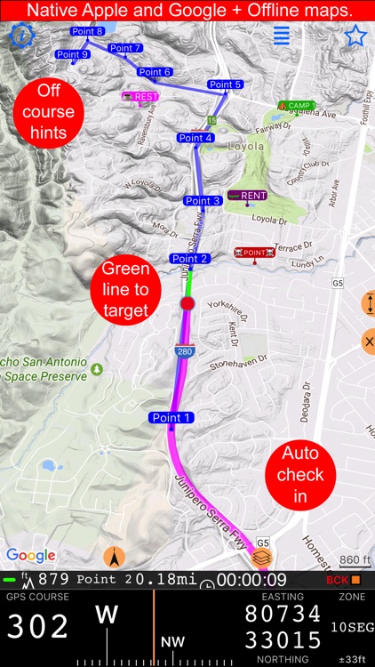
+ Create/measure routes and areas.
+ Barometric Vertical Speed Indicator (VSI, IVSI) in both scale and graph forms.
+ Integration of bluetooth sensors: Cycling cadence, Heart rate, Cycling speed.
All above belong to a basic version. Lifetime PRO Pack upgrade will add following capabilities:
+ Recording and sharing GPS tracks.
+ Moving waypoints between folders.
+ Showing ETA to a target as this requires GPS tracking.
+ Native Google map with fantastic terrain map, amazing 3D and real night mode.
+ Adding own/custom tile map servers.
+ Downloading offline maps. Offline maps import in .sqlitedb, rmaps, mbtiles formats. Support for overzoom and underzoom - offline map is shown even for zoom levels that are not downloaded.
+ GPX import and export for waypoints, tracks and routes.
+ Google Earth KML support for waypoints and tracks import/export. KMZ support for waypoints and tracks export, waypoints import.
+ Ground overlays. Import KMZ ground overlay or draw your own on the map in the app and share as kmz files!
+ CSV import/export for waypoints.
+ Voice coach to tell you active track distance and duration, current speed and altitude without need to open the app.
+ Support for Siri shortcuts in IOS 12 for starting and stopping GPS tracks.
+ From version 4.2 - support for OSGB (including grid shifts) and SK 42 in the coordinates converter.
+ BACKGROUND MODE. App will work in background automatically when tracking. You can use other apps while Compass 55 does its job in the background!
+ PRIVACY. Compass 55 never shares your location data with 3rd parties or ad agencies. Location data is used solely for telling you direction to a target and recording GPS tracks and never leave the app unless you decide to share by means of a track export. It always lets you know when background mode is on and never runs in background unless the track is being recorded.
! You can use this app on your iPhone as well as on any cellular iPad. **App will not work properly on iPods and wifi only iPads as they don't have GPS (external GPS module is required). As quite a lot of us are using external GPS modules, app is available for wifi only iPads and iPods.
! Please note that as with all GPS apps, continued use of GPS running in the background can dramatically decrease battery life.
Disclaimer:
AppAdvice does not own this application and only provides images and links contained in the iTunes Search API, to help our users find the best apps to download. If you are the developer of this app and would like your information removed, please send a request to takedown@appadvice.com and your information will be removed.
AppAdvice does not own this application and only provides images and links contained in the iTunes Search API, to help our users find the best apps to download. If you are the developer of this app and would like your information removed, please send a request to takedown@appadvice.com and your information will be removed.