You are using an outdated browser. Please
upgrade your browser to improve your experience.
The top row displays the X(horizontal) and Y(vertical) levels both in degrees and percent

Compass Level Chart
by Colin Hsi
What is it about?
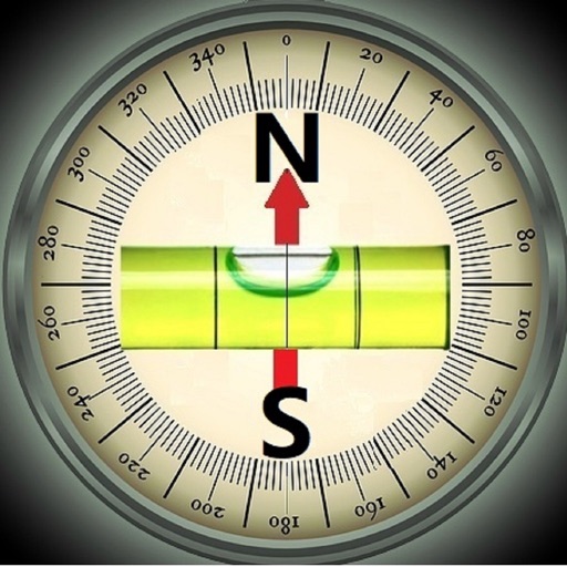
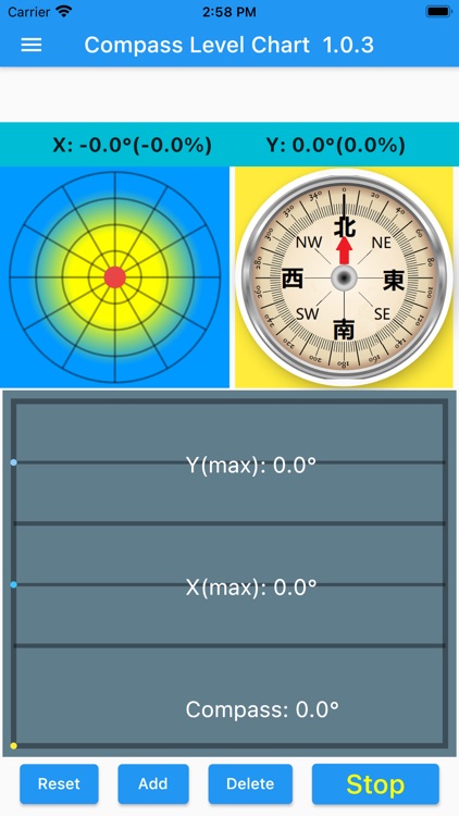
The top row displays the X(horizontal) and Y(vertical) levels both in degrees and percent. The left circle simulates a water bubble inside a ground level meter. The compass uses the top center as north. Upon start, it will start collecting one set of data every 0.2 seconds. Each set of data has the X degree, Y degree, and Compass angle. The chart stores and displays the latest 100 data sets, and old data will be deleted. [STOP] will stop the sampling and plotting. [RESET] will clear the list of data. [ADD] will add one data set per click. [DELETE] will delete one set of data. The maximum value of each component is displayed in each section. Y(max) shows the maximum value of all Y data in the chart. X(max) is the maximum value of all X data.
App Store Description
The top row displays the X(horizontal) and Y(vertical) levels both in degrees and percent. The left circle simulates a water bubble inside a ground level meter. The compass uses the top center as north. Upon start, it will start collecting one set of data every 0.2 seconds. Each set of data has the X degree, Y degree, and Compass angle. The chart stores and displays the latest 100 data sets, and old data will be deleted. [STOP] will stop the sampling and plotting. [RESET] will clear the list of data. [ADD] will add one data set per click. [DELETE] will delete one set of data. The maximum value of each component is displayed in each section. Y(max) shows the maximum value of all Y data in the chart. X(max) is the maximum value of all X data.
Since the Compass measurement may be affected by all neighboring magnetic components, calibration is necessary and should be done frequently. To calibrate, simply move the phone in a figure 8 pattern, like writing the letter '8' with the phone in the air. Swing the phone back and forth a couple of times and it will calibrate the compass. This program samples data continuously, and the calibration can be done when the program is active. The basic idea is to let the magnetic sensor establish a 3D reading of the phone environment to derive the North direction. The program will run continuously in the background until closed.
Disclaimer:
AppAdvice does not own this application and only provides images and links contained in the iTunes Search API, to help our users find the best apps to download. If you are the developer of this app and would like your information removed, please send a request to takedown@appadvice.com and your information will be removed.
AppAdvice does not own this application and only provides images and links contained in the iTunes Search API, to help our users find the best apps to download. If you are the developer of this app and would like your information removed, please send a request to takedown@appadvice.com and your information will be removed.