You are using an outdated browser. Please
upgrade your browser to improve your experience.
Sometimes we need to know the precise weather condition where we’re living in, Earth Weather Live is a weather app, which is used to display the live weather report of our region as well as worldwide

Earth Weather Live
by Sathish Sha


What is it about?
Sometimes we need to know the precise weather condition where we’re living in, Earth Weather Live is a weather app, which is used to display the live weather report of our region as well as worldwide. Especially we can search by the country/region/locality to see the live weather report of the place.
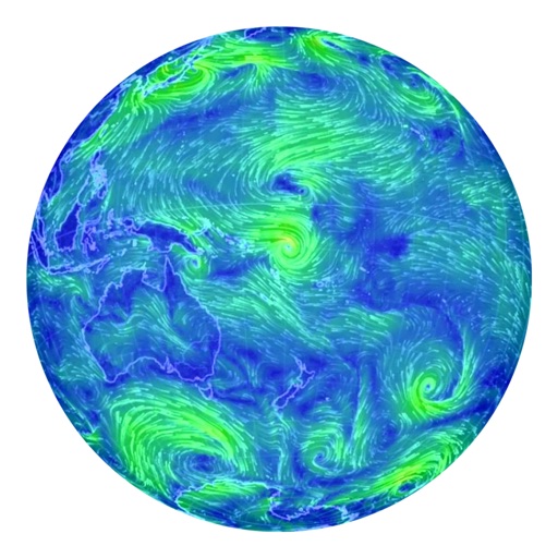
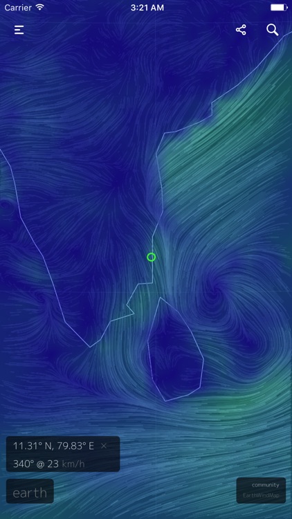
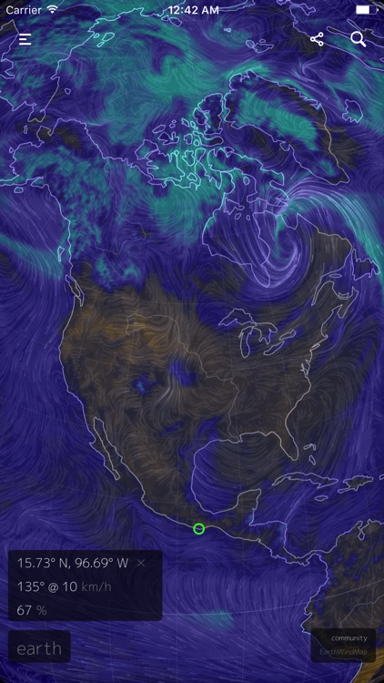
App Screenshots

App Store Description
Sometimes we need to know the precise weather condition where we’re living in, Earth Weather Live is a weather app, which is used to display the live weather report of our region as well as worldwide. Especially we can search by the country/region/locality to see the live weather report of the place.
In rainy or story times Earth weather live will be more useful for finding what’s happening in weather.
No registration/No login and no details getting from user apart from location to detect the current location of the user.
Height :
Atmospheric pressure corresponds roughly to altitude several pressure layers are meteorologically interesting they show data assuming the earth is completely smooth note: 1 hectopascal (hPa) = 1 millibar (mb)
Surface - the "Surface" layer represents conditions at ground or water level this layer follows the contours of mountains, valleys, etc.
• 1000hPa ~100 m, near sea level conditions
• 850hPa ~1,500 m, planetary boundary, low
• 700hPa ~3,500 m, planetary boundary, high
• 500hPa ~5,000 m, vorticity
• 250hPa ~10,500 m, jet stream
• 70hPa ~17,500 m, stratosphere
• 10hPa ~26,500 m, even more stratosphere
Overlay :
Show another dimension of data using color some overlays are valid at a specific height while others are valid for the entire thickness of the atmosphere
• Wind - wind speed at specified height
• Temp - temperature at specified height
• RH - relative humidity at specified height
• WPD - Instantaneous Wind Power Density. Measure of power available in the wind: ½ρv3, where ρ is air density and v is wind velocity
• TPW - Total Precipitable Water. Total amount of water in a column of air stretching from ground to space
• TCW - Total Cloud Water. Total amount of water in clouds in a column of air from ground to space
• 3HPA - 3-hour Precipitation Accumulation. Amount of precipitation over the next three hours
• CAPE - Convective Available Potential Energy from Surface. Indicates the buoyancy of air, a measure of atmospheric instability and predictor of severe weather
• MSLP - Mean Sea Level Pressure. Air pressure reduced to sea level
• MI - Misery Index. Perceived air temperature as combination of heat index and wind chill
• SST - Sea Surface Temperature. Temperature of the ocean surface
• SSTA - Sea Surface Temperature Anomaly. Difference in ocean temperature from daily average during years 1981-2011
• HTSGW - Significant Wave Height. Roughly equal to mean wave height as estimated by a "trained observer"
• COsc - Carbon Monoxide Surface Concentration. The fraction of carbon monoxide present in air at the earth's surface
• CO2sc - Carbon Dioxide Surface Concentration. The fraction of carbon dioxide present in air at the earth's surface
• SO2sm - Sulfur Dioxide Surface Mass. Amount of sulfur dioxide in the air near the earth's surface
• DUex - Dust Extinction. The aerosol optical thickness (AOT) of light at 550 nm due to dust
• SO4ex - Sulfate Extinction. The aerosol optical thickness (AOT) of light at 550 nm due to sulfate
Projection :
• Atlantis (A)
• Azimuthal Equidistant (AE)
• Conic Equidistant (CE)
• Equirectangular (E)
• Orthographic (O)
• Patterson (P)
• Stereographic (S)
• Waterman Butterfly (WB)
• Winkel Tripel (W3)
Longitude :
• Longitude (-360 - 360). Example: -214.68
Latitude :
• Latitude (-360 - 360). Example: 14.2
Zoom :
• Zoom (0-3000)
Let's fly with the wind..
Disclaimer:
AppAdvice does not own this application and only provides images and links contained in the iTunes Search API, to help our users find the best apps to download. If you are the developer of this app and would like your information removed, please send a request to takedown@appadvice.com and your information will be removed.
AppAdvice does not own this application and only provides images and links contained in the iTunes Search API, to help our users find the best apps to download. If you are the developer of this app and would like your information removed, please send a request to takedown@appadvice.com and your information will be removed.