You are using an outdated browser. Please
upgrade your browser to improve your experience.
This app displays the most recent earthquakes on a 3D globe (or a 2D map) that can be enlarged

Earthquake Finder
by Danny Pilkenton

What is it about?
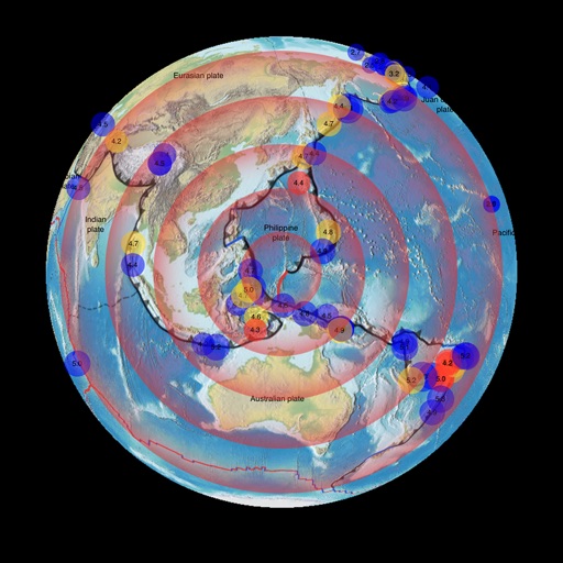
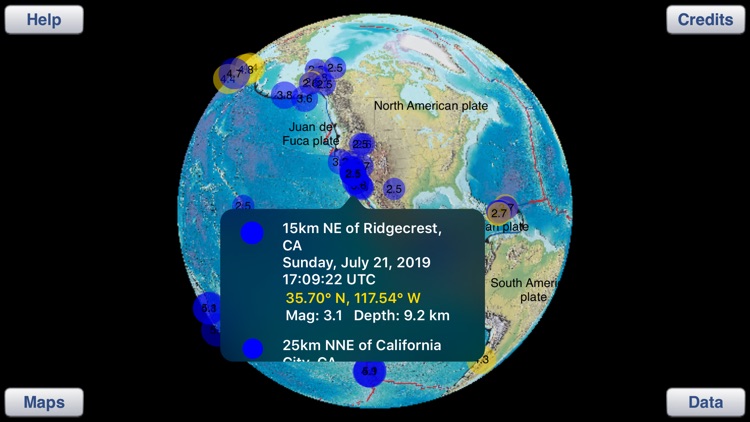
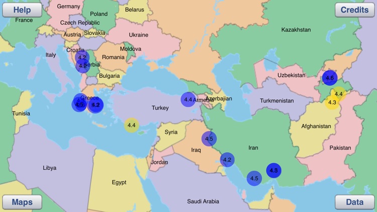
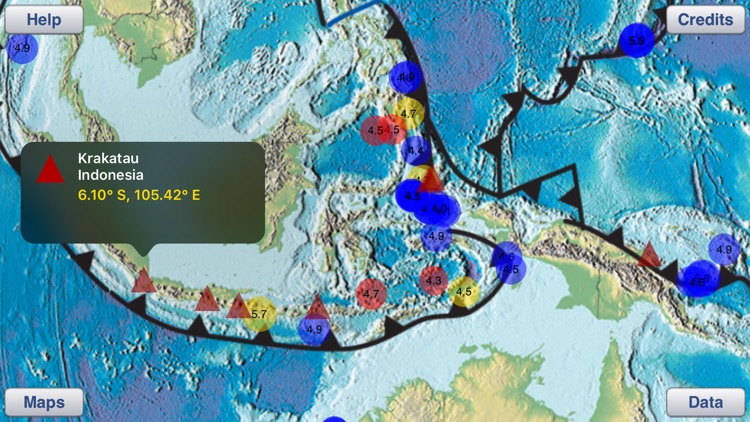
This app displays the most recent earthquakes on a 3D globe (or a 2D map) that can be enlarged. Select a time range and minimum magnitude in a data controls pop-up. Then tap an earthquake circle to see a list of all earthquakes at that location, sorted by date and time. For each earthquake in the list the date, time, latitude, longitude, magnitude, and depth are displayed.
App Screenshots
App Store Description
This app displays the most recent earthquakes on a 3D globe (or a 2D map) that can be enlarged. Select a time range and minimum magnitude in a data controls pop-up. Then tap an earthquake circle to see a list of all earthquakes at that location, sorted by date and time. For each earthquake in the list the date, time, latitude, longitude, magnitude, and depth are displayed.
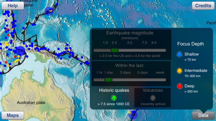
Pop-up data controls allow you to select: the date range (up to the previous week's earthquakes), the range of magnitudes and depths that are displayed, and a view of recent volcanic activity or historic, large earthquake locations.
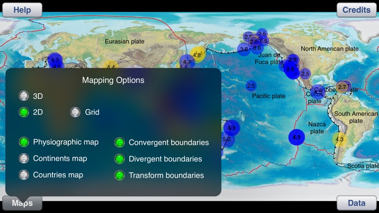
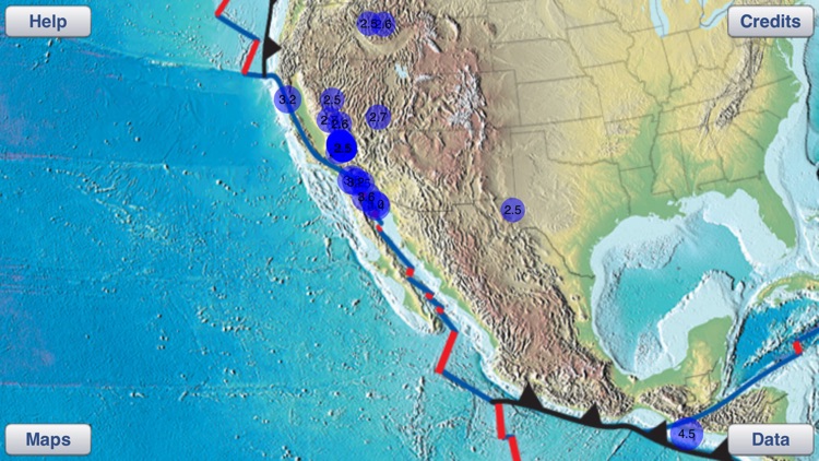
Pop-up map controls allow you to select the type of plate boundaries displayed as well as different maps that show physiographic features, continents, or countries. Use these controls to study the relationship between earthquakes, volcanoes and tectonic plate boundaries.
Earthquake data is obtained from a USGS data feed and is updated every 5 minutes (requires an internet connection).
Disclaimer:
AppAdvice does not own this application and only provides images and links contained in the iTunes Search API, to help our users find the best apps to download. If you are the developer of this app and would like your information removed, please send a request to takedown@appadvice.com and your information will be removed.
AppAdvice does not own this application and only provides images and links contained in the iTunes Search API, to help our users find the best apps to download. If you are the developer of this app and would like your information removed, please send a request to takedown@appadvice.com and your information will be removed.