You are using an outdated browser. Please
upgrade your browser to improve your experience.
Municipal GeoSmart 3D is a smart enterprise geospatial platform and applications where the spatial data from various GIS platforms of the three municipalities (Abu Dhabi, Al Ain and Al Dhafra) are unified and consolidated to a single seamless geospatial database at DPM

Geo Municipal Hub
by DPM
What is it about?
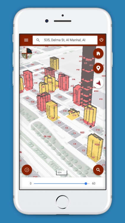
Municipal GeoSmart 3D is a smart enterprise geospatial platform and applications where the spatial data from various GIS platforms of the three municipalities (Abu Dhabi, Al Ain and Al Dhafra) are unified and consolidated to a single seamless geospatial database at DPM. The unified geospatial data is also shared with AD-SDI stakeholder community through ADSIC. The GeoSmart applications are built using the latest OGC compliant open-source technologies and has live integrations with other governmental business systems like ELMS, MePS, TAWTEEQ, BDMS, DED Licenses, CRM, MePS, etc., using ArcGIS and secured web services. The GeoSmart application visualizes data using the latest vector tiling technologies in 3D.
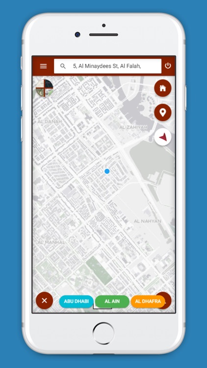
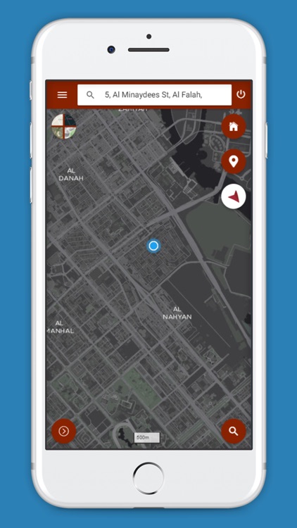
App Screenshots

App Store Description
Municipal GeoSmart 3D is a smart enterprise geospatial platform and applications where the spatial data from various GIS platforms of the three municipalities (Abu Dhabi, Al Ain and Al Dhafra) are unified and consolidated to a single seamless geospatial database at DPM. The unified geospatial data is also shared with AD-SDI stakeholder community through ADSIC. The GeoSmart applications are built using the latest OGC compliant open-source technologies and has live integrations with other governmental business systems like ELMS, MePS, TAWTEEQ, BDMS, DED Licenses, CRM, MePS, etc., using ArcGIS and secured web services. The GeoSmart application visualizes data using the latest vector tiling technologies in 3D.
Disclaimer:
AppAdvice does not own this application and only provides images and links contained in the iTunes Search API, to help our users find the best apps to download. If you are the developer of this app and would like your information removed, please send a request to takedown@appadvice.com and your information will be removed.
AppAdvice does not own this application and only provides images and links contained in the iTunes Search API, to help our users find the best apps to download. If you are the developer of this app and would like your information removed, please send a request to takedown@appadvice.com and your information will be removed.