You are using an outdated browser. Please
upgrade your browser to improve your experience.

Explore and Manage Maps with Precision with GMaps Gis Map Surveys

GMaps: GIS GPS & Area Measure
by Suphawadee Yaprasat

What is it about?
Explore and Manage Maps with Precision with GMaps Gis Map Surveys
App Screenshots

App Store Description
Explore and Manage Maps with Precision with GMaps Gis Map Surveys
Experience unparalleled accuracy in land surveying and management with GMaps Gis Map Surveys! Designed for both professional surveyors and casual users, our app offers comprehensive features for high-precision mapping and geographical measurements.
Key Features:
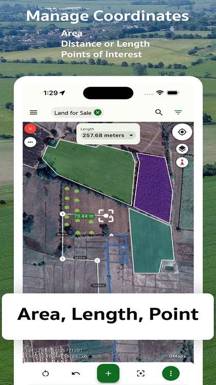
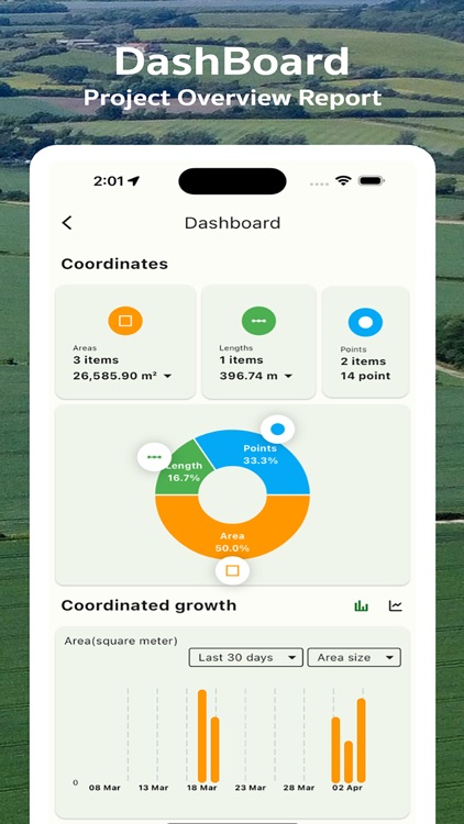
* Land Measurement: Utilize high-precision tools for measuring area and distance on maps.
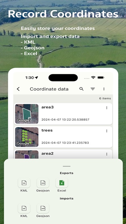
* Coordinate Capture: Easily add various coordinates to your map and build your private coordinate database.
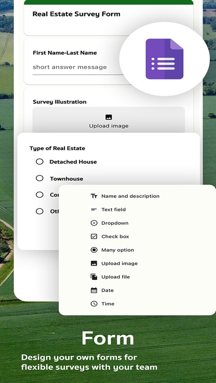
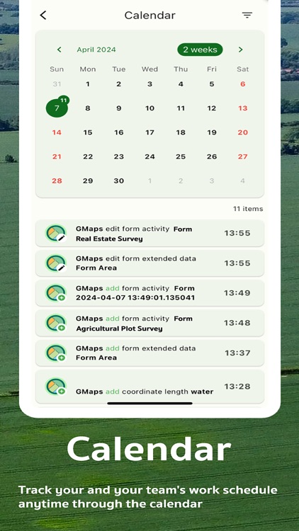
* Survey Data Logging: Record survey details with customizable forms.
* Collaboration: Efficiently work together with your team on surveying and land management projects.
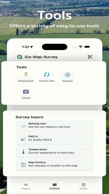
* Unit Conversion: Quickly and accurately convert between various measurement units.
* Compass: Navigate your travels with a high-precision compass.
* GPS Map Camera: Use your device's camera for measuring coordinates and display them on a GPS map.
Ideal for Agriculturists, Surveyors, and Resource Managers:
Whether you're measuring land for agriculture, construction, or resource management, GMaps Gis Map Surveys is an essential tool for planning and managing your terrain.
Multiple Data Export Options:
Supports exporting data in formats like KML, GeoJSON, and Excel to suit all your needs.
Supports Various Coordinate Types:
Whether you need place coordinates, latitude/longitude, DMS, UTM, MGRS, or Geohash, our app has you covered.
Download GMaps Gis Map Surveys today and experience the ultimate in precision mapping and land surveying!
Terms of Use: https://www.apple.com/legal/internet-services/itunes/dev/stdeula/
Disclaimer:
AppAdvice does not own this application and only provides images and links contained in the iTunes Search API, to help our users find the best apps to download. If you are the developer of this app and would like your information removed, please send a request to takedown@appadvice.com and your information will be removed.
AppAdvice does not own this application and only provides images and links contained in the iTunes Search API, to help our users find the best apps to download. If you are the developer of this app and would like your information removed, please send a request to takedown@appadvice.com and your information will be removed.