You are using an outdated browser. Please
upgrade your browser to improve your experience.
An all-in-one app for hiking, snapping photos, and sharing nature with others

GPS Hiker
by Jason Chiu
FREE in the App Store
GPS Hiker puts many of the features you need from a handheld GPS device right on your iPhone. It supports tracking your hike, as well as importing and exporting GPX files and offline maps. The app also includes a built-in camera with features to share your images through email or Twitter.
What is it about?
With GPS Hiker, you get all of the features of a standalone GPS device and then some. It supports offline maps, using Open Street, Open Cycle, Hike Bike, and Custom Map Images. The app also supports importing and exporting GPX files, so you can use preplanned routes or save your tracks for use with other GPS applications. Follow your tracks along with those of others, helping to make sure you stay on the right path, importing GPX files from community websites. GPS Hiker also includes a built-in camera, so you can take pictures without ever leaving the app. You can share those photos through email or Twitter.
For those who...
- Want to enjoy geotagged photographs along with their hiking path
- Want to be able to import or export GPX files for better hiking
Not for those who...
- Don't like to hike
- Don't use GPS at all when they hike
Why we love it
The best feature of GPS Hiker is the ability to import GPX files from other GPS websites and devices. You can enjoy the benefit of following in others' footsteps, helping to ensure you make the most of your hike and stay on the right path to be safe. It supports geotagged photographs, so you can keep a visual memory of where you've been and what you've experienced.
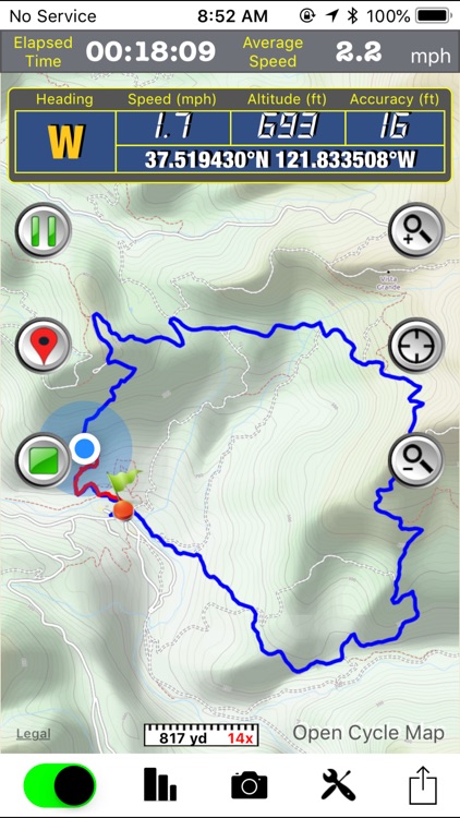
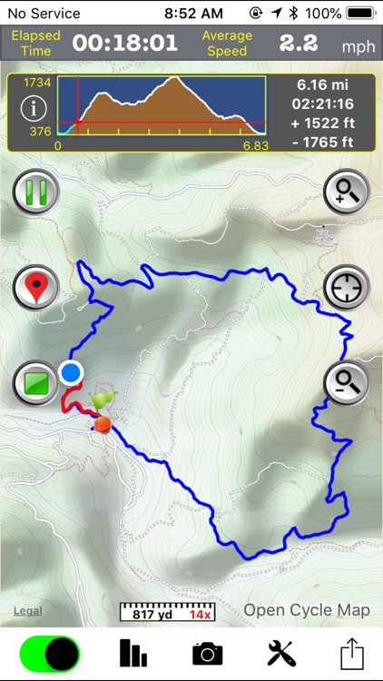
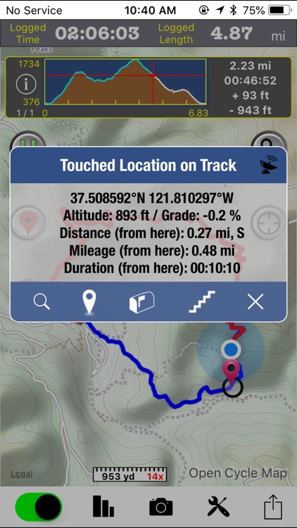
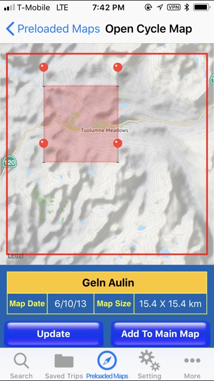
App Screenshots

App Store Description
GPS Hiker is a great and free application for outdoor activities. It supports GPS track logging, GPX file import/export and offline maps (Open Street Map, Open Cycle Map, Hike Bike and Custom Map Image) download and viewing. Camera, twitter and email features are integrated as well.
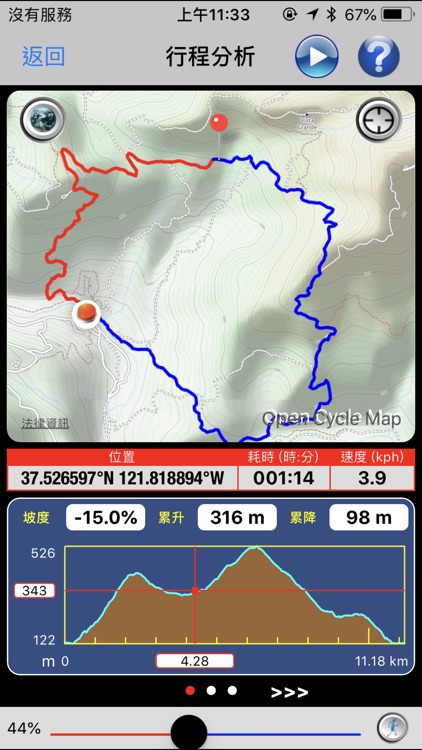
While in the outdoors and without cellular service, you can display currently logging tracks and previously logged tracks made by other parties simultaneously on the offline map to make sure you are on the right track. Photos taken during the logging session can be displayed on the map and saved for later use. You can also follow the previously logged track to assist your navigation and check the mileage and altitude information for reference.
GPS Hiker is proudly field-tested at Mission Peak, Fremont, CA, USA.
Features:
• GPS status (location, speed, heading, altitude) display.
• GPS logging & real-time trip information (time, distance, altitude gain/loss. ...) update.
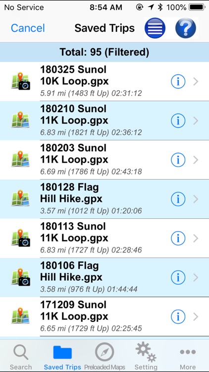
• Tracks and marks are stored in the standard GPX format.
• You can manually add GPX files to the application via iTune File Sharing.
• Import GPX file you download from community websites and display its tracks and marks on map.
• Simultaneously display current track logged by yourself and imported track logged by others on map to make sure you are on the right track.
• Follow the track of the imported trip to assist your navigation.
• Photo Marks: photos taken during the trip will be displayed on the map. Title and description can be added to photos.
• Press-To-Find: long-press on the main map to find EveryTrail trips within the visual range of the map.
• Press-To-Mark: long-press anywhere on the main map to create marks for your trip.
• Multiple color and transparency options to display imported tracks on the map.
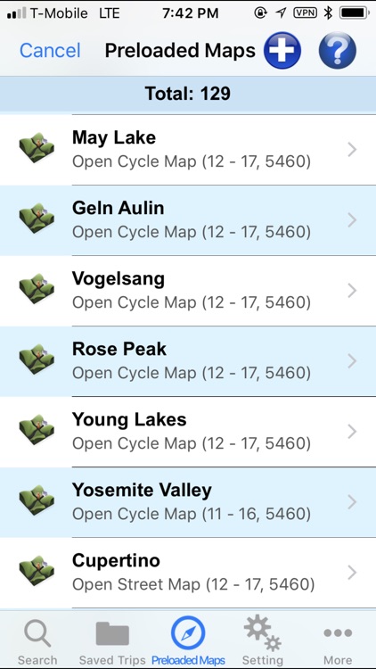
• Support online maps and offline maps (Open Street Map, Open Cycle Map, Hike Bike and custom map image).
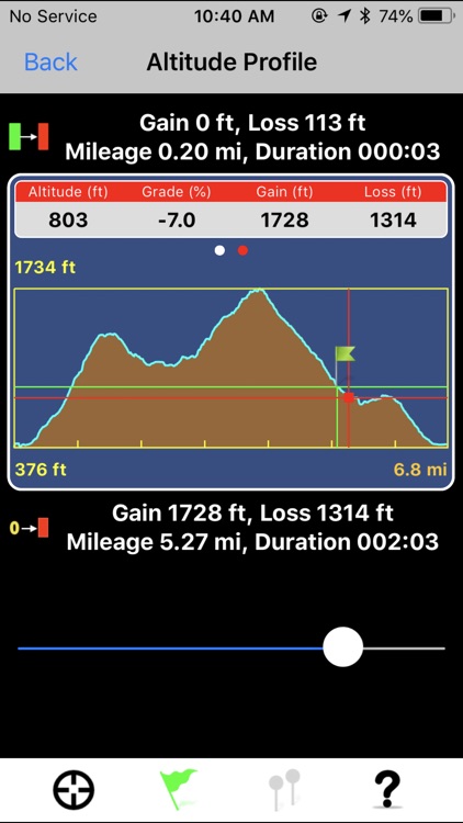
• Trip Analysis allows you walk through the imported tracks in minutes and learn the related mileage, altitude and time information.
• Trail log to record your hiking activities.
• Interactive Altitude Profile Viewer.
• Universal Locate button to locate current location, last mark, current trip and imported trip.
• GPS switch allows user to switch off GPS, when not in use, to save battery power.
• Support WGS84-UTM, WGS84-DMS, WGS84-DEG, TWD67-TM2, TWD97-TM2 coordinate formats.
• Take geo-tagged photos with the built-in camera function.
• Email your trip to friends after the trip is done.
• TweetMark: Tweet your current location and last-taken photo (within 3 minutes) to Twitter.
• GPS tracking continues to work in the background while you listen to music or use another application.
• Support QR code to download trips.
Notice:
• This application may continue to use GPS in the background, which can dramatically decrease battery life.
• You need to connect your iOS device with iTunes and enable the Application File Sharing feature to add GPX files and custom map images to the application or to retrieve the GPX files for your trips.
• This application is not intended for precise navigation. Please use it with good judgement and at user's own risk.
Disclaimer:
AppAdvice does not own this application and only provides images and links contained in the iTunes Search API, to help our users find the best apps to download. If you are the developer of this app and would like your information removed, please send a request to takedown@appadvice.com and your information will be removed.
AppAdvice does not own this application and only provides images and links contained in the iTunes Search API, to help our users find the best apps to download. If you are the developer of this app and would like your information removed, please send a request to takedown@appadvice.com and your information will be removed.