You are using an outdated browser. Please
upgrade your browser to improve your experience.
- GPS-HSI is a training program only for GROUNG TRAINING & NOT FOR NAVIGATION purposes

GPS HSI
by Mehmet SIMSEK

What is it about?
- GPS-HSI is a training program only for GROUNG TRAINING & NOT FOR NAVIGATION purposes.
App Screenshots

App Store Description
- GPS-HSI is a training program only for GROUNG TRAINING & NOT FOR NAVIGATION purposes.
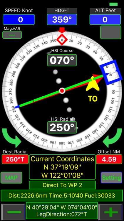
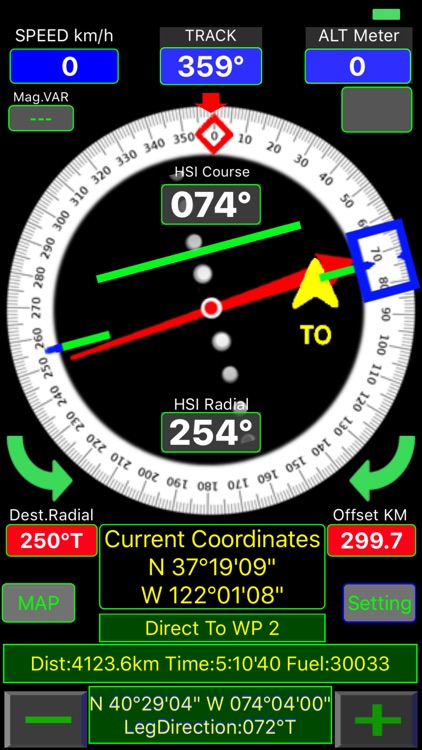
- GPS position type selectable between decimal or degrees.
- uses GPS position to calculate distance, time and estimate fuel consumption.
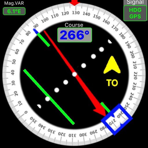
- HSI (Horizontal Situation Indicator) function shows your desired radial from selected waypoint,
- CDI (Course Deviation Indicator) shows selected corse shift up to + -10º
- TO / FROM indicator shows your selected HSI course approaching or away from selected Poi.
- Red Arrow shows Homing direction of selected waypoint
- MAP function use online map, you can create your planned route bye touching to map or with MyPoi button you can enter coordinates directly.
- Builded route recording and loading automatically.
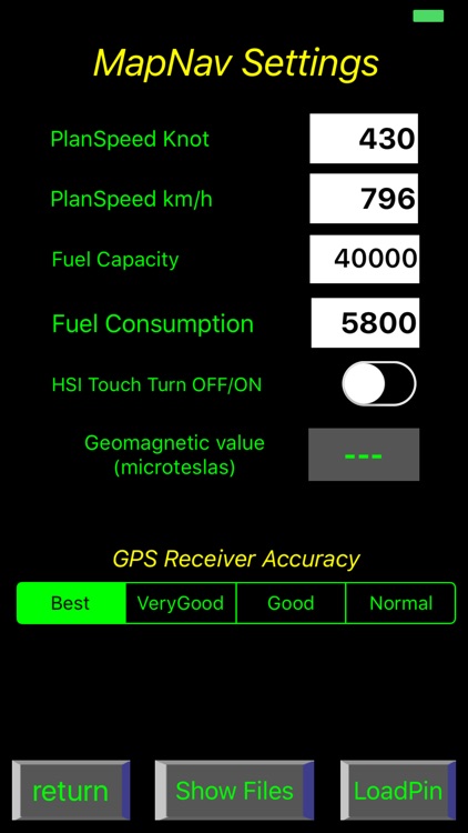
-From Setting page,
You can ON or OFF HSI Touch Turn function to control HSI with touch and turn.
You can set default values for estimate Ground speed, Fuel Capacity, Fuel Consumption to see route and leg estimates.
ATTENTION: Continued use of GPS running in the background can dramatically decrease battery life.
- You can create your data with any office program and you can put your own data to inside of GPS-HSI program via iTunes
For "airports.csv" data must be in these order for airport search
1. column: Latitude (example: 40.97 for North, -40.97 for South)
2. column: Longitude (example: 28.81 for East, -28.81 for West)
3. column: ICAO Code
4. column: IATA Code
5. column: Name
6. column: City or Country
For "nav.csv" data must be in these order for Navigation aids (VOR/NDB/TACAN/etc.) search
1. column: Latitude (example: 40.97 for North, -40.97 for South)
2. column: Longitude (example: 28.81 for East, -28.81 for West)
3. column: IATA Code
4. column: Country or City name
For "fix.csv" data must be in these order for Fix search
1. column: Latitude (example: 40.97 for North, -40.97 for South)
2. column: Longitude (example: 28.81 for East, -28.81 for West)
3. column: Fix Name
Disclaimer:
AppAdvice does not own this application and only provides images and links contained in the iTunes Search API, to help our users find the best apps to download. If you are the developer of this app and would like your information removed, please send a request to takedown@appadvice.com and your information will be removed.
AppAdvice does not own this application and only provides images and links contained in the iTunes Search API, to help our users find the best apps to download. If you are the developer of this app and would like your information removed, please send a request to takedown@appadvice.com and your information will be removed.