You are using an outdated browser. Please
upgrade your browser to improve your experience.
GPS navigation maps is a mobile application which guide the user throughout his journey from starting to the ending point

GPS Navigation Maps
by imdad hussain

What is it about?
GPS navigation maps is a mobile application which guide the user throughout his journey from starting to the ending point. GPS navigation maps is an Application through which you can find a way to many place.
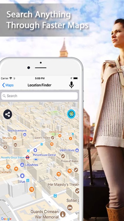
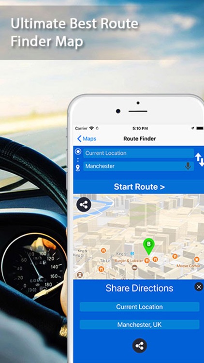
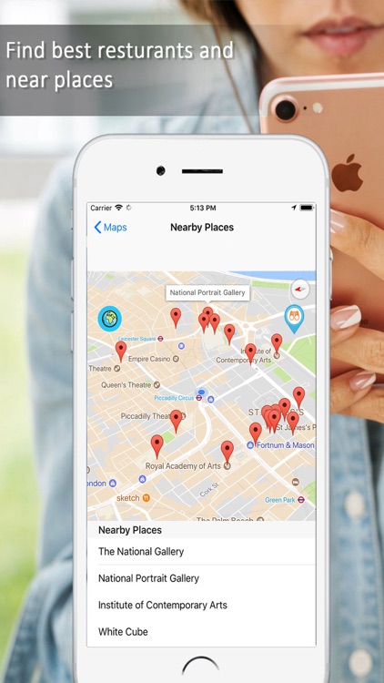
App Screenshots

App Store Description
GPS navigation maps is a mobile application which guide the user throughout his journey from starting to the ending point. GPS navigation maps is an Application through which you can find a way to many place.
Following are the functionalities of the apps:
>>Location Finder (Current Location / Search Location)
>>Route Finder (From point A to point B)
>>Live Traffic (Live traffic from all around the world)
>>Street View (Panoramic View of places)
>>Nearby Places (80+ nearby places from current location in 1000m radius)
The application uses an Internet connection to a GPS navigation system to provide turn-by-turn 3D view and provide a path by complete regulation how to arrive at a given destination. The application requires connection to Internet data (e.g. 3G, 4G, Wi-Fi, etc.) and normally uses a GPS satellite connection to determine its existing location. A user can enter a destination into the application, which will plot a path to it. The app displays the user's progress along the route and issues instructions for each turn. The App display the panoramic view to the gps pedestrian. The App keeps the user up-to-date about the best route to the destination, and is often updated according to changing factors such as traffic and road conditions. The App will also having a feature of nearby which guide the user about near places such as airport guide, malls, gas station by gps location tracker.
Disclaimer:
AppAdvice does not own this application and only provides images and links contained in the iTunes Search API, to help our users find the best apps to download. If you are the developer of this app and would like your information removed, please send a request to takedown@appadvice.com and your information will be removed.
AppAdvice does not own this application and only provides images and links contained in the iTunes Search API, to help our users find the best apps to download. If you are the developer of this app and would like your information removed, please send a request to takedown@appadvice.com and your information will be removed.