You are using an outdated browser. Please
upgrade your browser to improve your experience.

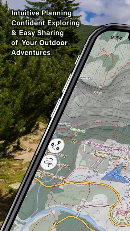
Hiking Maps was developed with guidance from hardcore hiking clubs that require rich and detailed maps, offline functionality, as well as easy planning right from their phones

Hiking Maps
by HopIN Digitech Co., Ltd.

What is it about?
Hiking Maps was developed with guidance from hardcore hiking clubs that require rich and detailed maps, offline functionality, as well as easy planning right from their phones. These hiking groups continue to guide us in our development of what we hope to one day be the best offline map app for the iPhone.
App Screenshots
App Store Description
Hiking Maps was developed with guidance from hardcore hiking clubs that require rich and detailed maps, offline functionality, as well as easy planning right from their phones. These hiking groups continue to guide us in our development of what we hope to one day be the best offline map app for the iPhone.
INTUITIVE ROUTE PLANNING
Intuitive planning is supported by three key features to make it a breeze to plan your journey entirely on your phone or prepare a route for sharing with larger groups.
Finger Route Tracing - Simply drag your finger along the approximate path you want to take, Hiking Maps will adjust your trace to match the closest navigable path. You can then review the distance, the difficulty based on elevation gain and try different alternatives. Save the route once satisfied and you’ll be able to follow it once you hit the trail.
Detailed Route Recording - When exploring new trails for group hikes or your own future returns, you can turn on recording and automatically track time, distance, altitude and elevation gain. You can also add a vast amount of helpful info such as images, videos, and audio notes along important waypoints.
Import Popular Hikes - Hiking Maps supports all major navigation tracking files such as GPX, KML, and KMZ.
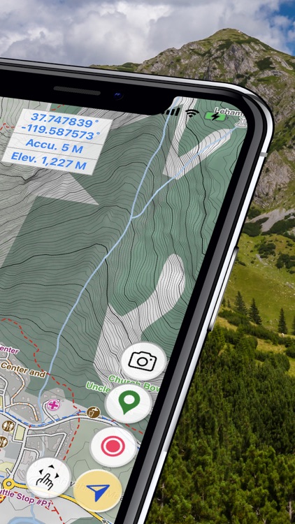
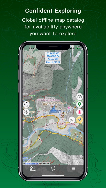
CONFIDENT EXPLORING
When it comes to exploring, helping you feel safe and confident was our biggest goal when designing Hiking Maps. We’ve added the following features to make that a reality:
Detailed Offline Maps – download maps before your journey and explore wilderness without having to waste your battery or having to rely on internet connection. You can use your maps much longer while in airplane mode and you can reach trails where internet connectivity is not available.
Off-Route Notification – adjustable text size lets you easily read the maps as you follow a pre-loaded track or explore new trails. Turn on off-route notifications and you’ll get an audio notification when you stray off the path.
SOS Alerts – preset who you want to notify as your emergency contacts and quickly send them an update with your location and condition if you face a challenge where you need a helping hand.
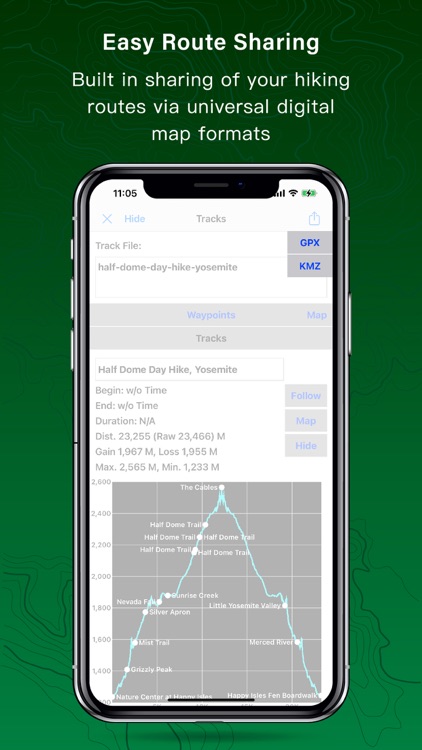
EASY ROUTE SHARING
Whether it’s sending your previous hike to a select group of hikers or sharing your adventure to a wider public, we make it easy to help spread the joy of hiking:
One Tap Sharing – after planning and creating a route in detail you can share it in any popular navigation file format with a friend or group of friends, or upload it to our public database of hikes enriched with all your waypoint information.
Create Professional Relief Maps – our advanced features let you create advanced navigation tools such as digital elevation models (DEM) relief maps.
Print-Ready Maps – create images of maps with waypoints and detailed topography information. Print the maps out or post them on your hiking group website or social media page and let fellow hikers get a good idea about your trail with a single glance.
Please note: You have 90 days to try out all features and settings of Hiking Maps after first installation.
Terms of Use: https://www.apple.com/legal/internet-services/itunes/dev/stdeula/
Disclaimer:
AppAdvice does not own this application and only provides images and links contained in the iTunes Search API, to help our users find the best apps to download. If you are the developer of this app and would like your information removed, please send a request to takedown@appadvice.com and your information will be removed.
AppAdvice does not own this application and only provides images and links contained in the iTunes Search API, to help our users find the best apps to download. If you are the developer of this app and would like your information removed, please send a request to takedown@appadvice.com and your information will be removed.