You are using an outdated browser. Please
upgrade your browser to improve your experience.
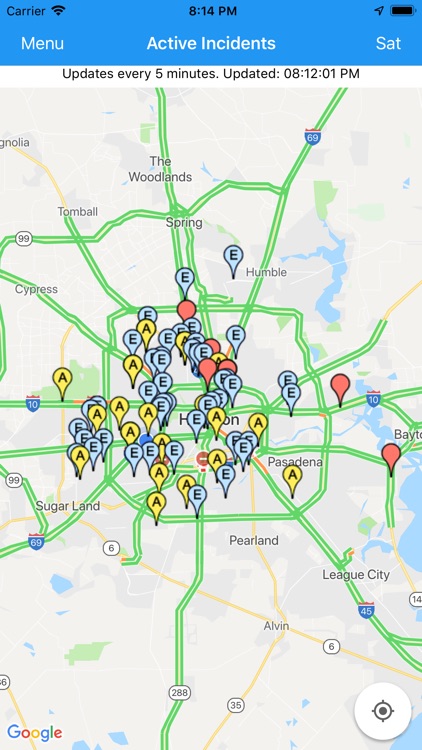
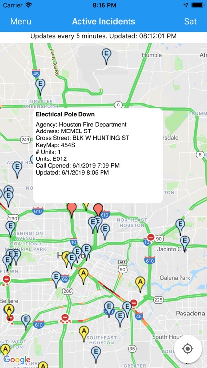
This map displays information about fires, traffic accidents, road hazards, and other active (ongoing) incidents using data from the City of Houston and other sources

Houston Incident Map
by David M Wilson

What is it about?
This map displays information about fires, traffic accidents, road hazards, and other active (ongoing) incidents using data from the City of Houston and other sources. Tap on a marker to see the type of incident, when the call was opened, a list of the units responding, and more.
App Store Description
This map displays information about fires, traffic accidents, road hazards, and other active (ongoing) incidents using data from the City of Houston and other sources. Tap on a marker to see the type of incident, when the call was opened, a list of the units responding, and more.
This app is not affiliated with the City of Houston, the Houston Fire Department, the Houston Police Department, or any other agency.
Disclaimer:
AppAdvice does not own this application and only provides images and links contained in the iTunes Search API, to help our users find the best apps to download. If you are the developer of this app and would like your information removed, please send a request to takedown@appadvice.com and your information will be removed.
AppAdvice does not own this application and only provides images and links contained in the iTunes Search API, to help our users find the best apps to download. If you are the developer of this app and would like your information removed, please send a request to takedown@appadvice.com and your information will be removed.