You are using an outdated browser. Please
upgrade your browser to improve your experience.
GPS Marine Charts App offers access to charts covering Oman

i-Boating:Oman,Arabian/Persian Gulf & Red Sea Maps
by Bist LLC
What is it about?
GPS Marine Charts App offers access to charts covering Oman. Only marine GPS app to have route assistance with Voice Prompts for marine navigation. It has route manager to create new boating routes or import existing GPX/KML routes. It supports Nautical Charts course up orientation.
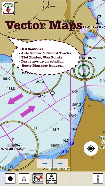
App Screenshots

App Store Description
GPS Marine Charts App offers access to charts covering Oman. Only marine GPS app to have route assistance with Voice Prompts for marine navigation. It has route manager to create new boating routes or import existing GPX/KML routes. It supports Nautical Charts course up orientation.
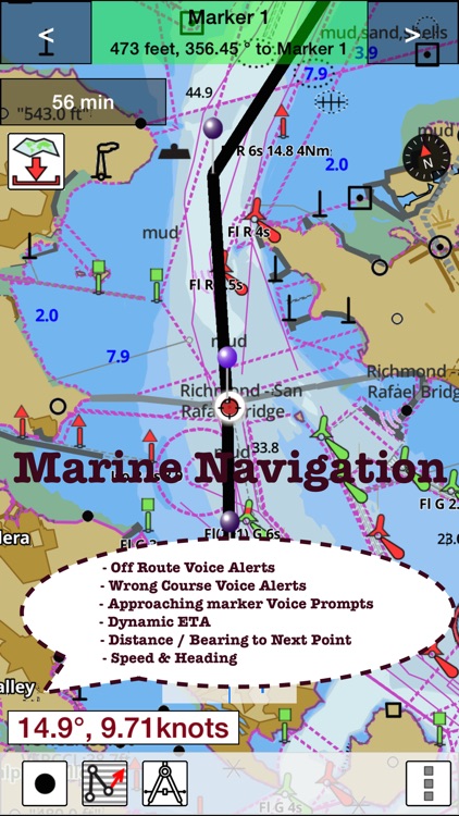
* Voice Prompts for marine navigation (requires GPS )
-prompts when approaching a boating route marker
-Continous distance and ETA updates
-Alerts when sailing/boating off route
-Alerts when boating in wrong direction
*** For any question, contact support at gpsnauticalcharts.com / http://www.gpsnauticalcharts.com ***
*Route Editing/Creation
-Create routes from scratch
-Edit existing GPX/KML routes.
-Add custom description to any route point.
-Drop markers along route.
* Offline Oman charts.
-Visually draw area to download
-Textual search
-Catalog
-Charts reprojected for WGS84 datum
*Seamless chart quilting of marine charts
*Distance Bearing tool
*Create custom way points
- Using GPS
-Select point on map
-Manually enter latitude & longitude coordinates
*POI layer for marine charts
- Overlay POIs
- POI list derived from the equivalent ENC and contains all categories including Buoy, Light, Harbour facility, Obstr.
*Search POIs/Way points
*Pan/Zoom/My Location
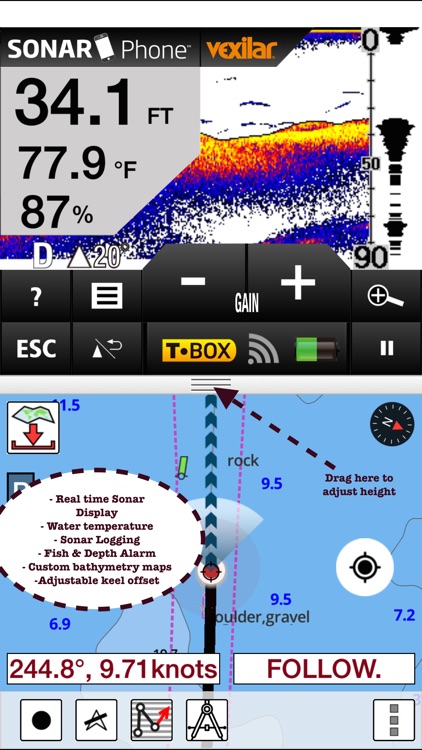
* Record Marine GPS tracks
* View tracks overlay
* Live track animation
* Track analytics/stats
* Export GPX tracks.
-Export to SDCard
-Share GPX trakcs with friends.
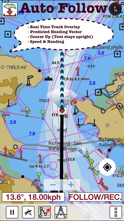
* Auto Follow Mode (Course up)
-Continuously updates boat's location on chart
- Adjustable update frequency
Sample Nautical Charts (please visit http://gpsnauticalcharts.com/main/folio-catalog-nautical-charts-app for complete list)
A Bandar-e Moqam
A Khalij-e Chabahar
A Muscat (Masqat) to Mina' al Fahl
Approaches to Said Bin Sultan Naval Base
B Chiruyeh
B Port Sohar
B Port Sultan Qaboos and Muscat (Masqat)
C Bandar-e Charak
C Bandar Jissah
D Bandar Khayran
D Sir Abu Nu'ayr
E Lavan Oil Terminal
E Qalhat LNG and OMIFCO Terminals
F Khawr al Quway' Anchorage
F Sur
G Qeys Anchorage
H Sirri Oil Terminal
I Bandar-e Lengeh
Masirah to the Strait of Hormuz
Northern Approaches to Masirah
Outer Approaches to Port Salalah (Mina Raysut)
Ra's Hilf Anchorage
Said Bin Sultan Naval Base
Southern Approaches to the Strait of Hormuz
PLEASE NOTE: Continued use of GPS running in the background can dramatically decrease battery life.
Disclaimer:
AppAdvice does not own this application and only provides images and links contained in the iTunes Search API, to help our users find the best apps to download. If you are the developer of this app and would like your information removed, please send a request to takedown@appadvice.com and your information will be removed.
AppAdvice does not own this application and only provides images and links contained in the iTunes Search API, to help our users find the best apps to download. If you are the developer of this app and would like your information removed, please send a request to takedown@appadvice.com and your information will be removed.