You are using an outdated browser. Please
upgrade your browser to improve your experience.

This “IGAD-ASIGN” application is made available to facilitate citizen contributions towards Disaster Risk Reduction (DRR) and IGAD’s work in this domain

IGAD - ASIGN
by AnsuR Technologies
What is it about?
This “IGAD-ASIGN” application is made available to facilitate citizen contributions towards Disaster Risk Reduction (DRR) and IGAD’s work in this domain. Photos provided by volunteers are used by IGAD to document local risks and successful risk-reduction work. The photos can also be used as field validation of IGAD, UNOSAT, RCMRD and other partners’ satellite image analyses, thus contributing to accurate and efficient DRR solutions. Images provided by citizens will help vulnerable countries in the region to make better and faster decisions for DRR.
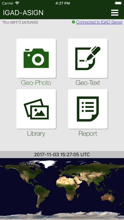
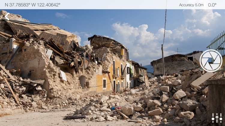
App Screenshots

App Store Description
This “IGAD-ASIGN” application is made available to facilitate citizen contributions towards Disaster Risk Reduction (DRR) and IGAD’s work in this domain. Photos provided by volunteers are used by IGAD to document local risks and successful risk-reduction work. The photos can also be used as field validation of IGAD, UNOSAT, RCMRD and other partners’ satellite image analyses, thus contributing to accurate and efficient DRR solutions. Images provided by citizens will help vulnerable countries in the region to make better and faster decisions for DRR.
Seconds after you send a geo-picture it will be available in a map at the receiver side. Selected images and data provided via this application will be integrated into professional on-line mapping portals and may be made available to the public. The photos are automatically time-stamped and geo-referenced (geo-pictures). GPS is most precise, but basically only works outdoors, hence the IGAD-ASIGN solution also includes positioning via cellular and Wi-Fi networks. Please add text to describe the photos. Your input is being received at am IGAD server for review and possible action to improve local DRR.
Contributors by definition will allow use of the images and data for non-commercial purposes by IGAD related to managing Disaster Risk Reduction related activities.
Photos are compressed significantly to save time, cost and bandwidth, but higher resolution parts can be automatically requested later if needed, in which case the photo-provider is notified with an SMS if the phone number is properly registered. Please note how this is done.
As a user of this application you will also be able to log in to the IGAD-ASIGN server and view your own photos. There is a TEST-switch, so do not be afraid to try it out.
IGAD-ASIGN has been developed by AnsuR, based on ASIGN from the European Project GEO-PICTURES, and is being operated in collaboration with UNITAR-UNOSAT.
This application is a simplified version of ASIGN. A professional tool for disaster managers, civil protection officers and early responders is also available.
Disclaimer:
AppAdvice does not own this application and only provides images and links contained in the iTunes Search API, to help our users find the best apps to download. If you are the developer of this app and would like your information removed, please send a request to takedown@appadvice.com and your information will be removed.
AppAdvice does not own this application and only provides images and links contained in the iTunes Search API, to help our users find the best apps to download. If you are the developer of this app and would like your information removed, please send a request to takedown@appadvice.com and your information will be removed.