You are using an outdated browser. Please
upgrade your browser to improve your experience.

iGIS - The world's first and leading iOS GIS

iGIS for iPad
by Geometry
What is it about?
iGIS - The world's first and leading iOS GIS.
iGIS for iPad is FREE but there are more add-ons
-
$24.99
iGIS Pro 1 year subscription
-
$4.99
iGIS Pro - 1 month subscription
App Screenshots

App Store Description
iGIS - The world's first and leading iOS GIS.
True GIS functionality is now available on the iPad! Your iPad. Your data. Your maps.
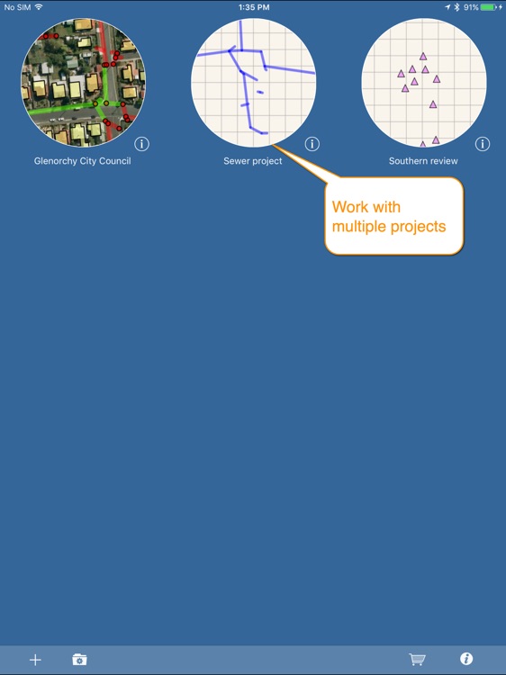
iGIS represents a new era in mobile GIS solutions by enabling users to load, view, investigate, create and export their own data over a background of map service imagery.
Importing data is easy with our unique data import facility supporting Mac, PC and Linux or via the USB cable. ESRI Shapefiles (.shp) are supported at the moment.
Great for field work as your spatial data is stored on the iPad, so there is no need for an Internet connection to see your data. We also support over 3000 projections, so there is no need for data re-projection.
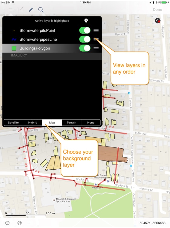
We include support for multiple layers of points, lines, and polygons and imagery – all styled as you like.
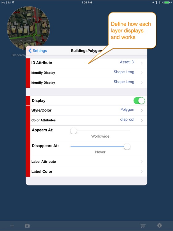
Add comments to your maps - A point layer is added with a name and description field. You can add or edit any of your layers - and even define your own data entry forms with dropdown lists for codes, etc.
Export your layers to ESRI shapefiles for use back in your enterprise.
Other features include:
- Great speed, using our multi-threaded map renderer.
- Support for large datasets.
- Add your own imagery
- Import and export of ESRI Shapefiles.
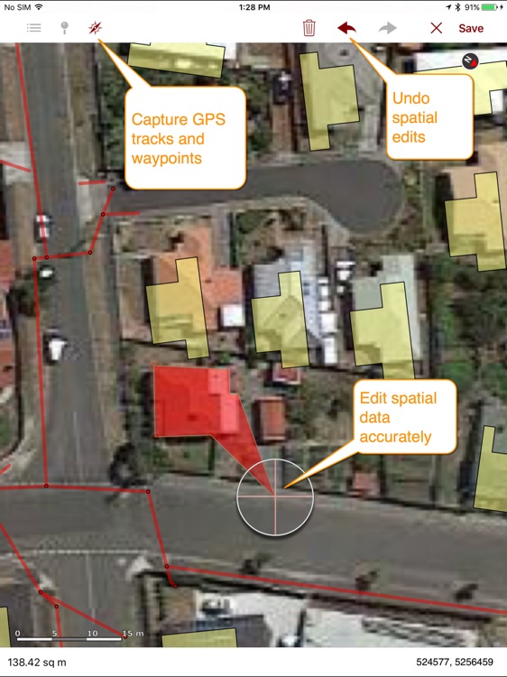
- Display current GPS location in your chosen projection ( + compass)
- Zoom to current location
- Zoom to data extent
- Map Pan, zoom in, zoom out
- Changeable drawing styles for a layer: size, color, transparency
- Set the draw order and visibility of map layers
- Set the zoom scale for layers via a simple slider
- Select and interrogate feature attributes via point and click
This application is designed for GIS professionals and an understanding of some basic GIS concepts such as layers, shapefiles, projections etc, would make using iGIS simpler. Please let us know if concepts in iGIS are unclear.
We know there’s a lot more functionality that we haven’t included. Let us know what features you’d like to see added or improved.
iGIS can use the GPS in the background. Continued use of GPS running in the background can dramatically decrease battery life.
Thanks for your interest,
The Geometry Team
Disclaimer:
AppAdvice does not own this application and only provides images and links contained in the iTunes Search API, to help our users find the best apps to download. If you are the developer of this app and would like your information removed, please send a request to takedown@appadvice.com and your information will be removed.
AppAdvice does not own this application and only provides images and links contained in the iTunes Search API, to help our users find the best apps to download. If you are the developer of this app and would like your information removed, please send a request to takedown@appadvice.com and your information will be removed.