You are using an outdated browser. Please
upgrade your browser to improve your experience.

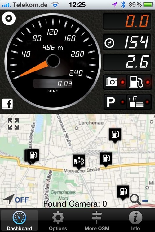
iLOC -iPhone Little OpenStreetMap Copilot is an app to assist you while driving, riding or walking

iLOC - OSM Copilot
by Johannes Eiseler
What is it about?
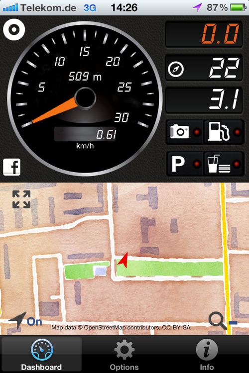
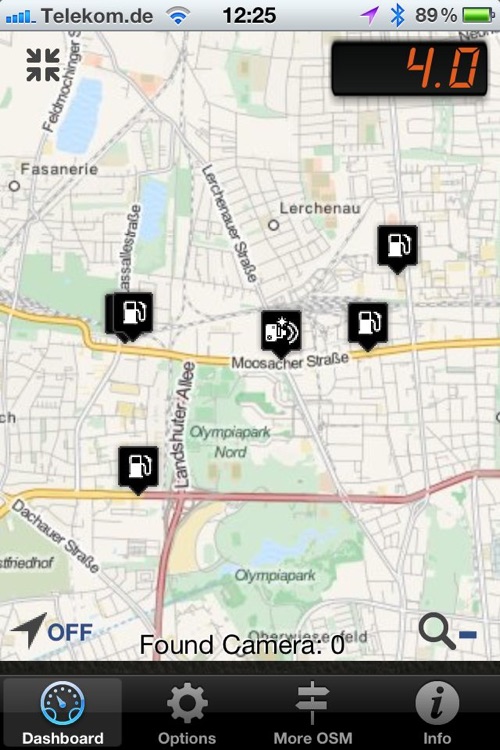
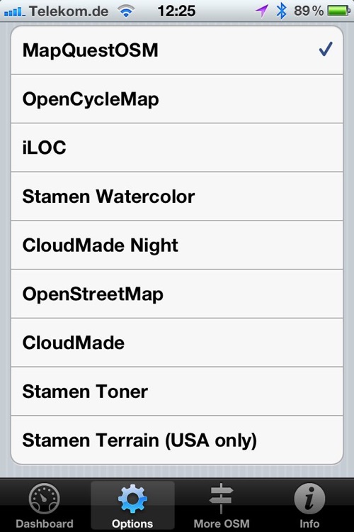
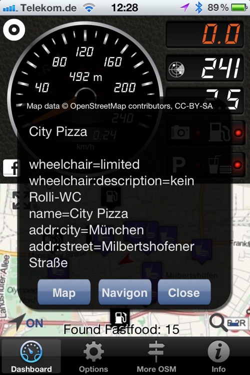
iLOC -iPhone Little OpenStreetMap Copilot is an app to assist you while driving, riding or walking. One of the main features are the possibility to easy post your position on Facebook. Though your friend and family know where you are. (If you like them to know it!). For sure their are the main GPS functions as showing position, speed heading and height. But as the main data input OpenStreetMap is used. So you can choose to see your position on different OSM maps.If you are riding a bike choose the bicycle map. Or you set the wonderful Stamen watercolor map for pleasure. More functions are measure distance and average speed. Search for fuel, parking, fast-food and traffic cameras around. With in app purchase you can log (and send) your routes, switch on sound alarm for traffi cams and have a lot more maps to choose from.
iLOC - OSM Copilot is FREE but there are more add-ons
-
$0.99
Upgrade to Pro
App Screenshots
App Store Description
iLOC -iPhone Little OpenStreetMap Copilot is an app to assist you while driving, riding or walking. One of the main features are the possibility to easy post your position on Facebook. Though your friend and family know where you are. (If you like them to know it!). For sure their are the main GPS functions as showing position, speed heading and height. But as the main data input OpenStreetMap is used. So you can choose to see your position on different OSM maps.If you are riding a bike choose the bicycle map. Or you set the wonderful Stamen watercolor map for pleasure. More functions are measure distance and average speed. Search for fuel, parking, fast-food and traffic cameras around. With in app purchase you can log (and send) your routes, switch on sound alarm for traffi cams and have a lot more maps to choose from.
Disclaimer:
AppAdvice does not own this application and only provides images and links contained in the iTunes Search API, to help our users find the best apps to download. If you are the developer of this app and would like your information removed, please send a request to takedown@appadvice.com and your information will be removed.
AppAdvice does not own this application and only provides images and links contained in the iTunes Search API, to help our users find the best apps to download. If you are the developer of this app and would like your information removed, please send a request to takedown@appadvice.com and your information will be removed.