You are using an outdated browser. Please
upgrade your browser to improve your experience.

iTrail is an all-in-one, in-your-pocket, sports performance tracking tool, and GPS recording application

iTrail
by Justin Davis
What is it about?
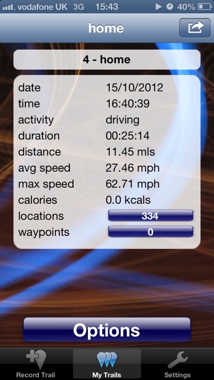
iTrail is an all-in-one, in-your-pocket, sports performance tracking tool, and GPS recording application. Whether you are running, cycling, walking, skiing, or drive, use iTrail to record your performance and location as you move. iTrail will work in the background whilst you listen to music, talk a call or anything else. iTrail uses iPhone's GPS receiver. It records your :
App Screenshots
App Store Description
iTrail is an all-in-one, in-your-pocket, sports performance tracking tool, and GPS recording application. Whether you are running, cycling, walking, skiing, or drive, use iTrail to record your performance and location as you move. iTrail will work in the background whilst you listen to music, talk a call or anything else. iTrail uses iPhone's GPS receiver. It records your :
* route
* speed, in real time, average and max
* distance travelled
* time with a stopwatch
* pace
* altitude
* calories used
This can be done every 5-60 seconds.
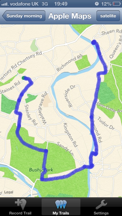
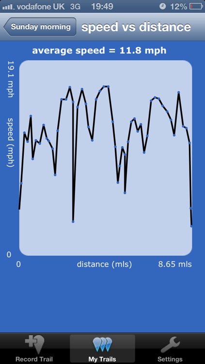
You can then view your route on interactive iOS maps, so iTrail can help as a navigation tool. Also ploy graphs of how your speed and altitude change as you move.
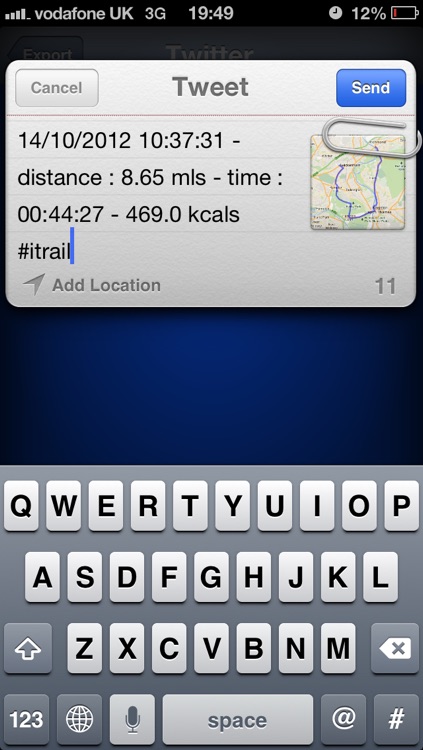
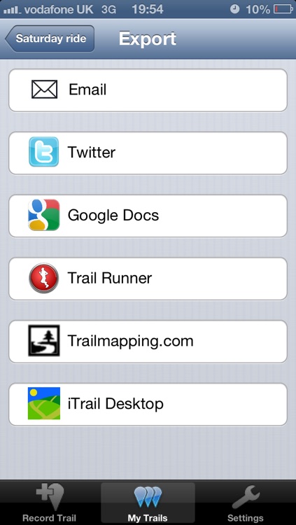
All your trails are stored permanently on iTrail's internal database so that you can view and share them later. iTrail is integrated with a number of tools that make sharing fun and easy.
iTrail is also integrated with TrailRunner (www.trailrunnerx.com), a Mac Desktop application offering great mapping and performance analysis.
iTrail also allows you to send trail data to :
* trailmapping.com
* Google Docs
* Twitter
Other capabilities :
* Labelled waypoints can be added to any trail.
* All GPS data is viewable, point by point, and exportable in KML and GPX formats. iTrail data can be used with Google Earth and Google Maps.
iTrail works best on the iPhone 3G, 3GS and the latest iPhone 4, as these have GPS receivers. iTrail does not work so well on the first generation iPhone.
*The accuracy of iTrail's location measurements is only as good as the GPS signal you have. Please use iTrail outdoors.
Please be aware, continued use of GPS running in the background can dramatically decrease battery life.
Disclaimer:
AppAdvice does not own this application and only provides images and links contained in the iTunes Search API, to help our users find the best apps to download. If you are the developer of this app and would like your information removed, please send a request to takedown@appadvice.com and your information will be removed.
AppAdvice does not own this application and only provides images and links contained in the iTunes Search API, to help our users find the best apps to download. If you are the developer of this app and would like your information removed, please send a request to takedown@appadvice.com and your information will be removed.