You are using an outdated browser. Please
upgrade your browser to improve your experience.
GPS Area Calculator – Accurate Land Measurement & Mapping Tool

Live GPS Land Area Calculator
by Muhammad Asad Khan
What is it about?
GPS Area Calculator – Accurate Land Measurement & Mapping Tool
App Store Description
GPS Area Calculator – Accurate Land Measurement & Mapping Tool
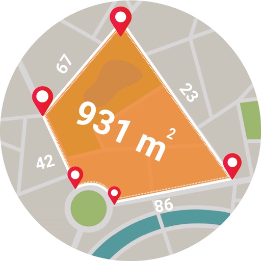
Effortlessly measure land areas, plots, fields, and distances with GPS Area Calculator, your all-in-one area measurement solution. Whether you’re a farmer, surveyor, real estate agent, or outdoor enthusiast, our app provides accurate and reliable measurements with just a few taps.
Why Choose GPS Area Calculator?
Accurate Area Measurement: Calculate land size precisely using advanced GPS technology.
Easy Mapping Tools: Draw on maps to measure irregular and complex shapes with ease.
Distance Measurement: Measure distances between multiple points quickly and accurately.
Multiple Units Supported: Choose from square meters, acres, hectares, square feet, and more.
Save & Share Results: Export your measurements and share them as images or files effortlessly.
Offline Mode: Measure areas even without an internet connection.
User-Friendly Interface: Simple, intuitive, and designed for everyone.
Versatile Usage: Ideal for farming, surveying, real estate, property management, and outdoor activities.
How It Works:
Select Your Measurement Mode: Choose Area Measurement or Distance Measurement.
Draw or Mark Points: Tap on the map to outline the area or draw lines to measure distance.
Instant Calculation: Get precise measurements instantly, displayed in your preferred unit.
Save & Share: Save your measurements for future reference or share them via various platforms.
Perfect For:
Farmers & Agricultural Experts: Measure crop fields, paddocks, and plots for planning and monitoring.
Surveyors & Engineers: Effortlessly calculate land area and distance for professional projects.
Real Estate Agents: Accurately measure properties and land boundaries.
Hikers & Outdoor Enthusiasts: Plan and measure hiking trails and camping sites.
Urban Planners & Land Developers: Visualize and calculate land for development purposes.
Disclaimer:
AppAdvice does not own this application and only provides images and links contained in the iTunes Search API, to help our users find the best apps to download. If you are the developer of this app and would like your information removed, please send a request to takedown@appadvice.com and your information will be removed.
AppAdvice does not own this application and only provides images and links contained in the iTunes Search API, to help our users find the best apps to download. If you are the developer of this app and would like your information removed, please send a request to takedown@appadvice.com and your information will be removed.