You are using an outdated browser. Please
upgrade your browser to improve your experience.

MapSocial is a map-based social network that uses emojis to show geotagged photos taken nearby

MapSocial - Create Photo Maps
by MapSocial LLC


What is it about?
MapSocial is a map-based social network that uses emojis to show geotagged photos taken nearby.
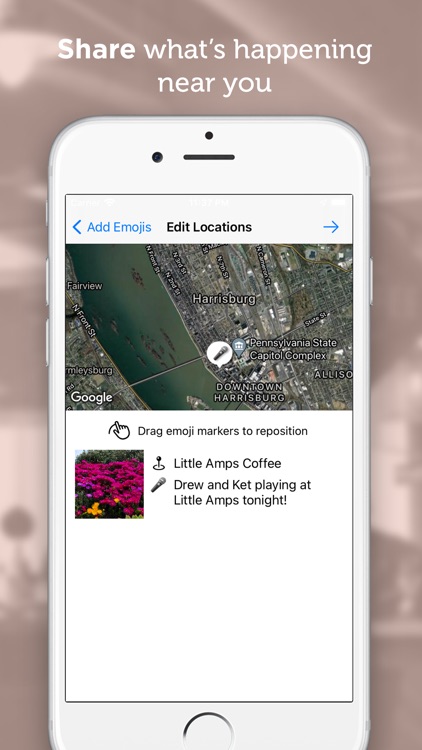
App Screenshots
App Store Description
MapSocial is a map-based social network that uses emojis to show geotagged photos taken nearby.
Find where the most activity is happening and discover new experiences such as live music, sporting events, festivals, shows, food trucks and more!
Join a community of urban explorers, photographers, and locals in your area and share your photos to let others know what's happening.
Just take a photo, tag an emoji, add a caption, and post!
We’d love to hear your feedback and suggestions. Email support@mapsocial.io and tell us what you think!
Disclaimer:
AppAdvice does not own this application and only provides images and links contained in the iTunes Search API, to help our users find the best apps to download. If you are the developer of this app and would like your information removed, please send a request to takedown@appadvice.com and your information will be removed.
AppAdvice does not own this application and only provides images and links contained in the iTunes Search API, to help our users find the best apps to download. If you are the developer of this app and would like your information removed, please send a request to takedown@appadvice.com and your information will be removed.