You are using an outdated browser. Please
upgrade your browser to improve your experience.
GPS Marine Charts App offers access to charts covering Croatia (derived from Hvratski Hidrografski Institute data)

Marine Navigation - Croatia - Offline Gps Nautical Charts & River Maps for Fishing, Sailing and Boating
by Bist LLC
What is it about?
GPS Marine Charts App offers access to charts covering Croatia (derived from Hvratski Hidrografski Institute data). Only marine GPS app to have route assistance with Voice Prompts for marine navigation. It has route manager to create new boating routes or import existing GPX/KML routes. It supports Nautical Charts course up orientation.
Marine Navigation is $29.99 but there are more add-ons
-
$29.99
Croatia - GPS Nautical Charts
App Screenshots
App Store Description
GPS Marine Charts App offers access to charts covering Croatia (derived from Hvratski Hidrografski Institute data). Only marine GPS app to have route assistance with Voice Prompts for marine navigation. It has route manager to create new boating routes or import existing GPX/KML routes. It supports Nautical Charts course up orientation.
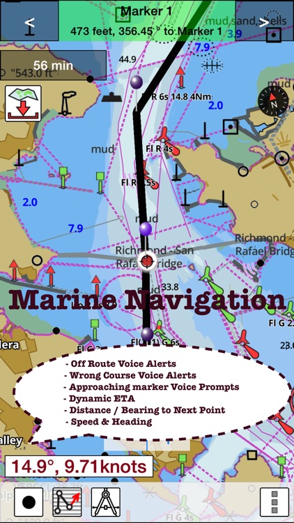
* Voice Prompts for marine navigation (requires GPS )
-prompts when approaching a boating route marker
-Continous distance and ETA updates
-Alerts when sailing/boating off route
-Alerts when boating in wrong direction
*** For any question, contact support at gpsnauticalcharts.com / http://www.gpsnauticalcharts.com ***
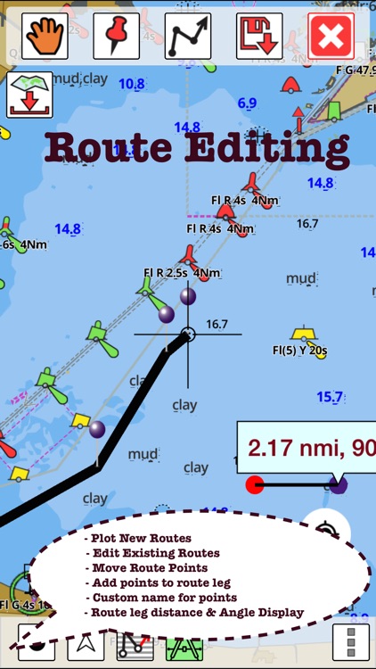
*Route Editing/Creation
-Create routes from scratch
-Edit existing GPX/KML routes.
-Add custom description to any route point.
-Drop markers along route.
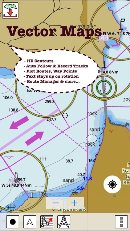
* Offline Croatia charts.
-Visually draw area to download
-Textual search
-Catalog
-Charts reprojected for WGS84 datum
*Seamless chart quilting of marine charts
*Distance Bearing tool
*Create custom way points
- Using GPS
-Select point on map
-Manually enter latitude & longitude coordinates
*POI layer for marine charts
- Overlay POIs
- POI list derived from the equivalent ENC and contains all categories including Buoy, Light, Harbour facility, Obstr.
*Search POIs/Way points
*Pan/Zoom/My Location
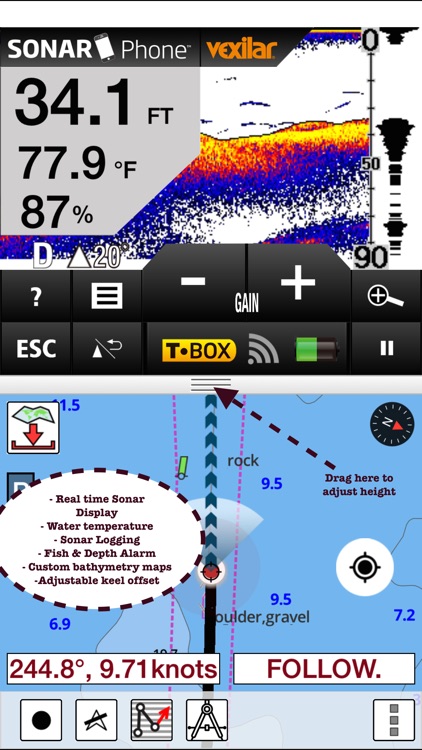
* Record Marine GPS tracks
* View tracks overlay
* Live track animation
* Track analytics/stats
* Export GPX tracks.
-Export to SDCard
-Share GPX trakcs with friends.
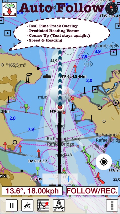
* Auto Follow Mode (Course up)
-Continuously updates boat's location on chart
- Adjustable update frequency
Sample Nautical Charts (please visit http://gpsnauticalcharts.com/main/folio-catalog-nautical-charts-app for complete list)
Adriatic Sea
A Izola
A Luka Cres
A Novigrad
Approaches to Bar and Boka Kotorska
Approaches to Dubrovnik including Luka Gruz
A Rijeka
A Sibenik and Approaches
A Zaljev Vela Luka
Bar
Bar to Split including Otok Palagruza
B Luka Koper
B Luka Martinscica
B Porec
B Rijeka Krka
B Senj
B Starogradski Zaljev
C Bakarski Zaljev
C Luka Telascica
Continuation of Kanal Malog Stona (Kanal Mali Ston)
Continuation to Karinsko More
C Ploce
C Rovinj
D Luka Pula
D Omisalj including Uvala Sapan
D Pakleni Kanal
D Pasmanski Kanal and Southern Approaches
E Luka Mali Losinj
E Sedmovrace
E Splitska Vrata
F Split
F Zaljev Rasa
Gulf of Trieste and Approaches
Kvarner, Kvarneric and Velebitski Kanal
Luka Gruz
Otocic Glavat to Ploce and Makarska
Otocic Veliki Skolj to Otocic Glavat
Otok Lastovo to Split and Vieste to Porto Civitanova
Otok Susac to Split
Otok Vis to Otok Susak and S. Benedetto del Tronto to Ravenna
Otok Vis to Sibenik
Peljeski Kanal
Porto di Monfalcone
Rogoznica to Zadar
Rt Kamenjak to Novigrad
Rt Marlera to Senj including Approaches to Rijeka
Sedmovrace to Trieste and Ravenna to Venezia
Zadar
Zadar to Luka Mali Losinj
PLEASE NOTE: Continued use of GPS running in the background can dramatically decrease battery life.
Disclaimer:
AppAdvice does not own this application and only provides images and links contained in the iTunes Search API, to help our users find the best apps to download. If you are the developer of this app and would like your information removed, please send a request to takedown@appadvice.com and your information will be removed.
AppAdvice does not own this application and only provides images and links contained in the iTunes Search API, to help our users find the best apps to download. If you are the developer of this app and would like your information removed, please send a request to takedown@appadvice.com and your information will be removed.