You are using an outdated browser. Please
upgrade your browser to improve your experience.

The app guides your walk along the Martley to Alfrick section of the Abberley and Malvern Hills Geopark Way – a 109 mile walk running between Bridgnorth in Shropshire England to Gloucester Cathedral

Martley
by BrooksDesigns
What is it about?
The app guides your walk along the Martley to Alfrick section of the Abberley and Malvern Hills Geopark Way – a 109 mile walk running between Bridgnorth in Shropshire England to Gloucester Cathedral. The trail is divided into 17 sections, with an app for each section.
App Screenshots

App Store Description
The app guides your walk along the Martley to Alfrick section of the Abberley and Malvern Hills Geopark Way – a 109 mile walk running between Bridgnorth in Shropshire England to Gloucester Cathedral. The trail is divided into 17 sections, with an app for each section.
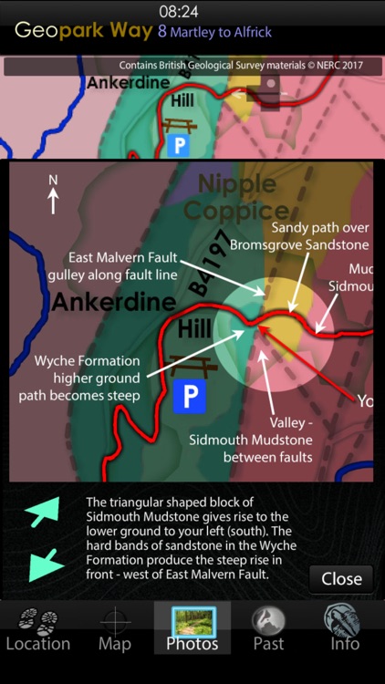
The 11.8km walk is mainly over the Triassic rocks of the Worcestershire Basin - a huge fault bound rift structure filled with upto 3km depth of Permian and Triassic sediments deposited during arid times, when this area lay within the Pangea supercontinent. Around half-way through the walk you climb up over the Silurian spine of the Abberley Hills, to Ankerdine Hill, then down into Knightwick Gap, cut by glacial meltwaters. You pass under the distinctive Osebury Rock, formed of Permian breccia, back onto hop growing country over Triassic sediments, to reach the attractive village of Alfrick.
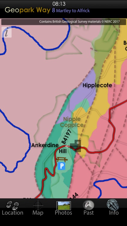
The app has 5 core views, the default is the Map of the trail, overlain on a geology map derived from the British Geological Survey DiGMapGB-50 (1:50,000 scale) data for the Martley to Alfrick area. You have this map built into the app, along with all the associated BGS data, which is then always available as you walk, served to your position by GPS or, by simply touching the map if using the app away from the area, or on a device without GPS. The map can be zoomed to x4.
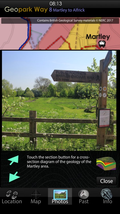
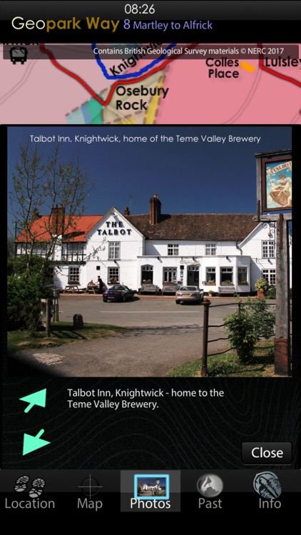
The Photos view contains a series of pictures taken along the walk, from the perspective of someone walking in either direction – you select which direction to view. When you use the app in the area, images and information relevant to your location are served to you. You can also virtually walk the path – perhaps to get a feel in advance of how challenging the terrain will be. Linked to the Photos view are 3D sections of the geology and reconstructions of ancient environments.
The Location view provides position data and optionally will record your walk and provide an updated estimate of how long to it will take you to complete.
The Past view places the rocks under you, into their global tectonic setting, of plate positions along with data for past CO2, oxygen, temperature, sea level and species extinction rate. Recreations of possible ancient landscapes of the GeoPark are provided, together with maps of past landmasses and oceans such as the Iapetus, Rheic and Tethys.
The Information view provides links to the organisations, including the Herefordshire and Worcestershire Earth Heritage Trust, who founded and continue to promote and manage the Geopark and the trail.
The app has all required data loaded and does not require cellular or WiFi connectivity in the field – just a charged battery.
Disclaimer:
AppAdvice does not own this application and only provides images and links contained in the iTunes Search API, to help our users find the best apps to download. If you are the developer of this app and would like your information removed, please send a request to takedown@appadvice.com and your information will be removed.
AppAdvice does not own this application and only provides images and links contained in the iTunes Search API, to help our users find the best apps to download. If you are the developer of this app and would like your information removed, please send a request to takedown@appadvice.com and your information will be removed.