You are using an outdated browser. Please
upgrade your browser to improve your experience.
Natural Disaster Maps provides maps for weather, earthquakes, and tsunamis from NOAA (National Oceanic and Atmospheric Administration), the USGS (United States Geological Survey), the PTWC (Pacific Tsunami Warning Center), and NASA (National Aeronautics and Space Administration)

Natural Disaster Maps
by Liveware Media, LLC
Natural Disaster Maps Offers Apple Watch App
Check the details on WatchAware
Check the details on WatchAware
What is it about?
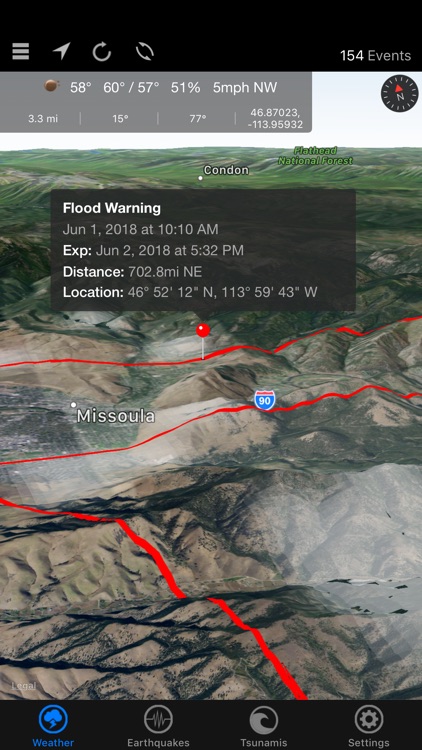
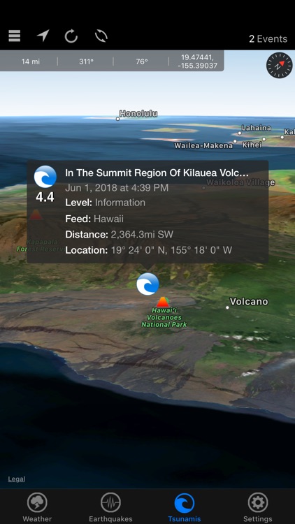
Natural Disaster Maps provides maps for weather, earthquakes, and tsunamis from NOAA (National Oceanic and Atmospheric Administration), the USGS (United States Geological Survey), the PTWC (Pacific Tsunami Warning Center), and NASA (National Aeronautics and Space Administration).
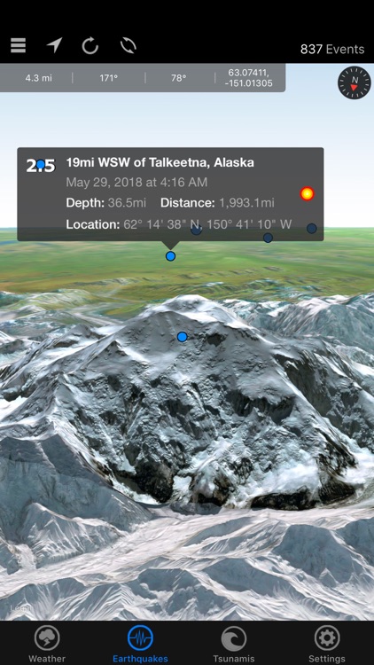
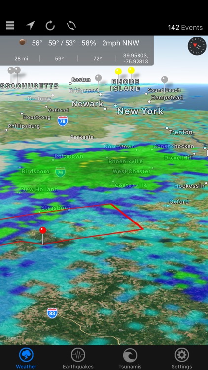
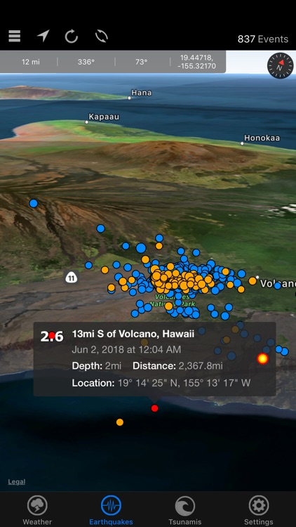
App Screenshots
App Store Description
Natural Disaster Maps provides maps for weather, earthquakes, and tsunamis from NOAA (National Oceanic and Atmospheric Administration), the USGS (United States Geological Survey), the PTWC (Pacific Tsunami Warning Center), and NASA (National Aeronautics and Space Administration).
Whether you are monitoring a storm and want to see real-time warnings, checking the size of a recent earthquake, wondering if there has been a tsunami warning issued, or tracking a hurricane, this app is for you!
Weather
- Real-Time NOAA weather events map
- Near real-time NOAA events map
- Doppler radar (updated every 10 minutes) map layer
- Clouds (updated every 3 hours) map layer
- 30 minute precipitation accumulation map layer
- 3 hour precipitation accumulation map layer
- 24 hour precipitation accumulation map layer
- Current hurricanes and typhoons (tropical cyclones) map layer
- Temperature, humidity, wind speed/direction, and forecast
Earthquakes and Tsunamis
- USGS earthquake events map
- Sort and filter earthquakes by magnitude, distance, and depth
- Pacific and Atlantic ocean tsunami events map
- Tectonic plates map layer
- Active volcanoes map layer
- Nuclear reactor map layer
This app relies on information taken from third-party feeds, and we are not responsible for the accuracy or lack of data being presented.
Disclaimer:
AppAdvice does not own this application and only provides images and links contained in the iTunes Search API, to help our users find the best apps to download. If you are the developer of this app and would like your information removed, please send a request to takedown@appadvice.com and your information will be removed.
AppAdvice does not own this application and only provides images and links contained in the iTunes Search API, to help our users find the best apps to download. If you are the developer of this app and would like your information removed, please send a request to takedown@appadvice.com and your information will be removed.