You are using an outdated browser. Please
upgrade your browser to improve your experience.
Boating Charts (NOAA Raster Navigational Charts) viewer is for recreational boating

New York - Sailing Charts
by Deepak Singh
What is it about?
Boating Charts (NOAA Raster Navigational Charts) viewer is for recreational boating.
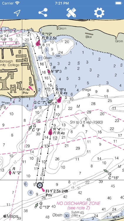
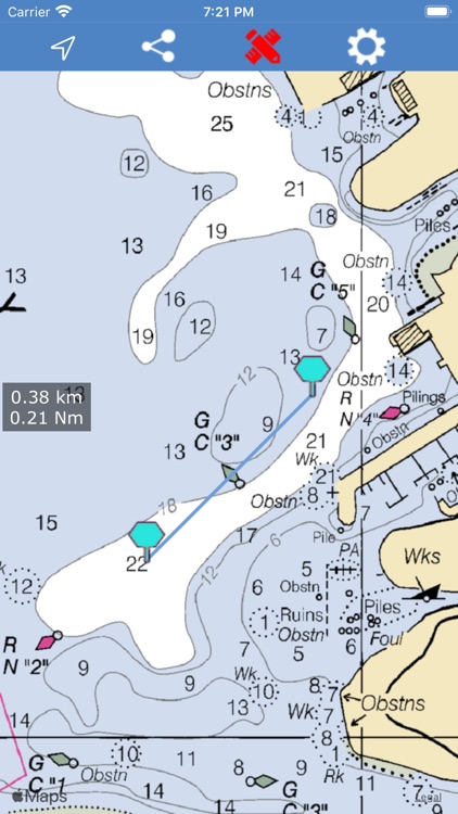
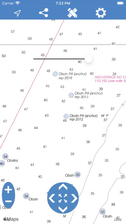
App Screenshots
App Store Description
Boating Charts (NOAA Raster Navigational Charts) viewer is for recreational boating.
Useful for continuous navigation and works offline.
All Raster Navigational Charts are obtained from NOAA.
Compatible to latest iOS devices.
▪ Measure Distances between any two points on map in Kilometres and Nautical Miles.
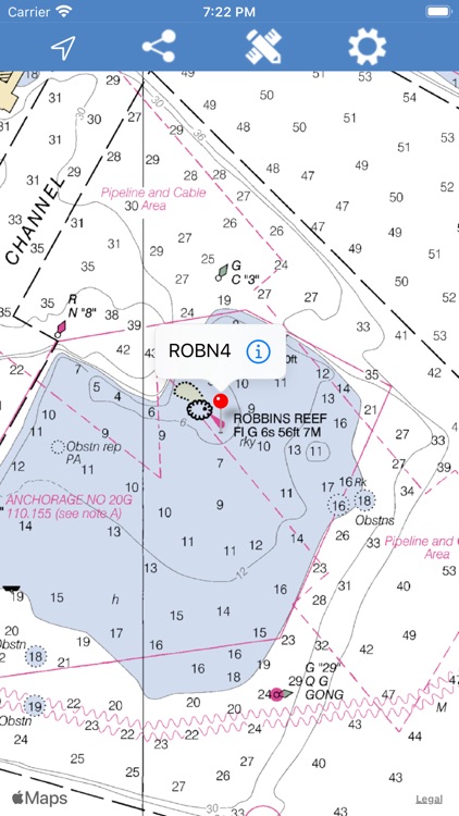
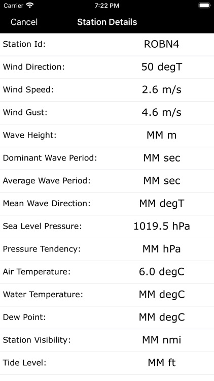
▪ Displays Buoy Stations data which is obtained from from NOAA NDBC. App saves data for offline use.
▪ Live tracking of user GPS positions. Draws track lines along the navigation route.
▪ Save and load tracks easily. Enables to export saved tracks.
▪ Locates user GPS on map and shows Coordinate in 2 formats & lets user copy or forward.
▪ GPS feature enables navigation for device Heading and Directions.
▪ Manage map layers through Settings. Once changes made inside settings will remain default until updated again.
▪ Zoom In and Zoom Out control handles transparent interaction with map while GPS is active.
▪ Pan control handles moving map to Top-Bottom-Right-Left sides for effective chart interaction.
▪ Zoom Extents brings chart bounds to visibility no matter where the map or user location is.
Transparency option allows handling opacity of charts visibility.
GPS Usage Disclaimer: "Continued use of GPS running in the background can dramatically decrease battery life." While not using this application change location services option to "When In Use" for this map in your Device Privacy settings.
Nautical Charts Disclaimer:
The NOAA RNC are intended for navigational use. They are intended to be used in their electronic form only. NOAA RNC are not intended to meet federal chart carriage regulations published in the Code of Federal Regulations. NOAA makes no representations that the RNC Service or the data provided thereunder meet federal chart carriage regulations. Users should consult the Code of Federal Regulations for current federal chart carriage requirements.
Updates to the RNC data available through the NOAA RNC Service are done on a "best efforts" basis. The timing of their availability is not guaranteed. Users are responsible for verifying the currentness of information obtained pursuant to the NOAA RNC Service.
Disclaimer:
AppAdvice does not own this application and only provides images and links contained in the iTunes Search API, to help our users find the best apps to download. If you are the developer of this app and would like your information removed, please send a request to takedown@appadvice.com and your information will be removed.
AppAdvice does not own this application and only provides images and links contained in the iTunes Search API, to help our users find the best apps to download. If you are the developer of this app and would like your information removed, please send a request to takedown@appadvice.com and your information will be removed.