You are using an outdated browser. Please
upgrade your browser to improve your experience.
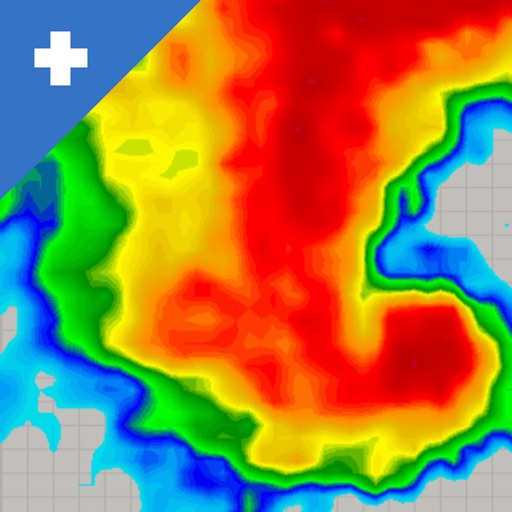
An app designed by and for weather enthusiasts, NOAA SuperRes Radar is the only app in that offers access to stunningly beautiful super hi-resolution radar mosaics for the continental US

NOAA SuperRes Radar US
by Shuksan Software, LLC
What is it about?
An app designed by and for weather enthusiasts, NOAA SuperRes Radar is the only app in that offers access to stunningly beautiful super hi-resolution radar mosaics for the continental US. SuperRes radar has 4 times the resolution of typical weather radar products (250 meters vs 1000 meters), so you will be able to view storm features that can't be viewed in ordinary radar apps. No other app delivers radar mosaics with this kind of accuracy in such an easy to use package.
App Store Description
An app designed by and for weather enthusiasts, NOAA SuperRes Radar is the only app in that offers access to stunningly beautiful super hi-resolution radar mosaics for the continental US. SuperRes radar has 4 times the resolution of typical weather radar products (250 meters vs 1000 meters), so you will be able to view storm features that can't be viewed in ordinary radar apps. No other app delivers radar mosaics with this kind of accuracy in such an easy to use package.
In addition to SuperRes Level 2 radar, NOAA RadarUS+ offers access to 3 km hourly forecast radar and the following features:
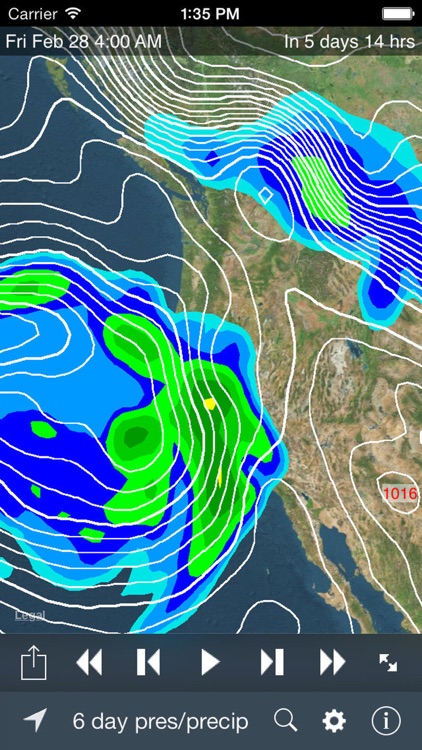
- 3 and 6 day precipitation and pressure forecasts from NOAA weather models
- Temperature overlay
- Snow/mixed precipitation display (only on 1km base reflectivity radar layer)
- 7 day forecasts and current conditions -- just press and hold for a second on the radar map.
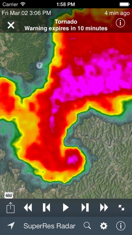
- Severe weather (flash flood, tornado, and severe thunderstorm) warnings. Tap on a warning box to display the full warning message from the National Weather Service. Note: these are *not* push alerts. The app must be open to view the warnings.
- Cloud cover and satellite imagery for the continental United States
- Advanced radar layers (echo tops, composite reflectivity, and storm total precipitation).
- Play, pause, and step animations
- Fast zoom in and zoom out
- Choice of radar palettes
- Multiple map styles (terrain, map, satellite, and hybrid)
- Displays time of radar image either as absolute time or relative to the current time
- GPS locator that finds and displays your current location
- Adjust the transparency (opacity) of the radar or cloud cover overlays
- Radar clutter filtering and smoothing
- Automatic refresh when new radar or cloud cover data is available
- Search for a location by zip code, city name, or address
- Legend for radar and cloud cover overlays
- Saves and restores your last location and zoom level
Note: Radar coverage only includes the continental United States. Alaska, Hawaii, and other US controlled territories are not included.
Support:
Please follow our Twitter stream at twitter.com/shuksansoft for breaking news and status updates.
Disclaimer:
AppAdvice does not own this application and only provides images and links contained in the iTunes Search API, to help our users find the best apps to download. If you are the developer of this app and would like your information removed, please send a request to takedown@appadvice.com and your information will be removed.
AppAdvice does not own this application and only provides images and links contained in the iTunes Search API, to help our users find the best apps to download. If you are the developer of this app and would like your information removed, please send a request to takedown@appadvice.com and your information will be removed.