You are using an outdated browser. Please
upgrade your browser to improve your experience.
The SoilWeb for iOS application accesses soil survey information (the SSURGO dataset, published by the USDA Natural Resources Conservation Service) at your current location

SoilWeb
by University of California, Davis
What is it about?
The SoilWeb for iOS application accesses soil survey information (the SSURGO dataset, published by the USDA Natural Resources Conservation Service) at your current location.
App Screenshots

App Store Description
The SoilWeb for iOS application accesses soil survey information (the SSURGO dataset, published by the USDA Natural Resources Conservation Service) at your current location.
This app was designed to be a lightweight version of the SoilWeb GMap web application. SoilWeb GMap features an interactive map for viewing and querying individual map units, while this app does not. However, SoilWeb for iOS conveniently provides a link to the SoilWeb GMap web app.
SoilWeb GMap is available at https://casoilresource.lawr.ucdavis.edu/gmap/
More information about SSURGO is available at https://www.nrcs.usda.gov/wps/portal/nrcs/detail/soils/survey/geo/?cid=nrcs142p2_053627
Features of SoilWeb for iOS include:
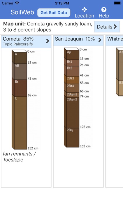
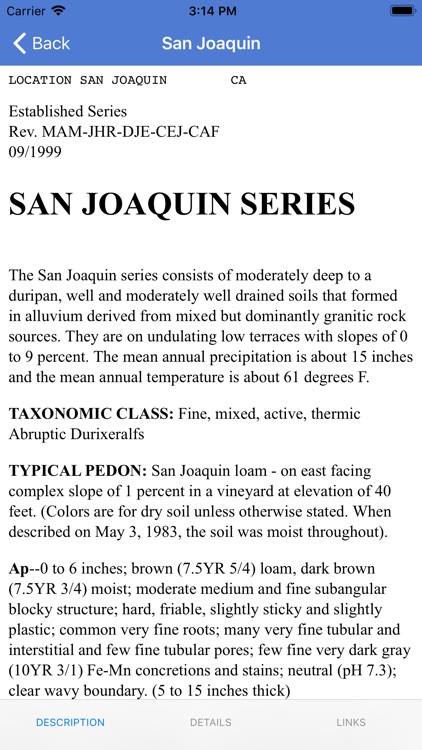
- Soil profile sketches, estimated proportions, and geomorphic position of soil components associated with the SSURGO "map unit" identified at your current location.
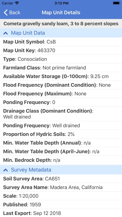
- Map unit aggregate data such as estimated water holding capacity.
- Soil survey area scale and publication date.
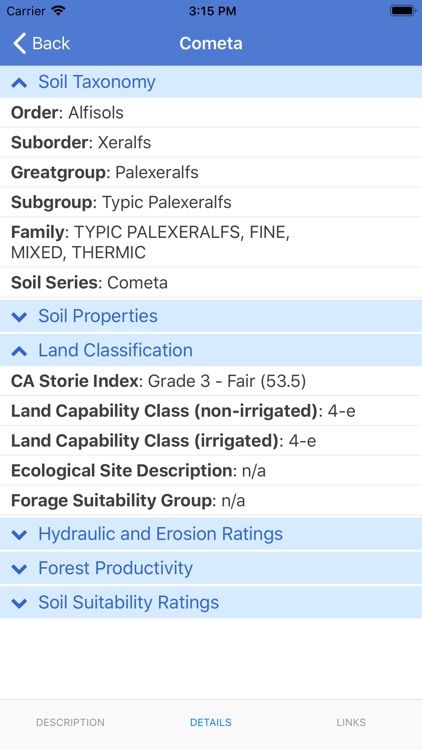
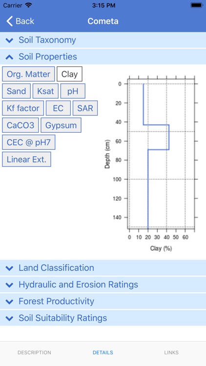
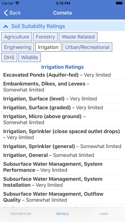
- Component details: soil taxonomy, soil property depth profiles, land classification ratings, hydraulic and erosion ratings, forest productivity, soil suitability ratings.
- Links to Official Series Descriptions (OSDs) generated automatically.
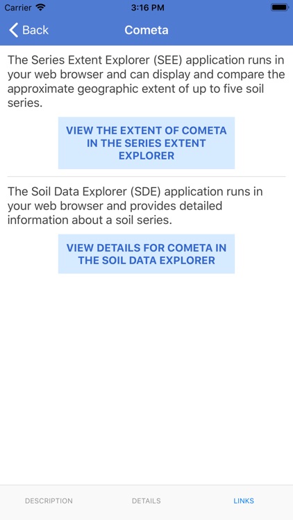
- Component links to related web apps: Series Extent Explorer (SEE) and Soil Data Explorer (SDE).
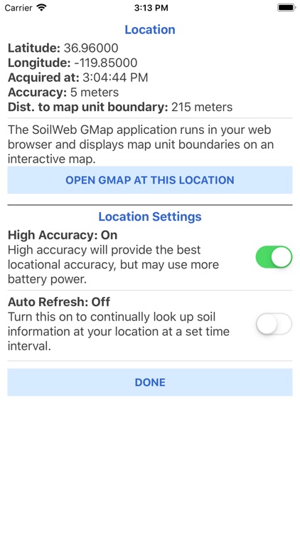
- Link to the SoilWeb GMap web application at your current location.
- Location accuracy setting allows you to select between standard accuracy (less accurate, uses less battery power) and high accuracy (more accurate, but may use more battery power).
- Location auto-refresh feature allows you to continually look up soil data at a specified time interval.
Disclaimer:
AppAdvice does not own this application and only provides images and links contained in the iTunes Search API, to help our users find the best apps to download. If you are the developer of this app and would like your information removed, please send a request to takedown@appadvice.com and your information will be removed.
AppAdvice does not own this application and only provides images and links contained in the iTunes Search API, to help our users find the best apps to download. If you are the developer of this app and would like your information removed, please send a request to takedown@appadvice.com and your information will be removed.