You are using an outdated browser. Please
upgrade your browser to improve your experience.
ThermGeek brings the following functionality to your iphone

ThermGeek
by Thomas Bähler
What is it about?
ThermGeek brings the following functionality to your iphone.
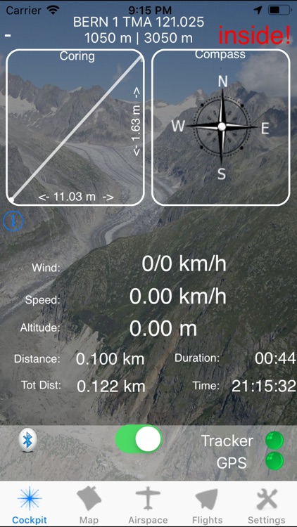
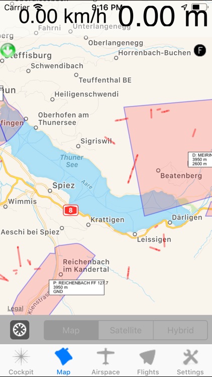
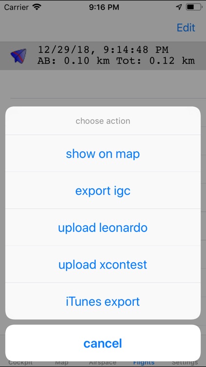
App Screenshots
App Store Description
ThermGeek brings the following functionality to your iphone.
- Live Tracking and support for the free Leonardo system on http://www.livetrack24.com and DHV Live XC, skylines-project.org
- Coring View, displays the last 100 points and help you to center a thermal. Red lines indicate a thermal (it goes up), blue lines indicate that you are going down faster that normal.
- You can download and display any airspace file in openair format. (Urls provided for Austria, Brazil, Czech Republic, Canada, Denmark, France, Germany, Ireland, Italy, Netherlands, Norway, Spain, Switzerland, United Kingdom, USA). You can also provide your own url
- Always see the distance to the closest airspace or cable! This can save your life!!!
- IGC File export.
Export of all your recorded flights as signed igc File
Accepted by xcontest.org and dhv
- Direct upload of IGC Files to Leonardo servers
- Wind Detection
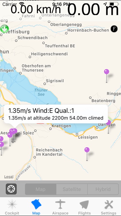
-You have access to a thermal database with over 40’000 thermals for central Europe
-Connect to Bluetooth Varios (FlyNet2, Flytec SensBox and SensorTag TI)
For the SensorTag, you should install the special Firmware at thermgeek@bähler.ch/validator-tools. It will increase the accuracy of the SensorTag to a usable state.
Livetrack
-------------
Record all your flights and let others watch your live track on livetrack24, or watch the flight again on the map
Airspace
------------
You can download any airspace file in openair format and display it on the map. Even while flying you can watch your position and check if you are near an airfield or a cable. The vertical Distance is calculated every 10s and displayed. If you are inside an airspace "inside" is shown.
When you have airfields with AGL entries, thermgeek tries to resolve the AGL.
Predefined URLS for airspace in Austria, UK, USA and Switzerland are already provided.
You will see the distance and angle to the closest airfield or cable.
WARNING: We accept no responsibility for the data provided.
Thermals
-------------
Are you at a location for the first time and ready to fly? Check out where other people have found a thermal. The database provides over 40’000 thermals in two different qualities.
Thermals are available in the following areas : south of France, central Italy, Switzerland and Austria.
Continued use of GPS running in the background can dramatically decrease battery
Disclaimer:
AppAdvice does not own this application and only provides images and links contained in the iTunes Search API, to help our users find the best apps to download. If you are the developer of this app and would like your information removed, please send a request to takedown@appadvice.com and your information will be removed.
AppAdvice does not own this application and only provides images and links contained in the iTunes Search API, to help our users find the best apps to download. If you are the developer of this app and would like your information removed, please send a request to takedown@appadvice.com and your information will be removed.