You are using an outdated browser. Please
upgrade your browser to improve your experience.
Makes from your iPhone/iPad a complete GPS device with the detailed OS Explorer maps provided by Ordnance Survey

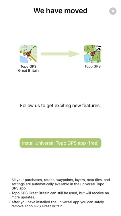
Topo GPS Great Britain
by rdzl
What is it about?
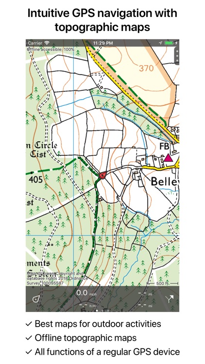
Makes from your iPhone/iPad a complete GPS device with the detailed OS Explorer maps provided by Ordnance Survey. Viewed maps will be stored on your device so that Topo GPS can also be used without an internet connection.
Topo GPS Great Britain is FREE but there are more add-ons
-
$0.99
64 km² of Great Britain
-
$2.99
256 km² of Great Britain
-
$9.99
1024 km² of Great Britain
-
$2.99
OpenStreetMap (World)
-
$1.99
256 km² of France
-
$0.99
64 km² of France
-
$33.99
4096 km² of Great Britain
App Screenshots
App Store Description
Makes from your iPhone/iPad a complete GPS device with the detailed OS Explorer maps provided by Ordnance Survey. Viewed maps will be stored on your device so that Topo GPS can also be used without an internet connection.
Why should you buy an expensive GPS device if you can install Topo GPS on your iPhone/iPad? Topo GPS contains all functions of a regular GPS device for less money, has a much more detailed map, and is more convenient to operate. The accuracy of the position determination is in favorable conditions about 5 m.
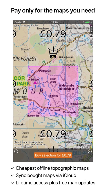
In order to use the detailed topographic maps you have to make an in-app purchase. You can easily select the sections you need on an overview map. You get lifetime access to purchased sections including future map updates. A discount will be given if you buy a large section at once.
Purchases are made available on all devices that share the same iCloud account.
Ideal for walking, hiking, cycling, mountainbiking, horse-riding, geocaching, trail running and other outdoor activities. Also suited for outdoor professionals.
- Map -
* Topographic map of Great Britain 1:25.000, OS Explorer, newest edition,
* Very detailed maps, with buildings, cultivation, all roads including the smallest forest trails, contour lines, and characteristic elements in the landscape.
* Future updates of the map are included for free.
* The map can be zoomed, moved and rotated.
* All maps of a certain region can be made offline accessible using the map download screen.
* Percentage of map that is offline accessible is indicated on the top left of the map.
- Intuitive interface -
* Clear menu with most important functions.
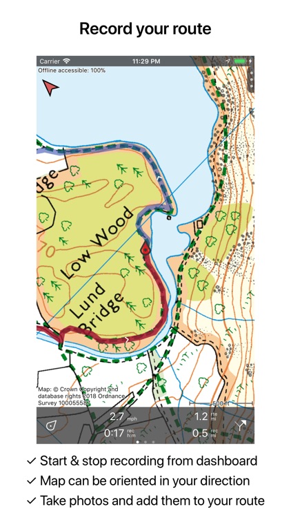
* Different dashboard panels with distance, time, speed, altitude and coordinates.
* Clear manual at www.topo-gps.com.
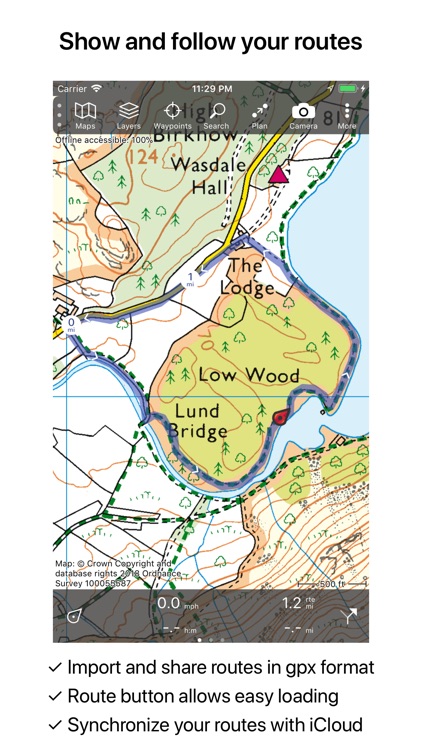
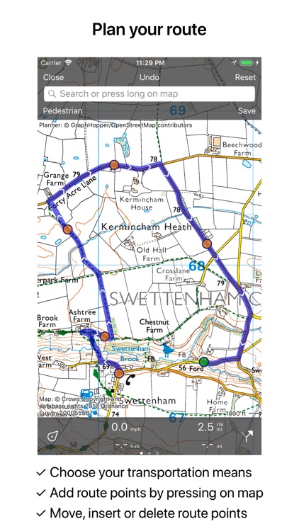
- Routes -
* Recording of routes, with pause and restart possibility.
* Planning of routes via route points.
* Importing routes in gpx, zipped gpx, kml, kmz, and OZI explorer plt format.
* Editing routes.
* Sharing routes.
* Free access to route collection Topo GPS.
* Routes can be synchronized with your other devices using iCloud.
* Searching routes with filters.
* Routes can be organized into folders.
* Maps of a route can be made offline accessible.
- Waypoints -
* Adding waypoints by pressing on map.
* Adding waypoints through address or coordinates.
* Supported coordinate systems: WGS84 decimal, WGS84 degree minutes (seconds), UTM, MGRS and Ordnance Survey Nat. Grid.
* Importing waypoints in gpx and zipped gpx format.
* Sharing waypoints.
* Editing waypoints.
* Photos can be added to waypoints.
* Waypoints can be synchronized with your other devices using iCloud.
* Searching waypoints with filters.
* Waypoints can be organized into folders.
- Your location -
* Location and movement direction indicated by arrowed marker.
* Displayable in WGS84 decimal, WGS84 degree minutes (seconds), UTM, MGRS and Ordnance Survey Nat. Grid coordinates.
* Sharing and saving as waypoint.
- In app purchases -
* Topographic maps of Belgium, Denmark, Finland, France, Germany, Netherlands, Norway, New Zealand and Sweden.
* OpenStreetMap world map.
If you are recording a route, the GPS will run in the background. Continued use of GPS running in the background can dramatically decrease battery life.
On an iPad and iPod touch, the location can only be determined with an accuracy of a few meters if the device contains a GPS. The iPhone always contains a GPS.
Rdzl, the company behind Topo GPS, does not obtain in any way the location of the user of Topo GPS. Rdzl does not obtain your routes and waypoints, unless you share a route with Topo GPS. Rdzl does not register which map tiles you have downloaded. We sell our product, not our user data.
Disclaimer:
AppAdvice does not own this application and only provides images and links contained in the iTunes Search API, to help our users find the best apps to download. If you are the developer of this app and would like your information removed, please send a request to takedown@appadvice.com and your information will be removed.
AppAdvice does not own this application and only provides images and links contained in the iTunes Search API, to help our users find the best apps to download. If you are the developer of this app and would like your information removed, please send a request to takedown@appadvice.com and your information will be removed.