You are using an outdated browser. Please
upgrade your browser to improve your experience.

Ride in the heart of Cariboo Country

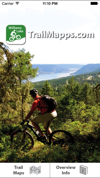
TrailMapps: Williams Lake
by Ryan Robertson
What is it about?
Ride in the heart of Cariboo Country! Find and ride over 100 named trails in the Williams Lake area. This app is a collaborative effort between the Williams Lake Cycling Club and TrailMapps.com; proceeds from the sale of this app go towards trail maintenance and enhancement.
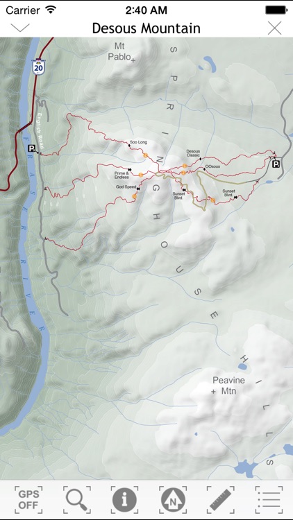
App Screenshots

App Store Description
Ride in the heart of Cariboo Country! Find and ride over 100 named trails in the Williams Lake area. This app is a collaborative effort between the Williams Lake Cycling Club and TrailMapps.com; proceeds from the sale of this app go towards trail maintenance and enhancement.
Featuring:
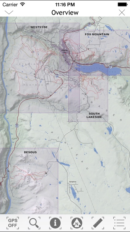
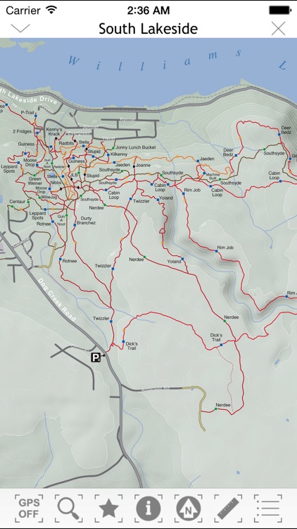
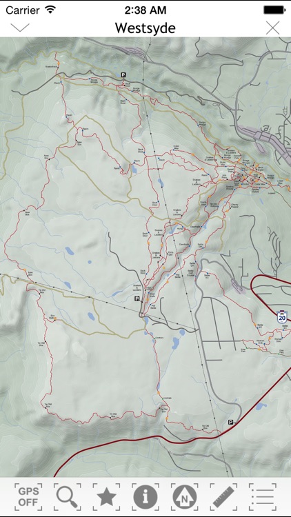
-overview map interface showing all of the riding areas
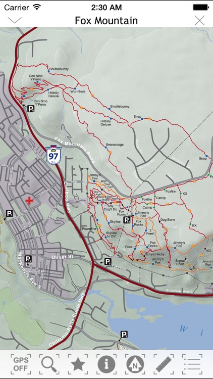
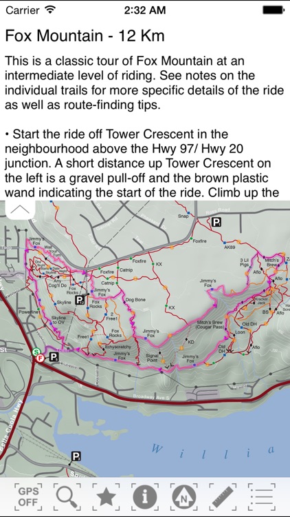
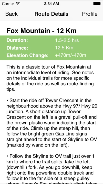
-custom large scale topographic maps of the trail networks for Desous Mountain, Fox Mountain, South Lakeside, and Westsyde trails
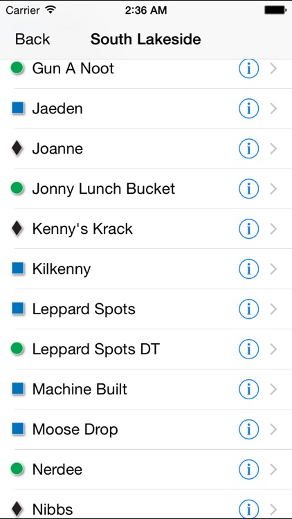
-descriptions and difficulty ratings for all trails
-info buttons along each trail open the trail description page and can be toggled on and off
-suggested route overlays to help take the guesswork out of how best to enjoy the trails
-location icon which accurately displays your position on the map
-compass tool to assist with orienting the map to your surroundings
-auto pan and zoom maps to selected trails
-dynamic scale bars to help you judge the distance of trails on the maps
-directions to parking areas for common trail access points (simply tap a parking symbol on the map)
-no cellular data required; works without a cell signal or Wi-Fi, once the app is downloaded you’ll have full access to all maps even without cell reception
Disclaimer:
AppAdvice does not own this application and only provides images and links contained in the iTunes Search API, to help our users find the best apps to download. If you are the developer of this app and would like your information removed, please send a request to takedown@appadvice.com and your information will be removed.
AppAdvice does not own this application and only provides images and links contained in the iTunes Search API, to help our users find the best apps to download. If you are the developer of this app and would like your information removed, please send a request to takedown@appadvice.com and your information will be removed.