You are using an outdated browser. Please
upgrade your browser to improve your experience.

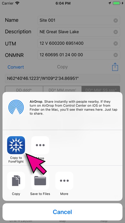
Designed as a companion app to ForeFlight

UTM For Flight
by Guy Fisher

What is it about?
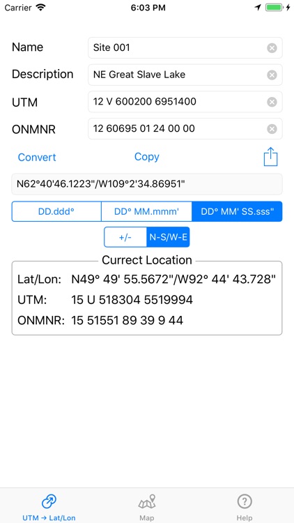
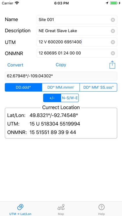
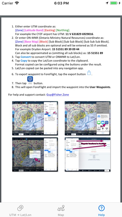
Designed as a companion app to ForeFlight. This utility converts UTM and ONMNR (Ontario Ministry Of Natural Resources) GPS coordinates to Lat/Lon (Latitude/Longitude) and then permits exporting the converted waypoint directly into ForeFlight user waypoints.
App Screenshots
App Store Description
Designed as a companion app to ForeFlight. This utility converts UTM and ONMNR (Ontario Ministry Of Natural Resources) GPS coordinates to Lat/Lon (Latitude/Longitude) and then permits exporting the converted waypoint directly into ForeFlight user waypoints.
ONMNR grid system is the standard used by pilots for forest fire suppression in Ontario.
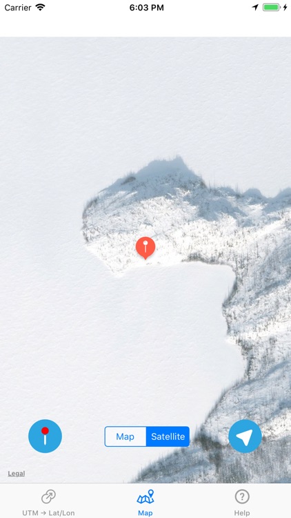
Converted waypoint can also be verified on the map within the app using either street map or satellite imagery.
Displays Current location in all 3 formats: Lat/Lon, UTM and ONMNR.
For help and support contact: Guy@Fisher.Zone
Disclaimer:
AppAdvice does not own this application and only provides images and links contained in the iTunes Search API, to help our users find the best apps to download. If you are the developer of this app and would like your information removed, please send a request to takedown@appadvice.com and your information will be removed.
AppAdvice does not own this application and only provides images and links contained in the iTunes Search API, to help our users find the best apps to download. If you are the developer of this app and would like your information removed, please send a request to takedown@appadvice.com and your information will be removed.