You are using an outdated browser. Please
upgrade your browser to improve your experience.

Walkit nwm is the urban walking route planner for the West Midlands of the United Kingdom, allowing you to generate optimised A to B walking routes throughout the region (see list of supported areas below)

Walkit Network West Midlands
by West Midlands Combined Authority
What is it about?
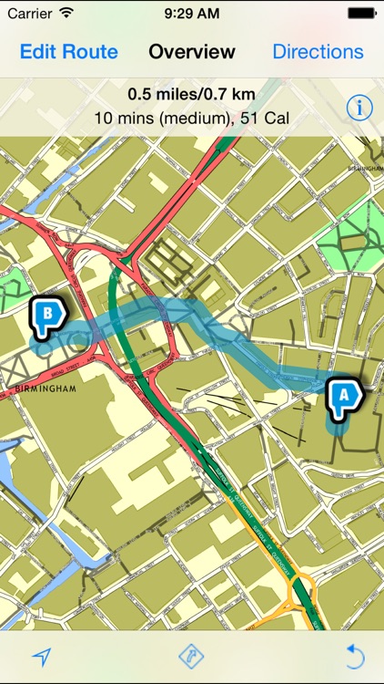
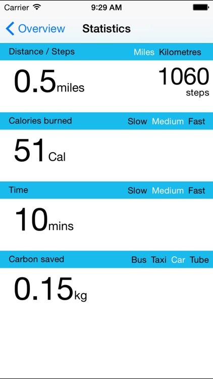
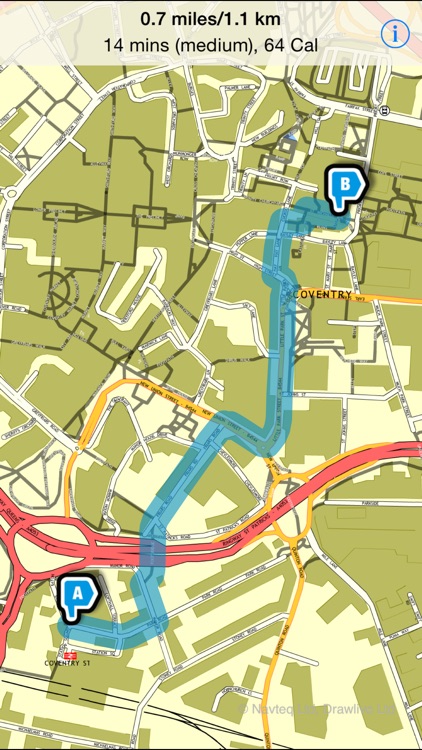
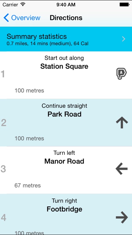
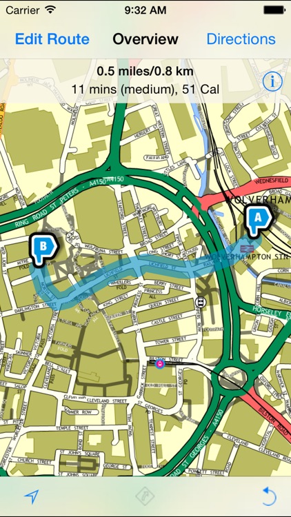
Walkit nwm is the urban walking route planner for the West Midlands of the United Kingdom, allowing you to generate optimised A to B walking routes throughout the region (see list of supported areas below). Each route includes a map, a set of written turn-by-turn directions, an estimated walking time (according to a slow, medium or fast pace), a journey distance (miles and kilometres), a calorie burn and an estimated carbon saving.
App Screenshots
App Store Description
Walkit nwm is the urban walking route planner for the West Midlands of the United Kingdom, allowing you to generate optimised A to B walking routes throughout the region (see list of supported areas below). Each route includes a map, a set of written turn-by-turn directions, an estimated walking time (according to a slow, medium or fast pace), a journey distance (miles and kilometres), a calorie burn and an estimated carbon saving.
You can specify up to four locations to route via, for additional flexibility, and with one touch you can reverse your walking route for the journey back.
Taking advantage of your phone's location-awareness, the map can be set to follow you as you walk, and can even be rotated to always show the way you are facing with your phone.
Following walking directions has never been easier!
Select between a direct (i.e. the quickest) route or a 'less busy' one that will try and avoid major roads and favour off-road paths through parks and by waterways.
Link in with Bus, Train and Metro journeys by planning your walking routes from stops and stations to your destination.
Walkit Network West Midlands gives you access to free walking route plans within the following districts:
* Birmingham
* Coventry
* Dudley
* Sandwell
* Solihull
* Walsall
* Wolverhampton
Please note that this app uses your phone's built in GPS. Continued use of GPS running in the background can dramatically decrease battery life.
Disclaimer:
AppAdvice does not own this application and only provides images and links contained in the iTunes Search API, to help our users find the best apps to download. If you are the developer of this app and would like your information removed, please send a request to takedown@appadvice.com and your information will be removed.
AppAdvice does not own this application and only provides images and links contained in the iTunes Search API, to help our users find the best apps to download. If you are the developer of this app and would like your information removed, please send a request to takedown@appadvice.com and your information will be removed.