You are using an outdated browser. Please
upgrade your browser to improve your experience.

Take Spatial Vision's award-winning SVmaps with you on your iPhone with the latest ORG map of Wilsons Promontory

Wilsons Promontory Outdoor Recreation Guide
by Spatial Vision


What is it about?
Take Spatial Vision's award-winning SVmaps with you on your iPhone with the latest ORG map of Wilsons Promontory.
App Screenshots
App Store Description
Take Spatial Vision's award-winning SVmaps with you on your iPhone with the latest ORG map of Wilsons Promontory.
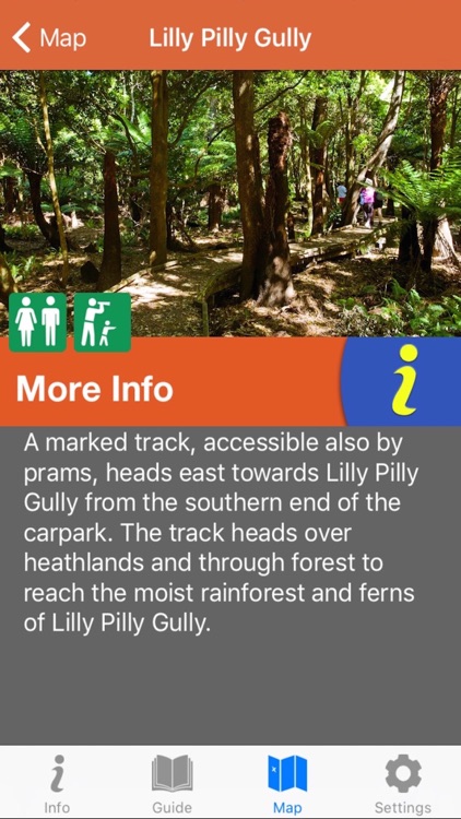
The Wilsons Promontory ORG app contains rich base mapping of the Wilsons Promontory National Park and Marine National Park. The app provides all the guide detail of the print map plus information about every site in the park. Reveal the extraordinary history of the area as you navigate through the park by foot or car, find the best place to camp or have a picnic, even rate your favourite walks.
Guide includes:
-introduction
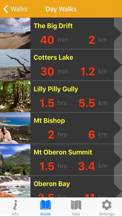
-colour-coded walks, including overnight walks, day walks, beach strolls and favourites (with distance, time, walk rating and warnings)
-history of the area
-flora and fauna
-fire and flood
-safety information
-vivid photography
-further information
-web sites, phone numbers
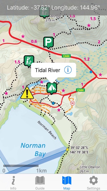
Detailed topographic map with recreation sites, points of interest, emergency access points, dynamic scale bar, heading, location in latitude and longitude as well as Map Grid of Australia, a detailed legend, usage instructions and app settings.
Disclaimer:
AppAdvice does not own this application and only provides images and links contained in the iTunes Search API, to help our users find the best apps to download. If you are the developer of this app and would like your information removed, please send a request to takedown@appadvice.com and your information will be removed.
AppAdvice does not own this application and only provides images and links contained in the iTunes Search API, to help our users find the best apps to download. If you are the developer of this app and would like your information removed, please send a request to takedown@appadvice.com and your information will be removed.